Stricklands, Chapel Road, Southampton (OASIS ID wessexar1-92058)

Wessex Archaeology, 2011. https://doi.org/10.5284/1000180. How to cite using this DOI

Digital Object Identifiers

Digital Object Identifiers (DOIs) are persistent identifiers which can be used to consistently and accurately reference digital objects and/or content. The DOIs provide a way for the ADS resources to be cited in a similar fashion to traditional scholarly materials. More information on DOIs at the ADS can be found on our help page.

Citing this DOI

The updated Crossref DOI Display guidelines recommend that DOIs should be displayed in the following format:

https://doi.org/10.5284/1000180
Sample Citation for this DOI

Wessex Archaeology (2011) Stricklands, Chapel Road, Southampton (OASIS ID wessexar1-92058) [data-set]. York: Archaeology Data Service [distributor] https://doi.org/10.5284/1000180

Data copyright © Wessex Archaeology unless otherwise stated

This work is licensed under the ADS Terms of Use and Access.
Creative Commons License


Southampton City Council logo
Wessex Archaeology logo

Primary contact

Wessex Archaeology
Portway House
Old Sarum Park
Salisbury
SP4 6EB
UK
Tel: 01722 326867
Fax: 01722 337562

Send e-mail enquiry

Resource identifiers

Digital Object Identifiers

Digital Object Identifiers (DOIs) are persistent identifiers which can be used to consistently and accurately reference digital objects and/or content. The DOIs provide a way for the ADS resources to be cited in a similar fashion to traditional scholarly materials. More information on DOIs at the ADS can be found on our help page.

Citing this DOI

The updated Crossref DOI Display guidelines recommend that DOIs should be displayed in the following format:

https://doi.org/10.5284/1000180
Sample Citation for this DOI

Wessex Archaeology (2011) Stricklands, Chapel Road, Southampton (OASIS ID wessexar1-92058) [data-set]. York: Archaeology Data Service [distributor] https://doi.org/10.5284/1000180

Introduction

Pre-excavation site shot from East

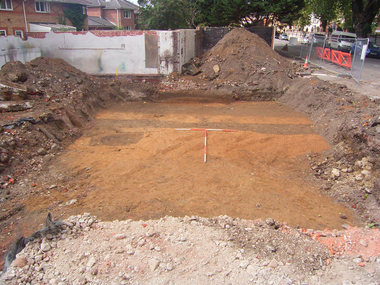
The fieldwork comprised of an archaeological excavation of the footprint of the proposed building. A total of four archaeological features were identified within the Site. These comprised two ditches and two inter-cutting pits. Two Saxon rubbish pits contained material associated with the disposal of both general domestic waste and cess material, and possibly industrial waste; the latter suggested by moderate quantities of slag retrieved from the fills of the pits. Although no dating evidence has been recovered, it is likely that the two ditches identified as lying perpendicular to the extant street frontage, represent post-medieval property boundaries.


ADS logo
Data Org logo
University of York logo