
Wiltshire and Swindon Historic Landscape Characterisation (HLC)
Tom Sunley, 2017. https://doi.org/10.5284/1042742. How to cite using this DOI
Data copyright © Tom Sunley, Dave Hooley unless otherwise stated
This work is licensed under the ADS Terms of Use and Access.

Primary contact
Tom
Sunley
HER Data Manager
Wiltshire Council
Wiltshire and Swindon History Centre
Cocklebury Road
Chippenham
Wiltshire
SN15 3QN
Resource identifiers
- ADS Collection: 2730
- DOI:https://doi.org/10.5284/1042742
- How to cite using this DOI

Overview
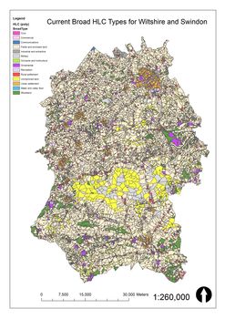
The Wiltshire and Swindon Historic Landscape Characterisation (HLC) Project archive comprises a selection of digital files that were generated during the lifespan of this five year project. This project investigated how the present day landscape of the county of Wiltshire is the product of its cultural development over time. The documents available were created to enable the HLC data to be disseminated, interrogated and queried as part of casework, management and research tasks. The electronic files which have been deposited include:
- Project Report: the full project report setting out the objectives, background, context, methodology, results and analysis of the HLC data
- Presentations: a variety of presentations given to stakeholders, partners, interested users to explain the purpose, nature and utility of the HLC data
- Outreach: a selection of materials to help publicise the aims, purpose and progress of the project during its lifespan (2012-2017)
- Project GIS: the ArcGIS data files for c.14,500 HLC polygons showing their projections and accompanied by metadata providing details on character, period, time depth and attributes
