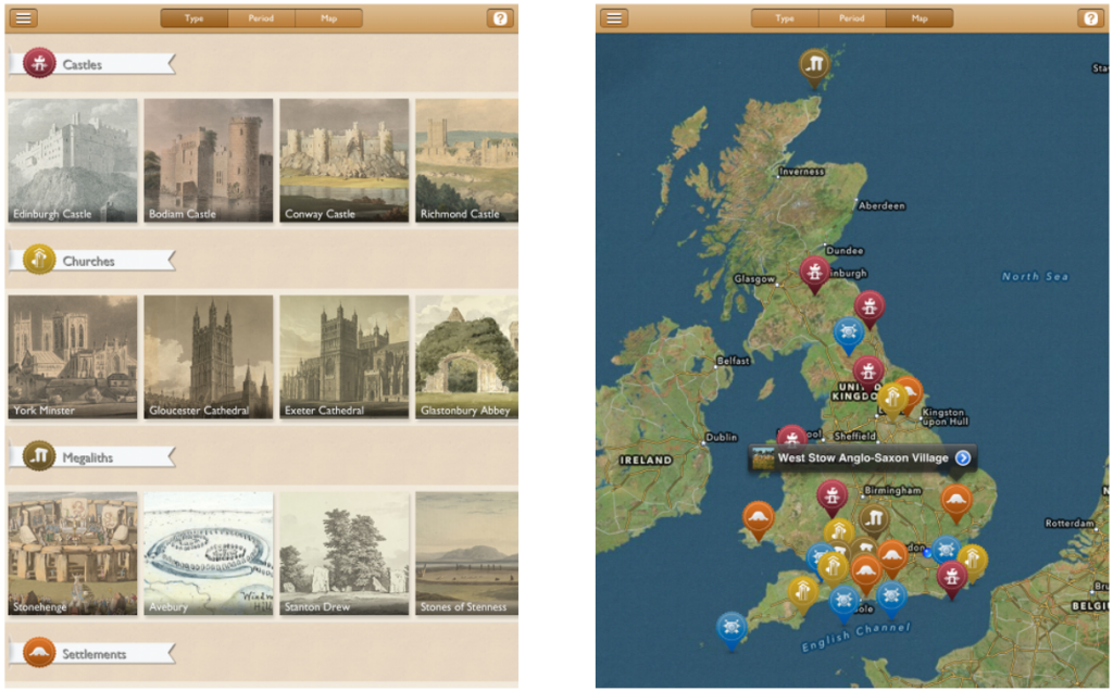
The Archaeology Britain iPad app was a collaboration between The British Library and the ADS to create an accessible iPad app with unique and interesting content from both organisations. The app presents antiquarian drawings, paintings and maps for some of Britain’s most important archaeological sites. The curated content provides unique and rarely seen perspectives for a wide range of sites from the stone age to the 20th century. The types of sites within the app are castles, churches, megaliths, settlements, and the defense of britain.
The apps target audience is the general public, and is unique due to the rare content provided from The British Library archives. Much of the included British Library content is not publically accessible, so the app offers a privileged view of some of the institutions most treasured collections. Additionally open content from the ADS and other sources (see Content Credits below) were included to provide context to The British Library content, although some of the non-British Library content stands up on its own.
The app was primarily developed by Ed Zukowski at The British Library with support from Michael Charno at the ADS. As domain specialists, the ADS took on the responsibility of curating the archaeological sites and content for the app. It was designed to enable users to discover the content via the typical What, When, and Where facets, similar to the Archsearch interface. In total there are 27 sites across 5 different What categories (Castles, Churches, Megaliths, Settlements, Defence of Britain) and 4 different When categories (Stone Age, Iron Age, Middle Ages, 20th Century). There was obvious simplification that was done to fit the sites into When categories, since many of the sites cover multiple periods. In later versions this complexity will hopefully be represented more accurately. The Where facet provides a map with the sites plotted across Britain.

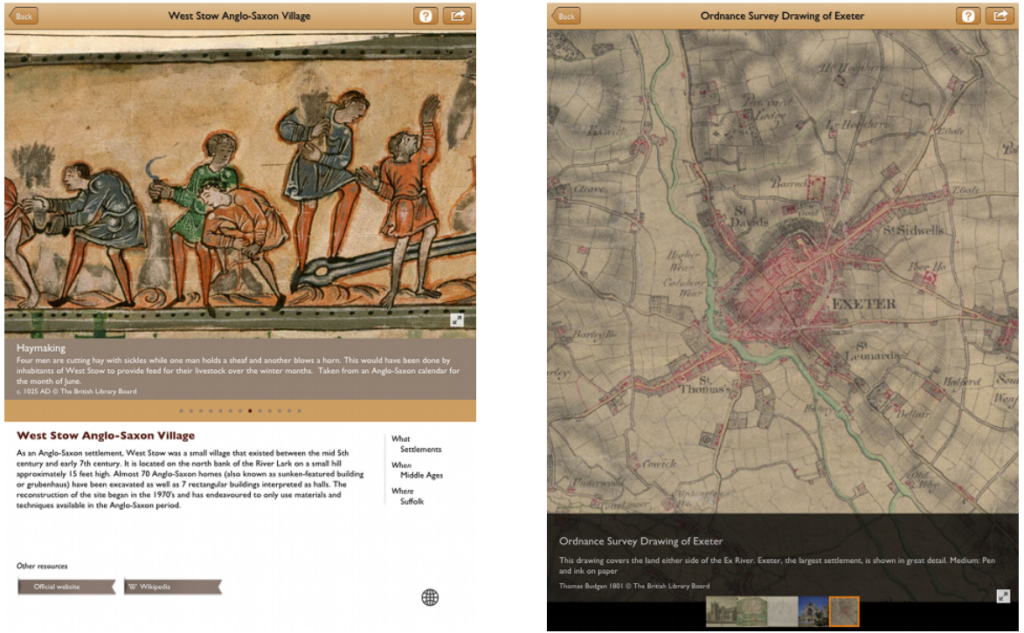
Each site within the app contains simple metadata, content related to the site, and links to online resources. The site metadata is simply What, When and Where information as well as a site description and a link to the map to show the site in its geographic context. The content for each site includes thumbnails which can be quickly navigated in addition to a title, description, creator, year and copyright informatoin for each image. The images can also be zoomed in to show greater detail, which is particularly useful for the old Ordnance Survey maps. Finally links to online resources for each site is also available, allowing the user to explore the sites further by providing links to the organisations tasked with maintaining the sites as well as links to the ADS archive if one exists.
The app’s source code will be made available as open source and re-usable for others wanting to create similar apps. The source code is being commented and prepared and will be linked to from here when it is available. The content and the graphics used in the app however are propietary and under strict copyright, so they will not be made available for re-use. However, if anyone wants to create a similar app with What, When and Where style navigation we hope our source code will be useful.
 FAQ
FAQ
Will there be an Android/iPhone/BlackBerry version of the app?
There are plans to port the app to the Android and/or iPhone platforms, however a time frame for this does not exist at the moment.
Will there be more sites/content added to future versions of the app?
More sites and content will be added when time and resources are available to The British Library and the ADS, however at the moment there are no plans to undertake this.
Content Credits
While most of the content for the app comes from The British Library and the ADS, there were also other contributers who deserve mention.
- Adam Montague: Breakwater Fort – http://www.theurbanexplorer.co.uk/
- Nicholas Mutton: Breakwater Fort – http://www.geograph.org.uk/
- Amy Randall: Old Sarum – http://www.englishheritageimages.com/
- Jane Hawkes: West Stow – http://www.york.ac.uk/library/collections/yorkdigitallibraryyodl/
- Brian Southern: Castell Henllys – http://www.pembrokeshirecoast.org.uk/
- Lewis Clarke: Bembridge Fort – http://www.geograph.org.uk/
- Douglas Law: Bembridge Fort – http://www.geograph.org.uk/


