Digital Object Metadata
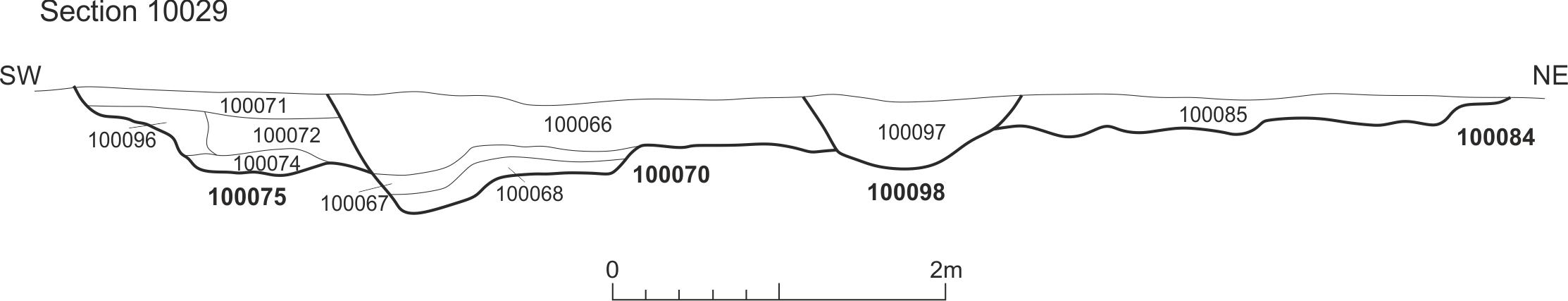
Section 10029 [100075] [100070] [100098] [100084]
Object ID: 2195420
![Preview of Section 10029 [100075] [100070] [100098] [100084]](1004722/images/preview/1C19WTLAR_Fig_6_1-50.jpg "Click to view Section 10029 [100075] [100070] [100098] [100084]")
Digital Object Information
| Object ID | 2195420 |
|---|---|
| Title | Section 10029 [100075] [100070] [100098] [100084] |
| Year Created | 2021 |
| Creation Dates | |
| Start date: 27-Oct-2021 | |
| Creator |
|
Access and Rights
| Cite as | West, J., (2021) Section 10029 [100075] [100070] [100098] [100084] [digital object]. York: Archaeology Data Service [distributor]. Object ID: 2195420 |
|---|---|
| Copyright |
|
| Licence | This work is licensed under a The Open Government Licence (OGL). |
| Primary Contact |
High Speed Two Ltd. 2 Snowhill Queensway Birmingham B4 6GA United Kingdom Tel: 08081 434 434 Email: [email protected] |
| Metadata Contact | ADS: [email protected] |
Content and Subject Information
| Data Type | Image |
|---|---|
| Language |
|
| Subject | Excavation |
| Section | |
| Drawing | |
| Location | Hertfordshire |
| West of Tilehouse Lane | |
| Coordinates | Latitude Longitude: 51.60297019 -0.511556722 |
File Information
| File name | 1C19WTLAR_Fig_6_1-50.jpg |
JPG |
Download File |
|---|---|---|---|
| Format | JPG | ||
| Format type | JPEG File Interchange Format (v. 1.01) | ||
| File size | 58 Kb | ||
| Checksum | 99c27e7f461bf712f02338d41de2d2c9 | ||
| Last modified | 13-Mar-2025 |
Relationships
| This Object is from Collection | Data from an Archaeological Recording at West of Tilehouse Lane, Three Rivers, Hertfordshire, 2019 (HS2 Phase One) |
|---|
Archived Metadata for Download
Download the metadata file(s) for this object, submitted as part of the collection. Please note that this deposited metadata may also contain metadata for associated files, or files of the same data type from this collection.
| Image metadata | |||
|---|---|---|---|
| Filename | 1C19WTLAR_ADS_raster_metadata.csv (2 Kb) |
CSV |
Info
Download |