Digital Object Metadata
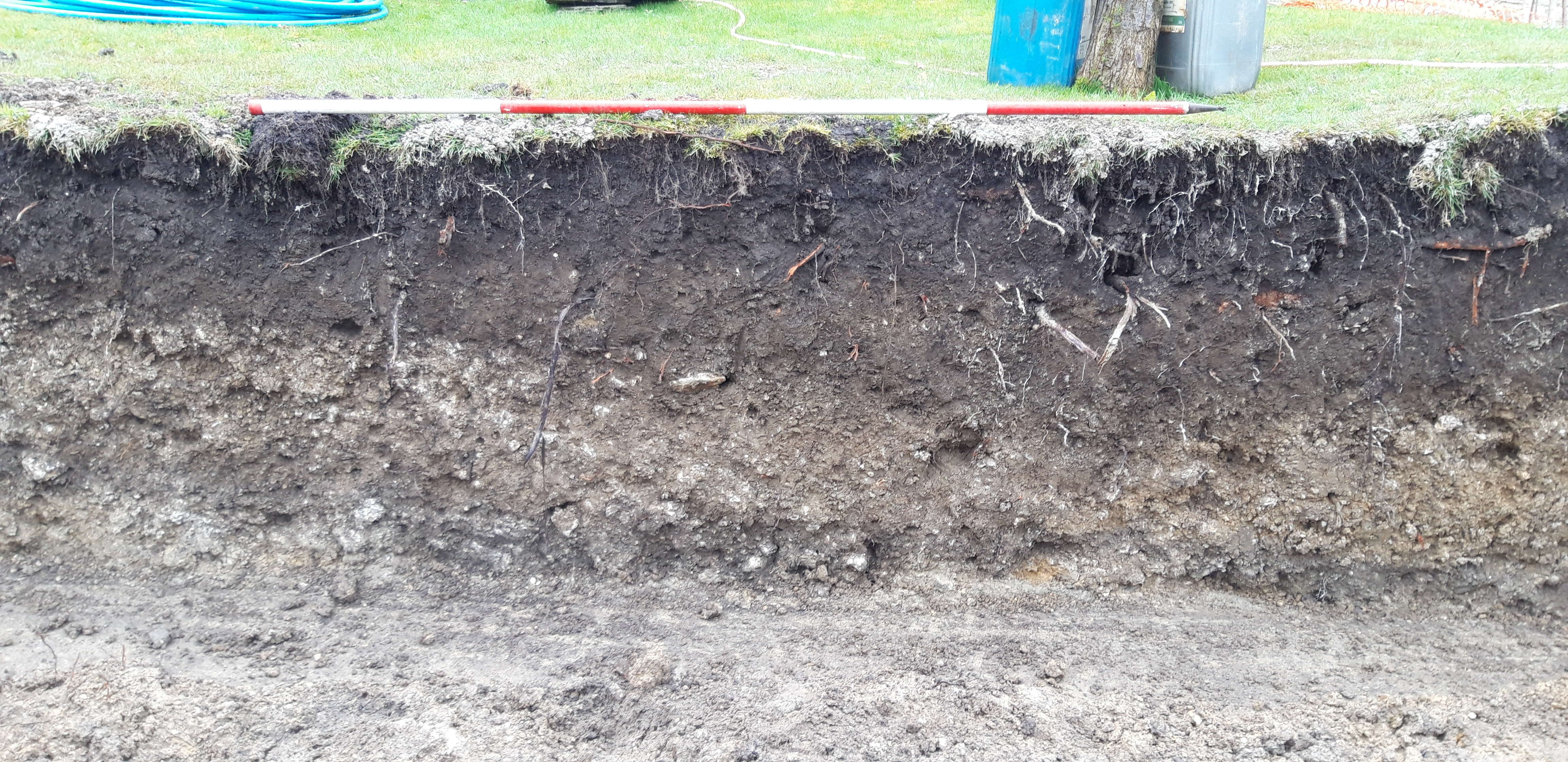
South facing section, across [104], (100), (112), (101). 2m scale.
Object ID: 2561776
![Preview of South facing section, across [104], (100), (112), (101). 2m scale.](1005495/images/preview/218320_204_58.jpg "Click to view South facing section, across [104], (100), (112), (101). 2m scale.")
Digital Object Information
| Object ID | 2561776 |
|---|---|
| Title | South facing section, across [104], (100), (112), (101). 2m scale. |
| Year Created | 2023 |
| Creation Dates | |
| Start date: 04-Apr-2019 | |
| Creator |
|
Access and Rights
| Cite as | Wessex Archaeology, (2023) South facing section, across [104], (100), (112), (101). 2m scale. [digital object]. York: Archaeology Data Service [distributor]. Object ID: 2561776 |
|---|---|
| Copyright |
|
| Licence | This work is licensed under a Creative Commons Attribution 4.0 International License. |
| Primary Contact |
Wessex Archaeology Portway House Old Sarum Park Salisbury SP4 6EB UK Tel: 01722 326867 Fax: 01722 337562 Email: [email protected] |
| Metadata Contact | ADS: [email protected] |
Content and Subject Information
| Data Type | Image |
|---|---|
| Subject | Feature |
| DITCH | |
| Ditch | |
| Periods | Medieval |
| Period Dates |
|
| Location | The Old Vicarage |
| Anchor Road | |
| England | |
| Wiltshire | |
| Calne | |
| Coordinates | OSGB: 400034 171000 |
File Information
| File name | 218320_204_58.jpg |
JPG |
Download File |
|---|---|---|---|
| Format | JPG | ||
| Format type | JPEG File Interchange Format (v. 1.01) | ||
| File size | 6.79 Mb | ||
| Checksum | 417e3cad6bd26a3d2c5b7d192618fde4 | ||
| Last modified | 11-Dec-2023 |
Relationships
| This Object is from Collection | Report, Images, and Data from an Archaeological Investigation by Strip, Map, and Sample Excavation at The Old Vicarage, Anchor Road, Calne, 2019. |
|---|
Archived Metadata for Download
Download the metadata file(s) for this object, submitted as part of the collection. Please note that this deposited metadata may also contain metadata for associated files, or files of the same data type from this collection.
| The Old Vicarage Calne 2019 Image metadata - Site Photos | |||
|---|---|---|---|
| Filename | ADS_raster_metadata_EXC.csv (17 Kb) |
CSV |
Info
Download |