Digital Object Metadata
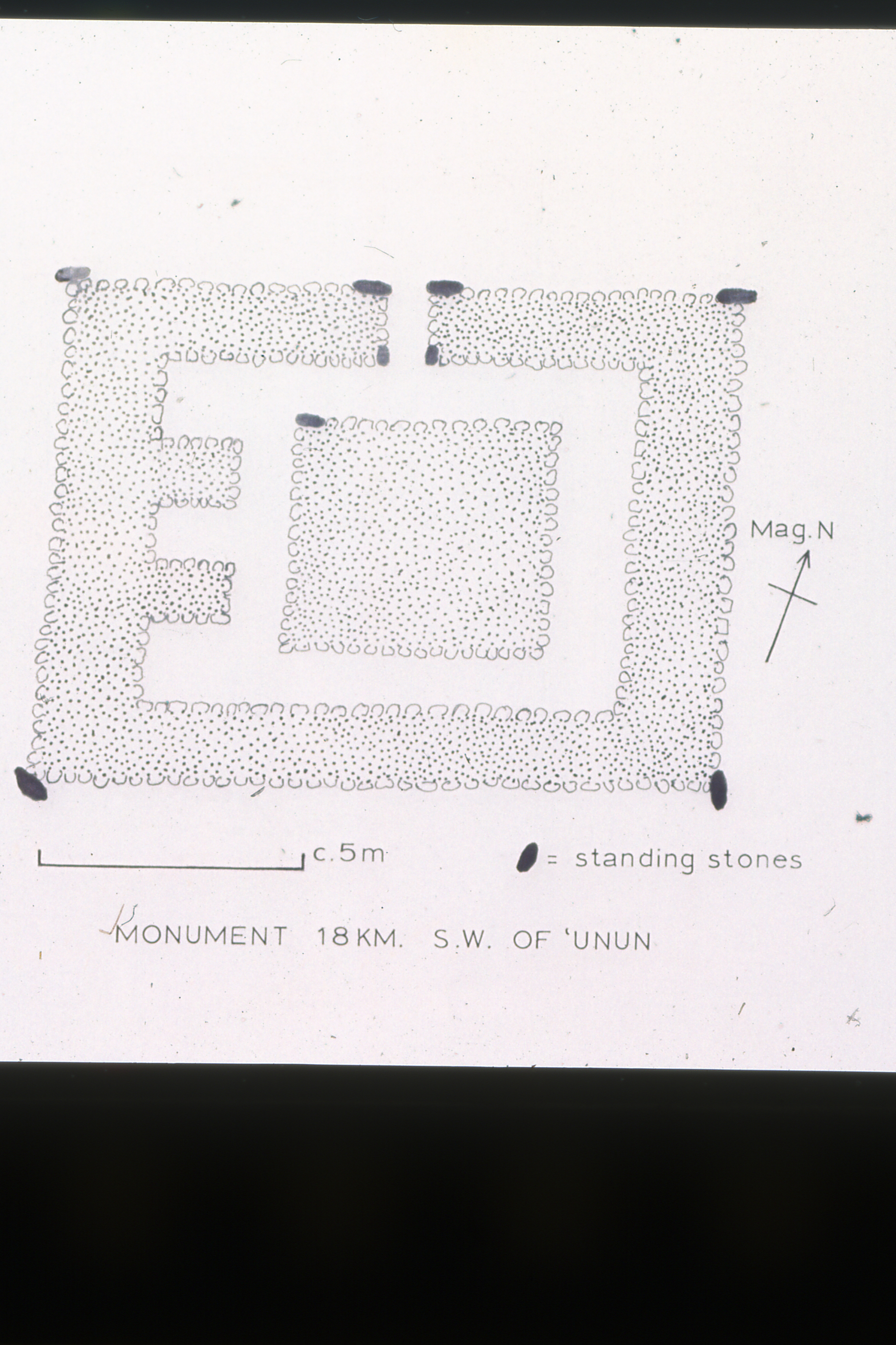
Plan of enclosed platform monument - 18km southwest of Unun
Object ID: 2605615

Digital Object Information
| Object ID | 2605615 |
|---|---|
| Title | Plan of enclosed platform monument - 18km southwest of Unun |
| Year Created | 1975 |
| Creator |
|
Access and Rights
| Cite as | British Institute in Eastern Africa, (1975) Plan of enclosed platform monument - 18km southwest of Unun [digital object]. York: Archaeology Data Service [distributor]. Object ID: 2605615 |
|---|---|
| Copyright |
|
| Licence | This work is licensed under a Creative Commons Attribution 4.0 International License. |
| Primary Contact |
British Institute in Eastern Africa 10 Carlton House Terrace London SW1Y 5AH United Kingdom Tel: +44 (0)20 7969 5201 |
| Metadata Contact | ADS: [email protected] |
Content and Subject Information
| Data Type | Image |
|---|---|
| Language |
|
| Location | Somalia |
| Eel Gaal (El Gal) | |
| Migiurtinia Region |
File Information
| File name | bieasom1319.jpg |
JPG |
Download File |
|---|---|---|---|
| Format | JPG | ||
| Format type | JPEG File Interchange Format (v. 1.02) | ||
| File size | 5.48 Mb | ||
| Checksum | e08f1253a3d3de18b002d12675c18bf1 | ||
| Last modified | 15-Oct-2009 |
Relationships
| This Object is from Collection | British Institute in Eastern Africa Digital Archives: Somalia |
|---|---|
| This Object is also Part of | Eel Gaal (Group) |
| Eel Gaal (Group) |
Archived Metadata for Download
Download the metadata file(s) for this object, submitted as part of the collection. Please note that this deposited metadata may also contain metadata for associated files, or files of the same data type from this collection.
| Raster metadata | |||
|---|---|---|---|
| Filename | ADS_raster_metadata_template.csv (531 Kb) |
CSV |
Info
Download |