Digital Object Metadata
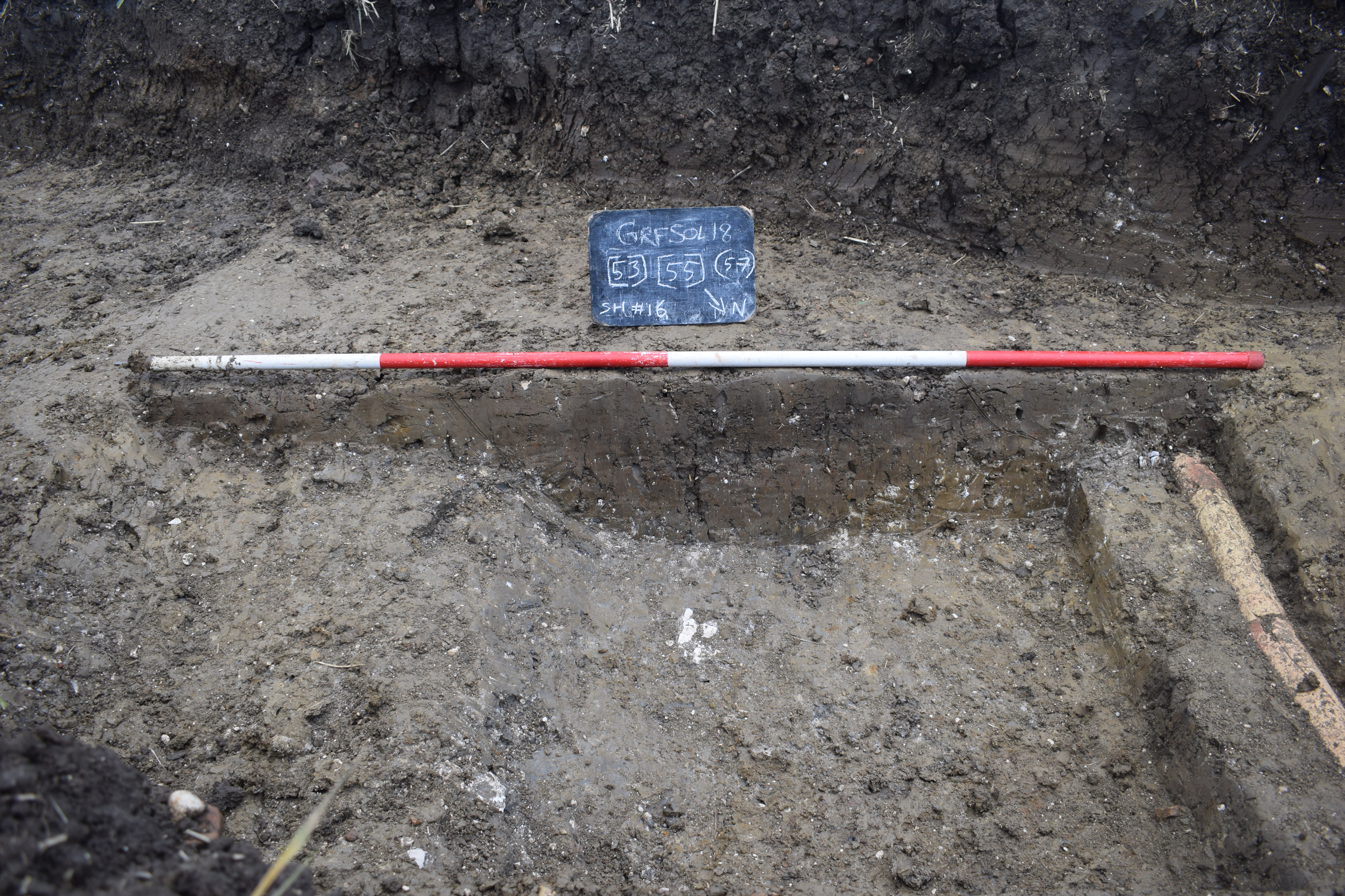
Northeast facing section of gully, ditch and land drain [53] and [55]
Object ID: 2757656
![Preview of Northeast facing section of gully, ditch and land drain [53] and [55]](1007145/images/preview/ECB5491_shot_16a.jpg "Click to view Northeast facing section of gully, ditch and land drain [53] and [55]")
Digital Object Information
| Object ID | 2757656 |
|---|---|
| Title | Northeast facing section of gully, ditch and land drain [53] and [55] |
| Year Created | 2024 |
| Creation Dates | |
| Start date: 07-Nov-2018 | |
| Creator |
|
Access and Rights
| Cite as | M, D., (2024) Northeast facing section of gully, ditch and land drain [53] and [55] [digital object]. York: Archaeology Data Service [distributor]. Object ID: 2757656 |
|---|---|
| Copyright |
|
| Licence | This work is licensed under a Creative Commons Attribution 4.0 International License. |
| Primary Contact |
Oxford Archaeology (Cambridge) 15 Trafalgar Way Bar Hill Cambridgeshire CB23 8SQ Email: [email protected] |
| Metadata Contact | ADS: [email protected] |
Content and Subject Information
| Data Type | Image |
|---|---|
| Language |
|
| Subject | Gully |
| Ditch | |
| Periods | Iron Age |
| Roman | |
| Period Dates |
|
| Location | Grafham Water Solar Farm |
| Coordinates | OSGB: 516724 266324 |
File Information
| File name | ECB5491_shot_16a.jpg |
JPG |
Download File |
|---|---|---|---|
| Format | JPG | ||
| Format type | Exchangeable Image File Format (Compressed) (v. 2.3.x) | ||
| File size | 6.99 Mb | ||
| Checksum | 26e9ef30c23a10e0ce45e8a207169e03 | ||
| Last modified | 05-Jul-2024 |
Relationships
| This Object is from Collection | Digital Archive from a Trial Trench Evaluation at Grafham Solar Array, Cambridgeshire, October-November 2018 |
|---|
Archived Metadata for Download
Download the metadata file(s) for this object, submitted as part of the collection. Please note that this deposited metadata may also contain metadata for associated files, or files of the same data type from this collection.
| Image metadata | |||
|---|---|---|---|
| Filename | ECB5491_GRFSOL18_RasterMetadata_ADS.csv (22 Kb) |
CSV |
Info
Download |