
Data from a Trial Trenching at Station 53C, Portway Farm, Aylesbury Vale, Buckinghamshire, 2020-2021 (HS2 Phase One)
High Speed Two Ltd., INFRA Archaeology, 2024. https://doi.org/10.5284/1119140. How to cite using this DOI
Data copyright © High Speed Two Ltd. unless otherwise stated
This work is licensed under a The Open Government Licence (OGL).

Primary contact
High Speed Two Ltd.
2 Snowhill
Queensway
Birmingham
B4 6GA
United Kingdom
Tel: 08081 434 434
Resource identifiers
- ADS Collection: 4328
- DOI:https://doi.org/10.5284/1119140
- How to cite using this DOI

Introduction
This collection comprises a digital archive of photographs, GIS files, scanned site records and a report from trial trenching by INFRA Archaeology at Station 53C, Portway Farm, Buckinghamshire.
Project Summary
The trial trenching, consisting of 32 evaluation trenches, was undertaken to help clarify the location, extent, survival and significance of any heritage assets in the vicinity of the Site, the aims of the trial trenching were then to:
- Confirm the presence/absence, extent and depth of any surviving Second World War remains within the Site
- Determine the nature, date, condition, state of preservation, complexity and significance of any Second World War remains
- Determine the likely range, quality and quantity of artefactual and environmental evidence present Suggest measures, if appropriate and feasible, for further archaeological investigation to mitigate identified significant impacts
The trial trenching also contributed to answering the following specific Generic Written Scheme of Investigation: Historic Environment Research and Delivery Strategy (HERDS) KC (Knowledge Creation) objectives:
- KC45: The conflicts of the 20th century define the history of modern Britain and the world: how can we achieve a greater understanding of the significance of sites associated with conflict to local communities along the route?
- KC47: Test and develop geophysical survey methodologies.
Re-Use Value Statement
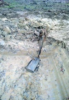
Although the results of the Trial Trench Evaluation were relatively limited, further work does have the potential to yield additional information about the structures within the Site or unstratified artefact scatters associated with wartime activity. The association with SOE activities also makes the Site itself more unusual in the context of Second World War archaeology, and thus makes the dataset presented here a rare opportunity to examine the archaeological remains associated with secret operations.
If undertaken additional fieldwork should focus on the detailed recording of the surviving transmitter building which may shed further light on the wartime activities of the Station. This should be coupled with archival research to explore any surviving documentation associated with the Site and its function/layout.
A further technique to consider would be a systematic metal detector survey, beyond the simple scanning of topsoil and subsoil from excavated trenches, to reveal a detailed plan of the unstratified artefactual material within the Site, specifically that associated with Station 53C. If any military artefacts were to be recovered it would add small, but valuable pieces of information about the military activities within the Site and the individuals who undertook them, especially as the below ground impact of the transmitter aerials is likely to have been relatively limited. It may also assist with identifying any foci of activity within certain areas of the Site, away from the main buildings. When used in conjunction with the findings submitted here such data could provide a key insight into SOE activities, provide insight into the development and construction of Transmitter Stations during the Second World War, and reveal how Second World War installations which were continued to be used into the Cold War era may have changed or remained consistent as requirements and technology evolved.
