Introduction
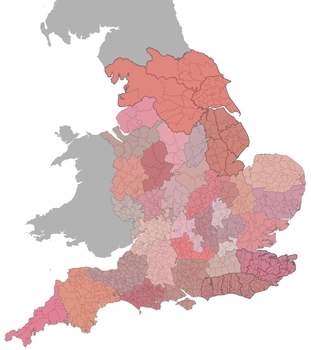
When the Normans arrived in England in AD 1066 they found a kingdom divided into a distinctive and complicated administrative geography. In compiling Domesday Book, the great survey of holdings and liabilities over much of England and parts of Wales completed in 1086, the assessors grouped information firstly into ‘shires’—districts that are in many cases the precursors of modern counties—and then into smaller divisions such as hundreds, wapentakes, and vills (estates), with additional groupings such as multiple hundreds and regional ealdormanries also discernible in the source. These administrative entities clearly had a territorial composition. Using the boundaries of estates, parishes, and hundreds mapped at later dates, numerous scholars have sought to reconstruct the administrative geography described in Domesday Book.
This archive contains digitised shapefiles of the administrative boundaries as they are believed to have existed in 1086. The data-package consists of three ESRI shapefiles, describing three tiers of administrative district that can be reconstructed from Domesday Book, ranging from small (DBhundreds.shp) to large (DBshires.shp) in scale, with some areas also having intermediate (DBinter.shp) administrative divisions.
Digital mapping of the Domesday hundreds was carried out as part of a three-year interdisciplinary research project Landscapes of Governance, which ran until November 2012 funded by the Leverhulme Trust, and which brought together researchers from the UCL Institute of Archaeology, the Institute for Name-Studies at the University of Nottingham, and the Department of History, University of Winchester. The spatial data collected here is supplemented by lexical listings of hundred names which form a separate resource ‘Electronic Anderson’ (Baker and Brookes, forthcoming). Separately and together, these data provide a powerful new tool for analyzing and re-assessing the nature of English territorial arrangements and their linguistic contents.