
Longstone Edge, Derbyshire Dales. Excavation
Fay Worley, Wendy Smith, Peter Popkin, Peter Reeves, Peter Murphy, Peter Andrews, Lucija Soberl, Gill Campbell, Peter Marshall, Ruth Leary, Chris Gleed-Owen, Wendy Smith, Pauline Beswick, Polydora Baker, Sheila Keyte, Richard Evershed, Tom Cromwell, Peter Makey, Simon Mays, Johannes van der Plicht, Christopher Bronk Ramsey, Jonathan Last, 2020. https://doi.org/10.5284/1081989. How to cite using this DOI
Data copyright © Historic England unless otherwise stated
This work is licensed under a Creative Commons Attribution 4.0 International License.

Primary contact
Historic England
Fort Cumberland
Fort Cumberland Road
Portsmouth
PO4 9LD
UK
Resource identifiers
- ADS Collection: 3753
- DOI:https://doi.org/10.5284/1081989
- How to cite using this DOI
Introduction
Longstone Edge is found on the western end of High Rake, an east-west aligned limestone escarpment in the Peak District National Park, c 5 km north of Bakewell (NGR SK 2088 7341). The escarpment, in the north-eastern part of the White Peak limestone plateau, rises to 390 m above sea-level; its southern edge has been quarried during medieval and post-medieval lead mining and the two barrows recorded in this archive came to be situated on the northern lip of the former quarry, known as Longstone Rake. They were threatened by slippage and collapse of the quarry edge and by subsidence cracks which were opening up to the north and west of this face. The threat was heightened because of vibration from on-going fluorspar mining, carried out by Laporte Minerals, 180 m below the ground surface.
A topographical survey of the site was undertaken in December 1995 by the Central Archaeology Service (CAS) of English Heritage (now Historic England), and the excavation of the two barrows was undertaken over 10 weeks between August and October 1996, directed by Peter Reeves.
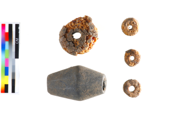
The fieldwork and analysis recorded in this archive revealed that the two barrows had very different histories. Barrow 1 exhibited several phases of use in the Neolithic and Early Bronze Age, and was reused in later prehistory and the Romano-British period. The earliest human remains, which date to the 4th millennium cal BC, comprise some crushed bone on the land surface beneath the barrow mound. The form of the site in the Neolithic is unclear but it is possible that a low ring-cairn pre-dates the mound into which it was incorporated and belongs to the initial mortuary phase. Also predating the main barrow mound is a cist grave containing disturbed remains of two individuals and fragments of a Beaker pot. The grave fill contained large quantities of small mammal bones, probably deriving from owl pellets. Subsequently, following the deposition of a Food Vessel cremation, the main barrow mound was constructed.
Barrow 2, which had been partly excavated in the 19th century by Thomas Bateman, had a less complex sequence and fewer finds, though there were human remains broadly contemporary with those in the Barrow 1 cist grave. Assemblages of struck flint, prehistoric and Romano-British pottery, human and animal remains, charred plant remains and molluscs were recovered from both monuments and provide information on the nature of human activity in different periods and the formation processes that have operated.
The project was published in Derbyshire Archaeological Journal (2014), Volume 134.
