
The Verderers of the New Forest Higher Level Stewardship Scheme
Peter Crow, Network Mapping, Cambridge University Technical Services, 2020. https://doi.org/10.5284/1095844. How to cite using this DOI
Data copyright © Forest Research, The Verderers of the New Forest, New Forest National Park Authority, Forestry England, Cambridge University Technical Services unless otherwise stated
This work is licensed under a Creative Commons Attribution 4.0 International License.
Primary contact
Archaeology Team
New Forest National Park Authority
Lymington Town Hall
Avenue Road
Lymington
SO41 9ZG
Resource identifiers
- ADS Collection: 3530
- DOI:https://doi.org/10.5284/1095844
- How to cite using this DOI
Introduction
The Verderers of the New Forest Higher Level Stewardship (HLS) Scheme is a large environmental scheme to restore and enhance internationally important habitants on the Crown lands of the New Forest National Park.
The ten-year project, running from 2010 to 2020, was funded by Natural England using funding drawn from both the EU and the UK. It was the largest such scheme in England. The project was overseen by a board drawn from the chief executives of the partner organisations, principally the New Forest National Park Authority (NFNPA), Forestry England (FE), Natural England (NE) and the New Forest Verderers, and has five main objectives:
- Wildlife conservation
- Protection of the historic environment
- Maintenance and enhancement of landscape quality and character
- Promote public access and understanding
- Resource protection
Elements of the scheme included wetland restoration (reversing the effects of managed drainage introduced in the 19th century), verge restoration (restoring erosion caused by vehicles on grass verges alongside forest roads), habitat restoration (in Sites of Special Scientific Interest) and the promotion of historic practices such as commoning. A key element of aim 2 was that land upon which restoration or conservation took place would show evidence of archaeological feature protection, and that within three years of work being undertaken, there would be no evidence of ongoing degradation. This would include maintaining the depth of soil protecting features, the reduction of detrimental features such as scrub or animal burrows, and the prevention of activities such as heather burning or vehicle damage. This included the installation of rabbit proof mesh on two Scheduled Ancient Monuments (SAMs).
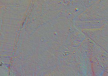
The HLS scheme funded a Lidar survey of the Crown lands, as well as aerial photography in both high-resolution colour photographs and near-infrared imagery. These data were used to inform annual surveys of the Crown lands, conducted by NFNPA archaeologists and volunteers during the winter months. The work to visit, assess, record and, in some instances, preserve historic features was titled the Heritage Mapping project. Over the ten years of the project, several thousand previously unrecorded historic features, ranging from prehistoric burial mounds to Second World War military installations, were surveyed and recorded.
