Introduction
This is a child collection of the main A14 Cambridge to Huntingdon archaeological project archive. For the purposes of analysis, the various Targeted Excavation Areas (TEAs) that formed the mitigation work have been grouped into eight Landscape Blocks.
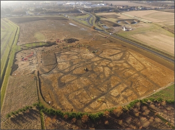
This child collection concerns the Bar Hill Landscape Block. Bar Hill comprised five TEAs (34, 37, 38, 41 and 46) covering 23.35 hectares over a 7.5km stretch between Bar Hill and Girton. The archaeological remains comprised a series of complex Iron Age and Roman farmsteads. Significant middle – late Iron Age settlements were identified at three sites, comprising a series of enclosures which seem to have been focused mainly on the management of livestock. One of these settlements continued through into the later Roman period, though it was redeveloped through a series of planned enclosures. This was probably related to the larger settlement agglomeration revealed at Northstowe to the north. Another small, enclosed settlement was established on the claylands during the middle Roman period. Both settlements were abandoned by the end of the fourth century AD.