Introduction
This is a child collection of the main A14 Cambridge to Huntingdon archaeological project archive. For the purposes of analysis, the various Targeted Excavation Areas (TEAs) that formed the mitigation work have been grouped into eight Landscape Blocks.
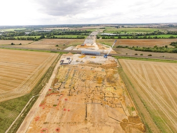
This child collection concerns the River Great Ouse Landscape Block. River Great Ouse lay to the east of the river and comprised four TEAs (19, 20, 21 and 49), covering a total area of 19.82 hectares. The evidence suggests that during the earlier prehistoric period there was only sporadic activity and short-term occupation, with the only significant feature being a large timber circle monument which has been tentatively dated to the early Bronze Age. In the middle Iron Age, two settlements were identified, c 1km apart. The smaller eastern settlement was largely abandoned by the late Iron Age, whereas the larger settlement to the west settlement had at least two connected areas of occupation and continued into the Roman period, developing into a substantial complex farmstead. An adult male inhumation burial associated with this farmstead had aDNA and isotopic signatures suggesting he originated thousands of miles to the east in the Caucasus and had a possible connection with the known movement of Sarmatian cavalry into Britain in the later second century AD. The settlement underwent major re-development during the late Roman period, when it became what is thought to be a villa complex defined by a substantial double-ditched sub- rectangular enclosure and a range of timber buildings, although the area of the presumed main villa building was not excavated. The villa continued until at least the later fourth century and there was no further activity of any significance.