Introduction
This is a child collection of the main A14 Cambridge to Huntingdon archaeological project archive. For the purposes of analysis, the various Targeted Excavation Areas (TEAs) that formed the mitigation work have been grouped into eight Landscape Blocks.
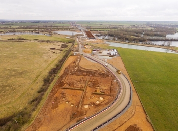
This child collection concerns the West of Ouse Landscape Block. West of Ouse comprised three TEAs (14, 15, 16) covering 20 hectares spread over 1.5km on the river terrace that descends into the valley of the River Great Ouse to the south of Brampton. The excavations revealed earlier prehistoric activity located adjacent to the River Great Ouse with an oblong Neolithic monument overlain by a circular Bronze Age Barrow. A group of six cremations were deposited in the early Bronze Age with funerary activity continuing into the middle Bronze Age when a significant cremation cemetery, comprising 51 cremation burials, was cut into the southeastern quadrant of the mound. A late Bronze Age – early Iron Age pit alignment was located to the north of the Barrow. Two middle to late Iron Age Settlements were revealed, along with two different Roman settlements, one of which developed with a network of enclosures, fields and trackways over a considerable area. Both were associated with early Roman pottery production, and fell out of use by the third century AD. A group of five early Saxon SFBs were identified across the landscape block.