Overview
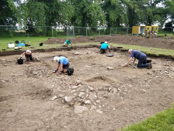
The WallCAP collection is broken into three sections. First is the WallGIS, a GIS and geodatabase that brings together over 150 years of archaeological research and data on the features of Hadrian’s Wall. The data can be downloaded for use in further research or explored through the web interface. Next is the Heritage at Risk data. These are the excavation reports and associated specialist reports that publish the results of WallCAP excavations and conservation work at 6 sites along Hadrian’s Wall – Heddon on the Wall, Cat Stairs and Peel Gap, Walltown Crags and Mucklebank turret, Corbridge, Cambeck, and Port Carlisle. Finally, it includes the Stone Sourcing and Dispersal data. This includes the results of stone recording and petrographic and other geological analysis from numerous locations along and near Hadrian’s Wall.
Artefacts from the WallCAP excavations at Corbridge in 2019 and 2021 have been archived with the English Heritage Corbridge Roman Town museum and archive. The physical archive for the WallCAP excavations at Cambeck in May 2021 has been archived with Tullie House Museum & Art Gallery, Carlisle.