Downloads
Files
|
|||
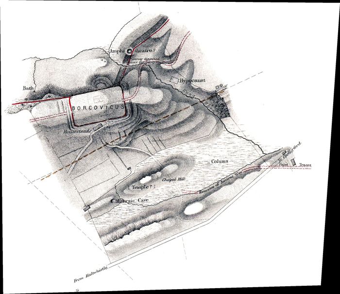
| WallCAP Georeferenced Basemap: 1850s Hadrian's Wall Survey - Housesteads Roman fort GeoTIFF | |||
|---|---|---|---|
| Filename | maclauchlan_Housesteads_geor.tif (13 MB) |
TIF |
Info
Download |
| Description | Georeferenced TIFF file of Housesteads Roman fort from the 1850s MacLauchlan survey of Hadrian's Wall. Surveyed and created by Henry MacLauchlan. | ||

|
|||
| WallCAP Georeferenced Basemap: 1749 Debbeig & Campbell Map GeoTIFF | |||
|---|---|---|---|
| Filename | 1749_Debbeig_and_Campbell_geor.tif (61 MB) |
TIF |
Info
Download |
| Description | Georeferenced TIFF file of the 1749 Debbeig & Campbell map, surveyed prior to the construction of the Military Road in the 1750s. Surveyed and created by Hugh Debbeig and Dugal Campbell. | ||
|
|||
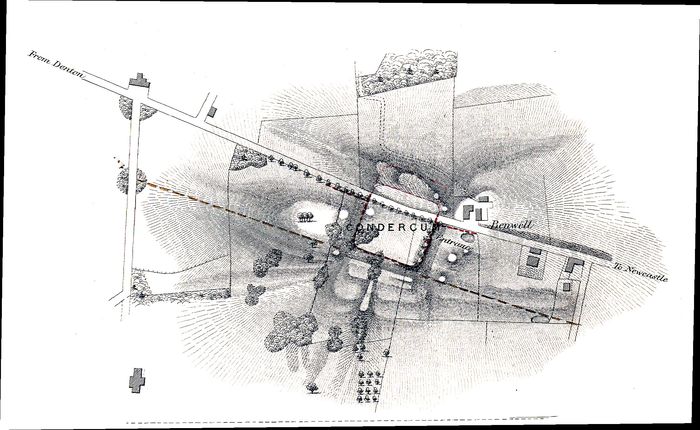
| WallCAP Georeferenced Basemap: 1850s Hadrian's Wall Survey - Benwell Roman fort GeoTIFF | |||
|---|---|---|---|
| Filename | maclauchlan_Benwell_geor.tif (8 MB) |
TIF |
Info
Download |
| Description | Georeferenced TIFF file of Benwell Roman fort from the 1850s MacLauchlan survey of Hadrian's Wall. Surveyed and created by Henry MacLauchlan. | ||

|
|||
| WallCAP Georeferenced Basemap: 1850s Hadrian's Wall Survey - Birdoswald Roman fort GeoTIFF | |||
|---|---|---|---|
| Filename | maclauchlan_Birdoswald_geor.tif (21 MB) |
TIF |
Info
Download |
| Description | Georeferenced TIFF file of Birdoswald Roman fort from the 1850s MacLauchlan survey of Hadrian's Wall. Surveyed and created by Henry MacLauchlan. | ||

|
|||
| WallCAP Georeferenced Basemap: 1850s Hadrian's Wall Survey - Bowness on Solway Roman fort GeoTIFF | |||
|---|---|---|---|
| Filename | maclauchlan_Bowness_on_Solway_geor.tif (8 MB) |
TIF |
Info
Download |
| Description | Georeferenced TIFF file of Bowness on Solway Roman fort from the 1850s MacLauchlan survey of Hadrian's Wall. Surveyed and created by Henry MacLauchlan. | ||

|
|||
| WallCAP Georeferenced Basemap: 1850s Hadrian's Wall Survey - Burgh by Sands Roman fort GeoTIFF | |||
|---|---|---|---|
| Filename | maclauchlan_Burgh_by_Sands_geor.tif (8 MB) |
TIF |
Info
Download |
| Description | Georeferenced TIFF file of Burgh by Sands Roman fort from the 1850s MacLauchlan survey of Hadrian's Wall. Surveyed and created by Henry MacLauchlan. | ||
|
|||
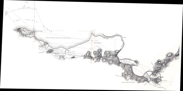
| WallCAP Georeferenced Basemap: 1850s Hadrian's Wall Survey - Carlisle to Bowness section of Hadrian's Wall GeoTIFF | |||
|---|---|---|---|
| Filename | maclauchlan_Carlisle_to_Bowness_geor.tif (107 MB) |
TIF |
Info
Download |
| Description | Georeferenced TIFF file of the Carlisle to Bowness section of the 1865 MacLauchlan survey of Hadrian's Wall | ||

|
|||
| WallCAP Georeferenced Basemap: 1850s Hadrian's Wall Survey - Carrawburgh Roman fort GeoTIFF | |||
|---|---|---|---|
| Filename | maclauchlan_Carrawburgh_geor.tif (6 MB) |
TIF |
Info
Download |
| Description | Georeferenced TIFF file of Carrawburgh Roman fort from the 1850s MacLauchlan survey of Hadrian's Wall. Surveyed and created by Henry MacLauchlan. | ||
|
|||
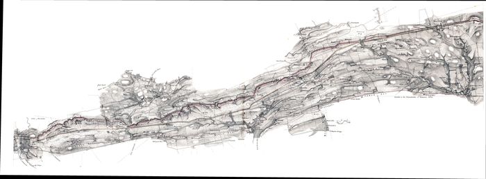
| WallCAP Georeferenced Basemap: 1850s Hadrian's Wall Survey - Carrawburgh to Magna section of Hadrian's Wall GeoTIFF | |||
|---|---|---|---|
| Filename | maclauchlan_Carrawburgh_to_Magna_geor.tif (75 MB) |
TIF |
Info
Download |
| Description | Georeferenced TIFF file of the Carrawburgh to Magna section of the 1865 MacLauchlan survey of Hadrian's Wall. Surveyed and created by Henry MacLauchlan. | ||

|
|||
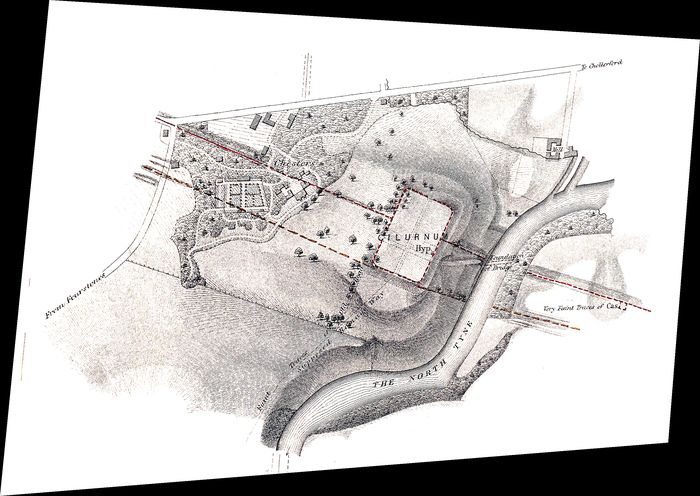
| WallCAP Georeferenced Basemap: 1850s Hadrian's Wall Survey - Castlesteads Roman fort and the Cambeck crossing GeoTIFF | |||
|---|---|---|---|
| Filename | maclauchlan_Cambeck_Castlesteads_geor.tif (12 MB) |
TIF |
Info
Download |
| Description | Georeferenced TIFF file of Castlesteads Roman fort and the Cambeck crossing from the 1850s MacLauchlan survey of Hadrian's Wall. Surveyed and created by Henry MacLauchlan. | ||
|
|||
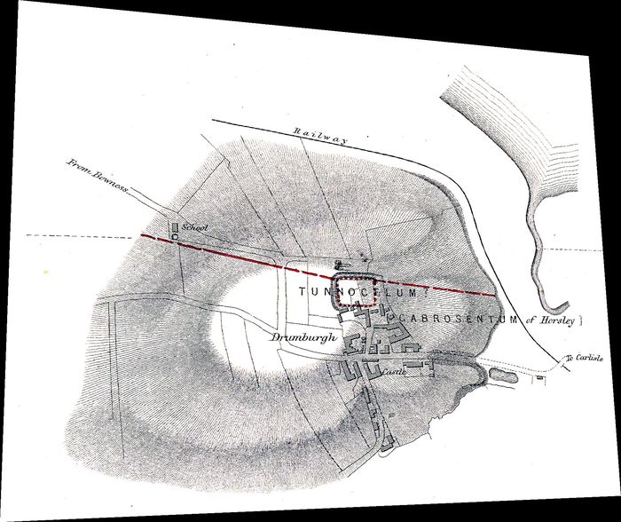
| WallCAP Georeferenced Basemap: 1850s Hadrian's Wall Survey - Chesters Roman fort GeoTIFF | |||
|---|---|---|---|
| Filename | maclauchlan_Chesters_geor.tif (17 MB) |
TIF |
Info
Download |
| Description | Georeferenced TIFF file of Chesters Roman fort from the 1850s MacLauchlan survey of Hadrian's Wall. Surveyed and created by Henry MacLauchlan. | ||
|
|||
| WallCAP Georeferenced Basemap: 1850s Hadrian's Wall Survey - Drumburgh Roman fort GeoTIFF | |||
|---|---|---|---|
| Filename | maclauchlan_Drumburgh_geor.tif (8 MB) |
TIF |
Info
Download |
| Description | Georeferenced TIFF file of Drumburgh Roman fort from the 1850s MacLauchlan survey of Hadrian's Wall. Surveyed and created by Henry MacLauchlan. | ||

|
|||
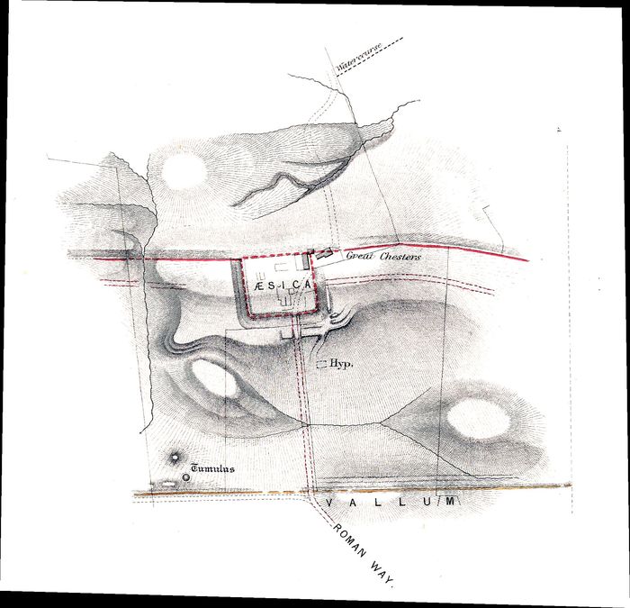
| WallCAP Georeferenced Basemap: 1850s Hadrian's Wall Survey - Gilsland to Walby section of Hadrian's Wall GeoTIFF | |||
|---|---|---|---|
| Filename | maclauchlan_Gilsland_to_Walby_geor.tif (86 MB) |
TIF |
Info
Download |
| Description | Georeferenced TIFF file of the Gilsland to Walby section of the 1850s MacLauchlan survey of Hadrian's Wall. Surveyed and created by Henry MacLauchlan. | ||
|
|||
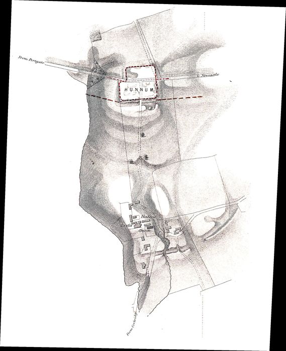
| WallCAP Georeferenced Basemap: 1850s Hadrian's Wall Survey - Great Chesters Roman fort GeoTIFF | |||
|---|---|---|---|
| Filename | maclauchlan_Great_Chesters_geor.tif (10 MB) |
TIF |
Info
Download |
| Description | Georeferenced TIFF file of Great Chesters Roman fort from the 1850s MacLauchlan survey of Hadrian's Wall. Surveyed and created by Henry MacLauchlan. | ||
|
|||
| WallCAP Georeferenced Basemap: 1850s Hadrian's Wall Survey - Hunnum Roman fort GeoTIFF | |||
|---|---|---|---|
| Filename | maclauchlan_Hunnum_geor.tif (17 MB) |
TIF |
Info
Download |
| Description | Georeferenced TIFF file of Hunnum Roman fort from the 1850s MacLauchlan survey of Hadrian's Wall. Surveyed and created by Henry MacLauchlan. | ||
|
|||
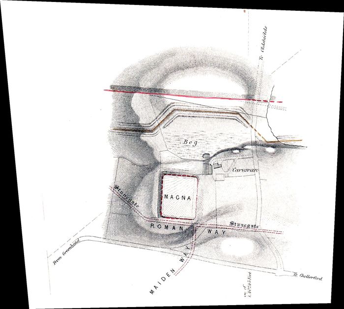
| WallCAP Georeferenced Basemap: 1850s Hadrian's Wall Survey - Magna Roman fort GeoTIFF | |||
|---|---|---|---|
| Filename | maclauchlan_Magna_geor.tif (9 MB) |
TIF |
Info
Download |
| Description | Georeferenced TIFF file of Magna Roman fort from the 1850s MacLauchlan survey of Hadrian's Wall. Surveyed and created by Henry MacLauchlan. | ||
|
|||
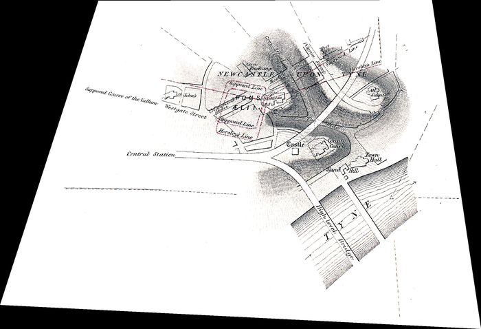
| WallCAP Georeferenced Basemap: 1850s Hadrian's Wall Survey - Pons Aelius Roman fort GeoTIFF | |||
|---|---|---|---|
| Filename | maclauchlan_Pons_Aelius_geor.tif (10 MB) |
TIF |
Info
Download |
| Description | Georeferenced TIFF file of Pons Aelius Roman fort from the 1850s MacLauchlan survey of Hadrian's Wall. Surveyed and created by Henry MacLauchlan. | ||

|
|||
| WallCAP Georeferenced Basemap: 1850s Hadrian's Wall Survey - Ruchester to Chesters section of Hadrian's Wall GeoTIFF | |||
|---|---|---|---|
| Filename | maclauchlan_Rudchester_to_Chesters_geor.tif (78 MB) |
TIF |
Info
Download |
| Description | Georeferenced TIFF file of the Ruchester to Chesters section of the 1850s MacLauchlan survey of Hadrian's Wall. Surveyed and created by Henry MacLauchlan. | ||
|
|||
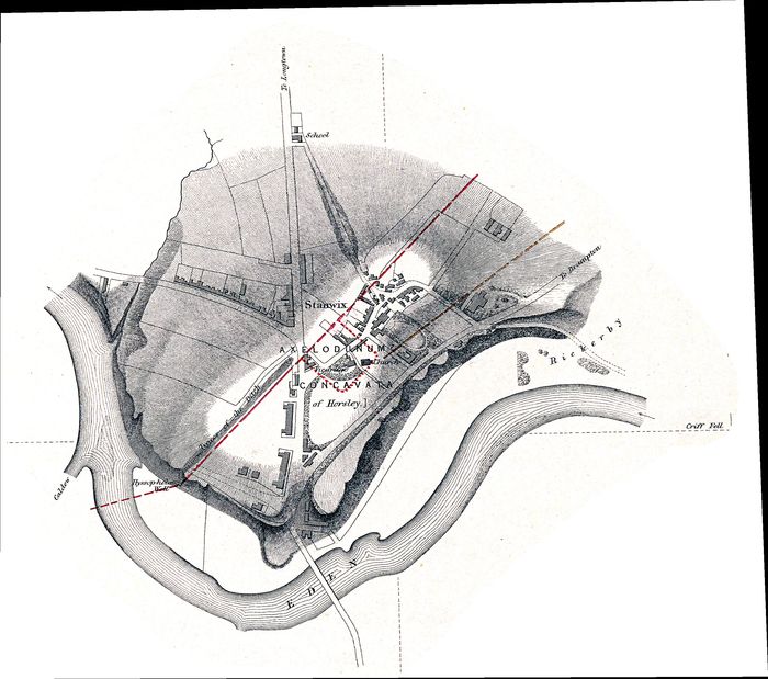
| WallCAP Georeferenced Basemap: 1850s Hadrian's Wall Survey - Stanwix Roman fort GeoTIFF | |||
|---|---|---|---|
| Filename | maclauchlan_Stanwix_Carlisle_geor.tif (19 MB) |
TIF |
Info
Download |
| Description | Georeferenced TIFF file of Stanwix Roman fort from the 1850s MacLauchlan survey of Hadrian's Wall. Surveyed and created by Henry MacLauchlan. | ||
|
|||
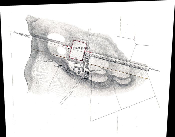
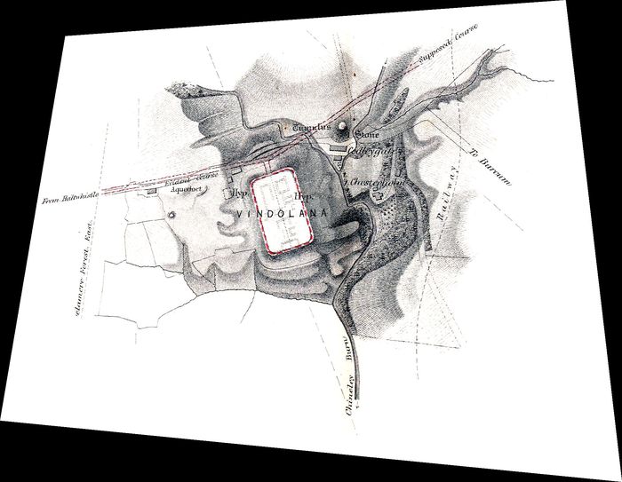
| WallCAP Georeferenced Basemap: 1850s Hadrian's Wall Survey - Vindobala Roman fort GeoTIFF | |||
|---|---|---|---|
| Filename | maclauchlan_Vindobala_geor.tif (15 MB) |
TIF |
Info
Download |
| Description | Georeferenced TIFF file of Vindobala Roman fort from the 1850s MacLauchlan survey of Hadrian's Wall. Surveyed and created by Henry MacLauchlan. | ||
|
|||
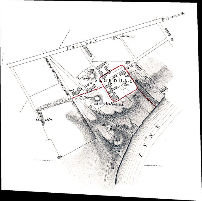
| WallCAP Georeferenced Basemap: 1850s Hadrian's Wall Survey - Vindolanda Roman fort GeoTIFF | |||
|---|---|---|---|
| Filename | maclauchlan_Vindolanda_geor.tif (9 MB) |
TIF |
Info
Download |
| Description | Georeferenced TIFF file of Vindolanda Roman fort from the 1850s MacLauchlan survey of Hadrian's Wall. Surveyed and created by Henry MacLauchlan. | ||
|
|||
| WallCAP Georeferenced Basemap: 1850s Hadrian's Wall Survey - Wallsend Roman fort GeoTIFF | |||
|---|---|---|---|
| Filename | maclauchlan_Wallsend_geor.tif (6 MB) |
TIF |
Info
Download |
| Description | Georeferenced TIFF file of Wallsend Roman fort from the 1850s MacLauchlan survey of Hadrian's Wall. Surveyed and created by Henry MacLauchlan. | ||

|
|||
| WallCAP Georeferenced Basemap: 1850s Hadrian's Wall Survey - Wallsend to Ruchester section of Hadrian's Wall GeoTIFF | |||
|---|---|---|---|
| Filename | maclauchlan_Wallsend_to_Rudchester_geor.tif (62 MB) |
TIF |
Info
Download |
| Description | Georeferenced TIFF file of the Wallsend to Ruchester section of the 1850s MacLauchlan survey of Hadrian's Wall. Surveyed and created by Henry MacLauchlan. | ||

|
|||
| WallCAP Georeferenced Basemap: 1921 reprint of the 1850s MacLauchlan survey of Hadrian's Wall GeoTIFF | |||
|---|---|---|---|
| Filename | maclauchlan1921_geor.tif (268 MB) |
TIF |
Info
Download |
| Description | Georeferenced TIFF file of the 1921 reprint of the 1850s MacLauchlan survey of Hadrian's Wall. Surveyed and created by Henry MacLauchlan. | ||

|
|||
| WallCAP Shapefile: Hadrian's Wall Frontier Settlement Locations | |||
|---|---|---|---|
| Filename | WallGIS_Settlement_point.zip (2 kB) |
ZIP |
Info
Download |
| Description | Point shapefile that represents the key settlements in the Hadrian's Wall frontier zone | ||

|
|||
| WallCAP Shapefile: Hadrian's Wall Frontier Settlement Polygons | |||
|---|---|---|---|
| Filename | WallGIS_Settlement_polygon.zip (3 kB) |
ZIP |
Info
Download |
| Description | Polygon shapefile that represents the key settlements in the Hadrian's Wall frontier zone | ||

|
|||
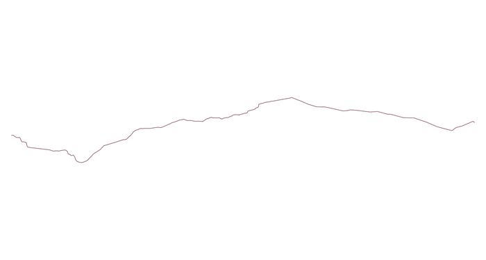
| WallCAP Shapefile: Hadrian's Wall Gates | |||
|---|---|---|---|
| Filename | WallGIS_Gateway_point.zip (2 kB) |
ZIP |
Info
Download |
| Description | Point shapefile that represents the locations of the stand alone gates through the line of Hadrian's Wall | ||
|
|||
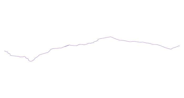
| WallCAP Shapefile: Hadrian's Wall Line of Curtain Wall | |||
|---|---|---|---|
| Filename | WallGIS_CurtainLine.zip (10 kB) |
ZIP |
Info
Download |
| Description | Polyline shapefile that represents the line of Hadrian's Wall curtain wall as one continuous polyline | ||
|
|||
| WallCAP Shapefile: Hadrian's Wall Line of Curtain Wall divided by miles | |||
|---|---|---|---|
| Filename | WallGIS_CurtainWall_polyline.zip (36 kB) |
ZIP |
Info
Download |
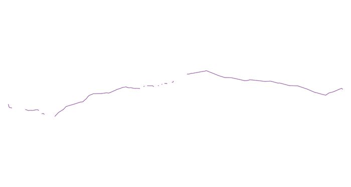
| Description | Polyline shapefile that represents the line of Hadrian's Wall curtain wall, divided into individual Wall miles. Each mile of the curtain wall has associated data from the WallGIS database. | ||
|
|||
| WallCAP Shapefile: Hadrian's Wall Line of Wall Ditch | |||
|---|---|---|---|
| Filename | WallGIS_DitchLine.zip (7 kB) |
ZIP |
Info
Download |
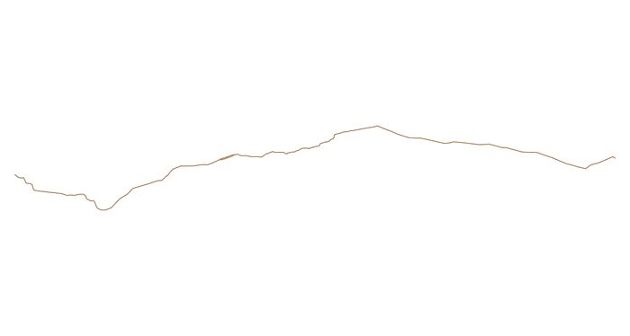
| Description | Polyline shapefile that represents the line of the Hadrian's Wall Wall Ditch as a simple polyline | ||
|
|||
| WallCAP Shapefile: Hadrian's Wall Line of Wall Ditch divided by miles | |||
|---|---|---|---|
| Filename | WallGIS_Ditch_polyline.zip (22 kB) |
ZIP |
Info
Download |
| Description | Polyline shapefile that represents the line of Hadrian's Wall Wall Ditch, divided into individual Wall miles. Each mile of the Ditch has associated data from the WallGIS database. | ||

|
|||
| WallCAP Shapefile: Hadrian's Wall Milecastle Discovery Area | |||
|---|---|---|---|
| Filename | WallGIS_MilecastleDiscoveryArea_polygon.zip (5 kB) |
ZIP |
Info
Download |
| Description | Polygon shapefile that represent an area of uncertainty around each Assumed Milecastle. The Discovery Area indicates an area of 300m on either side of an assumed Milecastle where the exact location of that milecastle could be found. | ||

|
|||
| WallCAP Shapefile: Hadrian's Wall Milecastle Locations | |||
|---|---|---|---|
| Filename | WallGIS_Milecastle_point.zip (15 kB) |
ZIP |
Info
Download |
| Description | Point shapefile that represents the location of each milecastle on Hadrian's Wall | ||

|
|||
| WallCAP Shapefile: Hadrian's Wall Milecastle Polygons | |||
|---|---|---|---|
| Filename | WallGIS_Milecastle_polygon.zip (20 kB) |
ZIP |
Info
Download |
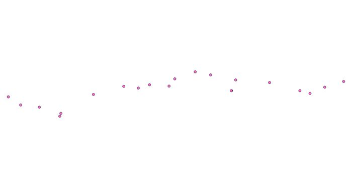
| Description | Polygon shapefile that represents each milecastle on the line of Hadrian's Wall | ||
|
|||
| WallCAP Shapefile: Hadrian's Wall Roman Fort Locations | |||
|---|---|---|---|
| Filename | WallGIS_Fort_point.zip (9 kB) |
ZIP |
Info
Download |
| Description | Point shapefile that represents the location of the Roman forts in the Hadrian's Wall frontier zone | ||
|
|||
| WallCAP Shapefile: Hadrian's Wall Roman Fort Polygons | |||
|---|---|---|---|
| Filename | WallGIS_Fort_polygon.zip (19 kB) |
ZIP |
Info
Download |
| Description | Polygon shapefile that represents each Roman fort in the Hadrian's Wall frontier zone | ||
|
|||
| WallCAP Shapefile: Hadrian's Wall Turret Discovery Area | |||
|---|---|---|---|
| Filename | WallGIS_TurretDiscoveryArea_polygon.zip (11 kB) |
ZIP |
Info
Download |
| Description | Polygon shapefile that represent an area of uncertainty around each Assumed Turret. The Discovery Area indicates an area of 100m on either side of an assumed Turret where the exact location of that turret could be found. | ||
|
|||
| WallCAP Shapefile: Hadrian's Wall Turret Locations | |||
|---|---|---|---|
| Filename | WallGIS_Turret_point.zip (22 kB) |
ZIP |
Info
Download |
| Description | Point shapefile that represents the location of each turret on Hadrian's Wall | ||
|
|||
| WallCAP Shapefile: Hadrian's Wall Turret Polygons | |||
|---|---|---|---|
| Filename | WallGIS_Turret_polygon.zip (31 kB) |
ZIP |
Info
Download |
| Description | Polygon shapefile that represents each turret on the line of Hadrian's Wall | ||
|
|||
| WallCAP Shapefile: Hadrian's Wall Vallum Line | |||
|---|---|---|---|
| Filename | WallGIS_VallumLine.zip (5 kB) |
ZIP |
Info
Download |
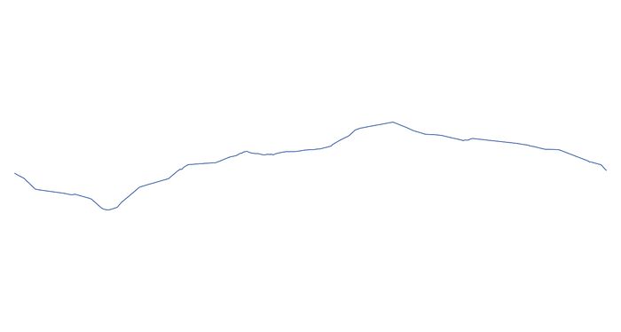
| Description | Polyline shapefile that represents the line of the Hadrian's Wall Vallum as a simple polyline | ||
|
|||
| WallCAP Shapefile: Hadrian's Wall Vallum Line divided by miles | |||
|---|---|---|---|
| Filename | WallGIS_Vallum_polyline.zip (17 kB) |
ZIP |
Info
Download |
| Description | Polyline shapefile that represents the line of Hadrian's Wall Vallum, divided into individual Wall miles. Each mile of the Vallum has associated data from the WallGIS database. | ||


