Introduction
This digital archive contains images, reports, site records, CAD, spreadsheets, databases and GIS from two phases of archaeological interest one a strip, map and sample excavation of three areas of archaeological identifed by the earlier trial trench evaluation. The work was undertaken by Wessex Archaeology between 16-Jul-2018 and 23-Nov-2018.
The initial trial trench evaluation (site code 205730) comprised six trial trenches targeted on known geophysical anomalies. One trench exposed three pits containing cremated bone (identifiable as human in two of the features) with one of the deposits representing the remains of an unurned burial. No datable material was found in any of the deposits, but their form is prehistoric in nature. The features correlate with a partial/irregular ring-shaped geophysical anomaly and a circular mound discernible within the LiDAR data, and would appear to indicate a small (c. 10 m-diameter) round barrow or other similar prehistoric funerary ringwork monument in this part of the Site. Two large pits were also revealed. One contained medieval pottery and slag, and the other contained timbers and cattle remains. The pit with the medieval pottery and slag correlated with a pond-like anomaly detected by the geophysical survey, with the other lying approximately 5 m south of another pond-like anomaly, in this instance corroborated by historic mapping. A small assemblage of finds was recovered from the evaluation, with six sherds of medieval pottery (c. 12th-15th-century) being the earliest easily datable artefacts. There is little indication the Site contains deposits of high palaeoenvironmental significance. The archive is currently held at Wessex Archaeology's Sheffield office and will be deposited with Derby Museum and Art Gallery, under a relevant accession code, in due course.
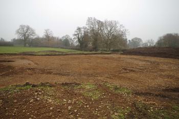
Three separate areas occupying 0.15 hectares in total were excavated during the later strip, map and sample excavation (site code 205731). Area 1 contained the remains of a plough-denuded barrow. A complete ring ditch enclosed a 22 m diameter area that contained the poorly preserved remains of the barrow mound and six cremation graves. One of the cremation graves contained a complete inverted Early Bronze Age Collared Urn containing the remains of three children (<17 years old). There was also an east-west ditch alongside a scatter of undated discrete pits/postholes within the enclosed area. The barrow mound had been cut by a 'C'-shaped ditch, which was radiocarbon dated to the medieval (13th-14th century) period. External to the ring ditch lay further pits, postholes and field boundary ditches. Some of these were post-medieval in date.
Within Area 2 lay a well or waterhole (2003); finds from the feature included a heat-blackened fragment of upper rotary quern of Roman disc form and worked wood, possibly representing part of a pulley wheel, radiocarbon dated to the 8th-10th century AD. A circular large pit/small pond (3003) was exposed in Area 3; within its upper fill were quantities of slag alongside medieval and post-medieval pot. Radiocarbon results indicate burials were made at the Site over a period of up to around 140 years in the later part of the Early Bronze Age. Unlike other funerary monuments in the region, the demographic profile of the dead seems relatively restricted, with a marked preponderance of immature individuals.
The topographic setting of the barrow - at the southwestern limit of the Derbyshire uplands above the River Dove, which links the Trent valley and the heart of the White Peak - is thought to have influenced the siting of the barrow, with the monument potentially having a territory-marking function. There was no evidence of the recurrence of funerary activity at the Site following the Early Bronze Age. It is however suggested that the presence of later features on and around the barrow - such as the well/waterhole with Roman and early medieval finds - may be rooted in the significance that later populations believed the monument to have. A 3D model of the urn was generated by structured light scanning in the post-excavation phase (see https://tinyurl.com/Doveridge-urn)