
Introduction
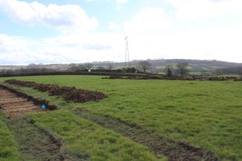
This digital archive comprises images and GIS data from an archaeological evaluation at Land South of Pewsham Way, Chippenham, Wiltshire. The work was undertaken in March and November 2022, by Cotswold Archaeology (CA). A total of 169 trenches were excavated.
The evaluation identified a small number of dispersed archaeological features within the proposed development area. Two fragments of worked flint of broad prehistoric date were recovered from the fill of a ditch identified in a trench excavated in the south-western part of the site. Further, albeit artefactually undated, features comprising a posthole and a possible cremation burial, of indeterminate human or animal origin, were identified in an adjacent trench and may be broadly contemporary.
A small group of postholes, seemingly forming a north-east/south-west alignment, were identified in a trench excavated in the western part of the site. A small quantity of pottery of broad late prehistoric date was recovered from the fill of two of these postholes.
Two ditches, most probably relating to agricultural land management or division and containing pottery of a broad Romano-British date, were identified in the north-western part of the site. A small number of artefactually undated ditches were also identified in nearby trenches and may be broadly contemporary.
A single sherd of pottery of 17th to 18th-century date and a fragment of industrial waste was recovered from a ditch, likely to relate to agricultural activity, identified in the north-western
part of the site. The ploughed out remains of at least two phases of medieval/post-medieval furrows were identified in the western parts of the site.