Introduction
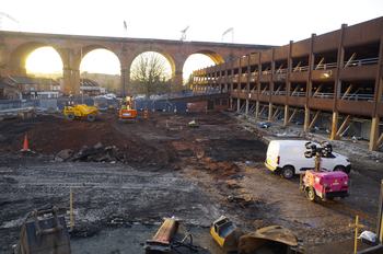
This digital archive comprises images, gis, cad, database, spreadsheet, report and site record data from an archaeological evaluation comprising the excavation of three trenches and an open area excavation in advance of the re-development of a car park at Heaton Lane, Stockport. The evaluation was undertaken by Wessex Archaeology in June 2020.
The results of the excavation revealed a palimpsest of 19th and 20th-century archaeological remains. These have been analysed to their full potential and it is recommended that a summary of the existing information be published in an appropriate journal. The earliest development on site was probably that shown on mid-19th century Ordnance Survey maps. Documentary evidence suggests that this dates to the 1830s, or a few years either side. A lack of definitively 18th-century finds confirms this general picture. Prior to the earliest development, the existing ground surface had been truncated, removing or reworking any agricultural soil. Levelling layers (primarily of silt and sand) were deposited at the beginning of the 19th-century development. In the west of the site the remains of the Wellington Bridge cotton mill were revealed, including the setting for at least one Cornish-type boiler, and large stone bases that may have been the steam engine foundation beds.
The mill was probably built by James Wilkinson and passed to his son Samuel Wright Wilkinson before closing around 1900. The general arrangement of the mill, known from historic maps, was confirmed by excavation. However, the excavation did not provide information regarding the workings or processes that would have occurred during the operation of the cotton mill. In the centre and east of the site the fragmentary remains of the walls of ranges of back-to-back and terraced houses were exposed. The majority of the houses were demolished in the early 1890s, although the Jacques Street terraces remained until the 1930s. The remains of road surfaces, and of levelling layers and services present beneath the roads, may have been contemporary with the back-to-back housing, if not representative of later modification or maintenance. These roads were removed, repurposed, truncated and/or renamed in the early 1890s. The site was gradually taken over by a gasworks.
The gasworks was built in 1825 but was at that time confined to the area north of the site. By 1895 the gasworks had expanded into the area of former back-to-back housing. The remains of an office, a weighbridge, yard entrances and a gasometer were identified by excavation. The former Wellington Bridge Mill building was incorporated into the gasworks in the early 20th century. Stockport Image Archive holds informative photographs of the mill and gasworks from this time. By 1934 the site had been wholly subject to demolition and a tram and bus depot erected in the place of the mill, housing and gasworks. Excavation revealed that the depot building was steel-framed with infill walls of machine brick and black ash mortar walls. An extensive range of drains was probably contemporary with the depot. In recent years the site has been used as a car park, following demolition of the tram and bus depot in 1978. The finds assemblage was typical of industrial sites of this period. Dateable artefacts provided little information about the phased development of the site. A single environmental sample was not informative.