Introduction
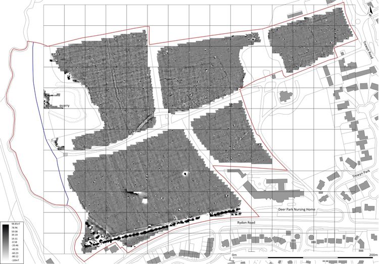
This collection comprises a report, images, geophysics data and site records from a geophysical survey and archaeological evaluation carried out by Sourth West Archaeology Ltd. (SWARCH) on land between Rydon Road and Trewyn Road, Holsworthy, Torridge, Devon from April to June 2020.
The site comprises six fields and it is located at the junction of Rydon Road and Trewyn Road. A previous archaeological assessment suggested that the current field boundaries and the current land usage have changed little since the early 19th century, with evidence of former bank and ditch features likely to survive below the ground.
The archaeological evaluation identified a total of 29 features, many of which are associated with phases of field system and with land drainage. A few of the features produced dating material, with those that did predominantly producing post medieval artefacts, whilst a small assemblage of post medieval artefacts was recovered from the topsoil. Also identified was a probable prehistoric round house with internal features which indicates that some of the identified anomalies pre-date the existing field system.