Digital Object Metadata
A14 TEA28 X39
Object ID: 2757377

Digital Object Information
| Object ID | 2757377 |
|---|---|
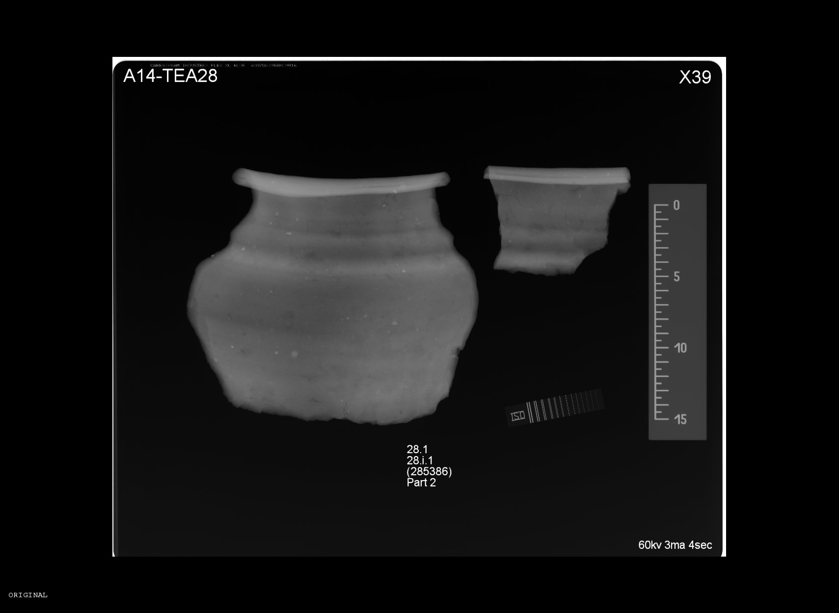
| Title | A14 TEA28 X39 |
| Description | X-ray from A14 TEA 20 showing 28.1 28.i.1(285386) |
| Creation Dates | |
| End date: 01-Oct-2021 | |
| Creator |
|
Access and Rights
| Cite as | A14 TEA28 X39 [digital object]. York: Archaeology Data Service [distributor]. Object ID: 2757377 |
|---|---|
| Copyright |
|
| Licence | This work is licensed under a Creative Commons Attribution 4.0 International License. |
| Primary Contact |
MOLA Headland Infrastructure Mortimer Wheeler House 46 Eagle Wharf Road London N1 7ED UK Tel: 020 7410 2285 Fax: 020 7410 2201 Email: [email protected] |
| Metadata Contact | ADS: [email protected] |
Content and Subject Information
| Data Type | Image |
|---|---|
| Language |
|
| Subject | Archaeological Recording |
| X-Ray | |
| Pottery Sherd | |
| Location | England |
| A14 Cambridge to Huntingdon | |
| Coordinates | OSGB: 522501 268263 |
File Information
| File name | A14-28_X39.jpg |
JPG |
Download File |
|---|---|---|---|
| Format | JPG | ||
| Format type | JPEG File Interchange Format (v. 1.01) | ||
| File size | 84 Kb | ||
| Checksum | f1abc3938d7d4b8ee02d8438ce18c199 | ||
| Last modified | 23-May-2023 |
Relationships
| This Object is from Collection | A14 Cambridge to Huntingdon Improvement Scheme: Digital Archive for Archaeological Works at Fenstanton Gravels Landscape Block, 2016-2018 |
|---|---|
| This Object is also Part of | X-rays (Group) |
Archived Metadata for Download
Download the metadata file(s) for this object, submitted as part of the collection. Please note that this deposited metadata may also contain metadata for associated files, or files of the same data type from this collection.
| X-ray metadata | |||
|---|---|---|---|
| Filename | A14_ADS_raster_metadata-X-rays_FenstantonGravels.csv (8 Kb) |
CSV |
Info
Download |