Digital Object Metadata
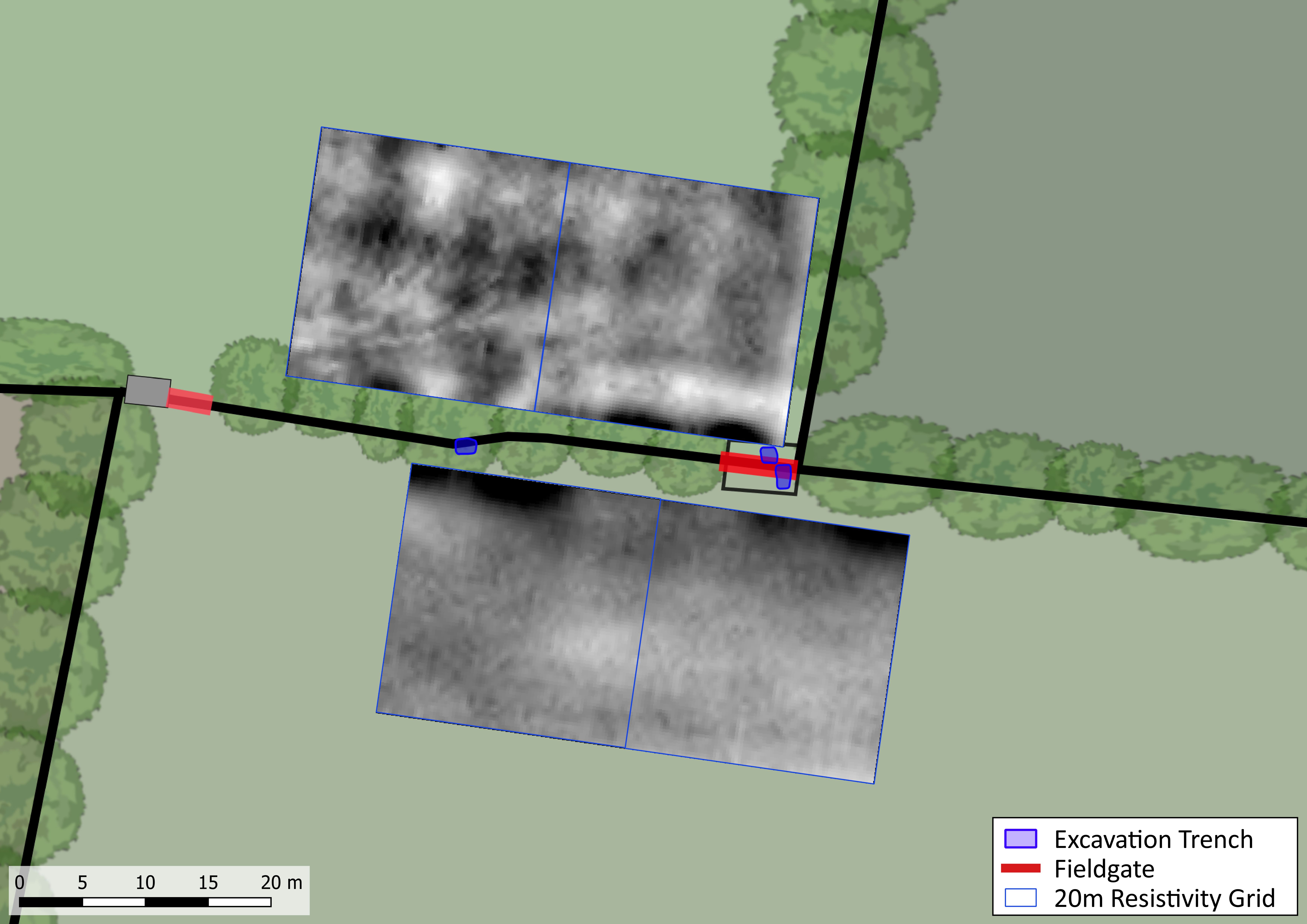
Map of the resistivity survey undertaken by WallCAP at Port Carlisle
Object ID: 2924627

Digital Object Information
| Object ID | 2924627 |
|---|---|
| Title | Map of the resistivity survey undertaken by WallCAP at Port Carlisle |
| Creation Dates | |
| Start date: 21-Aug-2023 | |
| Creator |
|
Access and Rights
| Cite as | Murphy, K., Map of the resistivity survey undertaken by WallCAP at Port Carlisle [digital object]. York: Archaeology Data Service [distributor]. Object ID: 2924627 |
|---|---|
| Copyright |
|
| Licence | This work is licensed under a Creative Commons Attribution 4.0 International License. |
| Primary Contact |
Prof Rob Collins School of History, Classics & Archaeology Newcastle University Newcastle upon Tyne NE1 7RU Email: [email protected] |
| Metadata Contact | ADS: [email protected] |
Content and Subject Information
| Data Type | Image |
|---|---|
| Subject | Geophysical survey |
| Hadrian's Wall | |
| Periods | Roman |
| Period Dates |
|
| Location | Port Carlisle, Cumbria |
| Coordinates | OSGB: 323412 562274 |
File Information
| File name | PC21_Resistivity.jpg |
JPG |
Download File |
|---|---|---|---|
| Format | JPG | ||
| Format type | JPEG File Interchange Format (v. 1.01) | ||
| File size | 1.19 Mb | ||
| Checksum | 8045cb71c190db729d81aadd1a6cd60e | ||
| Last modified | 17-Jul-2024 |
Relationships
| This Object is from Collection | WallCAP: Heritage At Risk (HAR) |
|---|---|
| This Object is also Part of | Port Carlisle (Group) |
Archived Metadata for Download
Download the metadata file(s) for this object, submitted as part of the collection. Please note that this deposited metadata may also contain metadata for associated files, or files of the same data type from this collection.
| ADS_raster_metadata_WallCAP_HAR | |||
|---|---|---|---|
| Filename | ADS_raster_metadata_WallCAP_HAR.csv (18 Kb) |
CSV |
Info
Download |