Digital Object Metadata
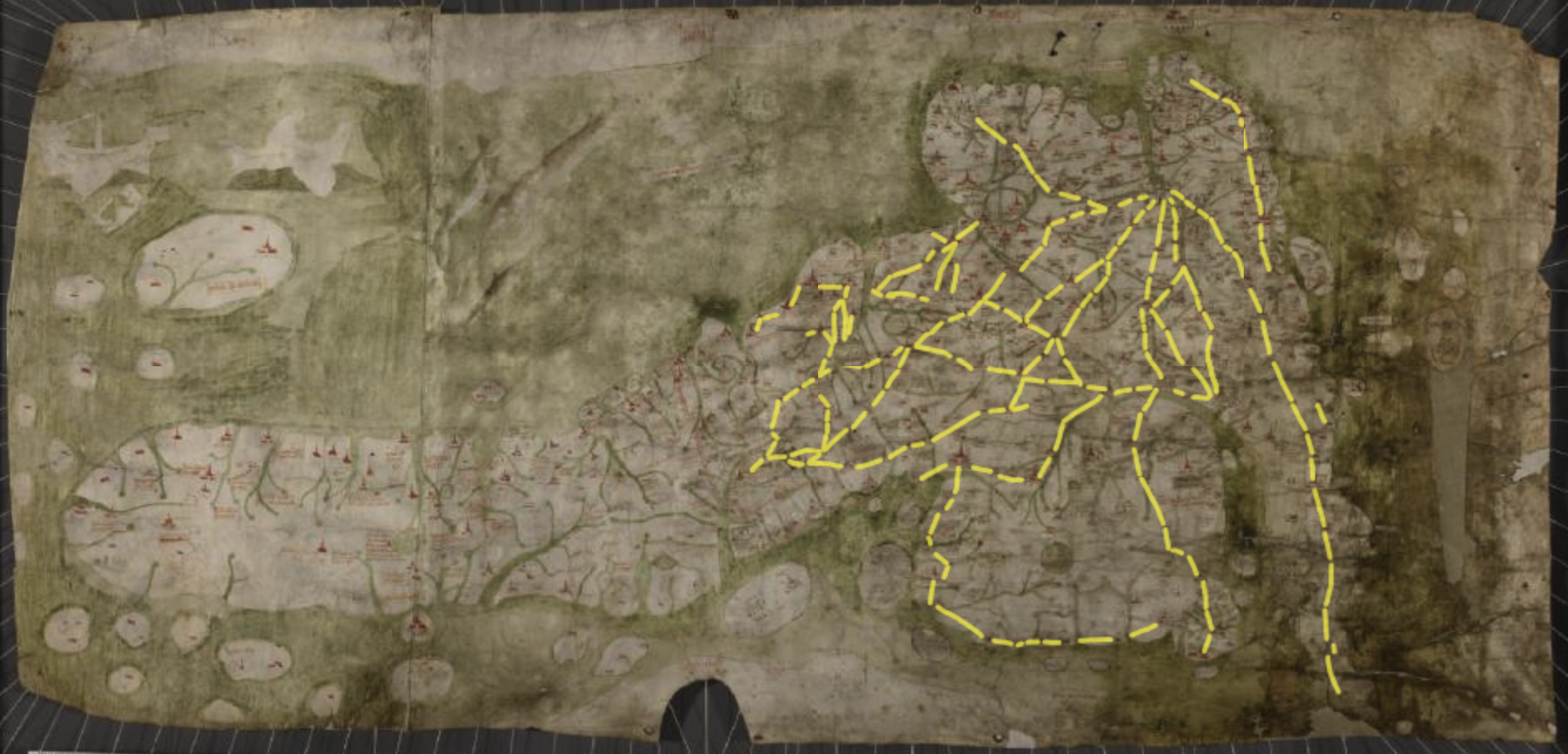
The Gough Map of Great Britain with the ‘red lines’ highlighted in yellow
Object ID: 2964410

Digital Object Information
| Object ID | 2964410 |
|---|---|
| Title | The Gough Map of Great Britain with the ‘red lines’ highlighted in yellow |
| Year Created | 2024 |
| Creation Dates | |
| Start date: 26-Jul-2024 | |
| Creator |
|
Access and Rights
| Cite as | Oksanen, E., (2024) The Gough Map of Great Britain with the ‘red lines’ highlighted in yellow [digital object]. York: Archaeology Data Service [distributor]. Object ID: 2964410 |
|---|---|
| Copyright |
|
| Licence | This work is licensed under a Creative Commons Attribution 4.0 International License. |
| Primary Contact |
Dr Stuart Brookes Institute of Archaeology UCL Institute of Archaeology Email: [email protected] 31-34 Gordon Square London WC1H 0PY England |
| Metadata Contact | ADS: [email protected] |
Content and Subject Information
| Data Type | Image |
|---|---|
| Language |
|
| Subject | Gough Map |
| Periods | Medieval |
| Period Dates |
|
| Location | England |
| Scotland | |
| Wales |
File Information
| File name | Gough_Map_website_image.png |
PNG |
Download File |
|---|---|---|---|
| Format | PNG | ||
| Format type | Portable Network Graphics (v. 1.2) | ||
| File size | 2.49 Mb | ||
| Checksum | 0edf76ba9a027f5d9e5afd002028b9e9 | ||
| Last modified | 06-Nov-2024 |
Relationships
| This Object is from Collection | The Routes and Roads of the Gough Map: GIS Database |
|---|
Archived Metadata for Download
Download the metadata file(s) for this object, submitted as part of the collection. Please note that this deposited metadata may also contain metadata for associated files, or files of the same data type from this collection.
| Image metadata | |||
|---|---|---|---|
| Filename | image_metadata.csv (1 Kb) |
CSV |
Info
Download |