Digital Object Metadata
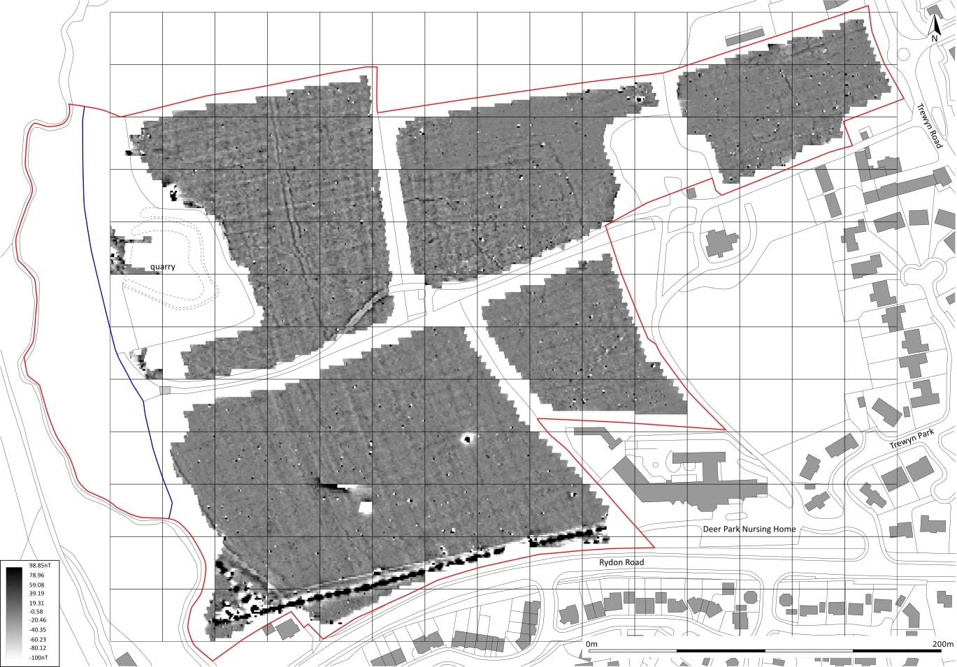
A greyscale shade plot of the gradiometer survey data (Minimal Processing).
Object ID: 2964917
.")
Digital Object Information
| Object ID | 2964917 |
|---|---|
| Title | A greyscale shade plot of the gradiometer survey data (Minimal Processing). |
| Year Created | 2024 |
| Creation Dates | |
| Start date: 25-Oct-2024 | |
| Creator |
|
Access and Rights
| Cite as | Webb, P., (2024) A greyscale shade plot of the gradiometer survey data (Minimal Processing). [digital object]. York: Archaeology Data Service [distributor]. Object ID: 2964917 |
|---|---|
| Copyright |
|
| Licence | This work is licensed under a Creative Commons Attribution 4.0 International License. |
| Primary Contact |
South West Archaeology Ltd The Old Dairy Hacche Lane Business Park South Molton Devon EX36 3LH UK Tel: 01769 573555 Email: [email protected] |
| Metadata Contact | ADS: [email protected] |
Content and Subject Information
| Data Type | Image |
|---|---|
| Language |
|
| Subject | Geophysical Survey |
| Topographical Drawing | |
| Location | Land between Rydon Road and Trewyn Road |
| Holsworthy | |
| England | |
| Devon | |
| Torridge | |
| Coordinates | OSGB: 233730 104385 |
File Information
| File name | HRR20_greyscale_shade_plot_001.jpg |
JPG |
Download File |
|---|---|---|---|
| Format | JPG | ||
| Format type | JPEG File Interchange Format (v. 1.01) | ||
| File size | 259 Kb | ||
| Checksum | 86818059a6b38cc69a171ed90b7597e4 | ||
| Last modified | 08-Nov-2024 |
Relationships
| This Object is from Collection | Digital Archive from a Geophysical Survey and Archaeological Evaluation at Rydon Road and Trewyn Road, Holsworthy, Torridge, Devon, April - June 2020 |
|---|
Archived Metadata for Download
Download the metadata file(s) for this object, submitted as part of the collection. Please note that this deposited metadata may also contain metadata for associated files, or files of the same data type from this collection.
| Image metadata | |||
|---|---|---|---|
| Filename | HRR20_raster_metadata.csv (82 Kb) |
CSV |
Info
Download |