
Blackwater Estuary Fish Traps, Essex
Essex County Council Field Archaeology Unit, 2013. https://doi.org/10.5284/1022580. How to cite using this DOI
Data copyright © Essex County Council Field Archaeology Unit unless otherwise stated
This work is licensed under the ADS Terms of Use and Access.

Primary contact
Ellen
Heppell
Project Officer
Archaeology South-East (Division of University College London)
Essex Office
The Old Magistrates Court
79 South Street
Braintree
CM7 3QD
Essex
Tel: 01376 331431
Resource identifiers
- ADS Collection: 1161
- DOI:https://doi.org/10.5284/1022580
- How to cite using this DOI

Downloads
Documents | Site plans | GIS | CAD | Photographs
Site plans
Documentation
| Descriptive documentation for document, site plan and photograph files | 231 Kb |
Documents
|
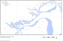
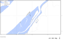
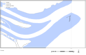
Blackwater Estuary, showing the fishtraps and the intertidal zone | 860 Kb | |
|
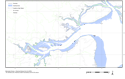
Blackwater Estuary, showing the fishtraps and the intertidal zone and modern parish boundaries | 991 Kb | |
|
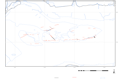
The Collins Creek fishtrap complex as planned in the 1990s - distinguishing between aerial photographic and field survey data. 1:10,000 | 120 Kb | |
|
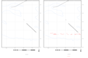
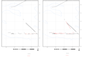
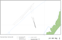
The Collins Creek fishtrap complex (west) 1:2,500; 1 - 1990s plan; 2- Plan comparing 1990 and 2003 data | 61 Kb | |
|
The Collins Creek Fishtrap Complex (west) 1:2,500; 1 - combined plan of 1990s and 2003 data with 2006 data added; 2 - combined plan of 1990s, 2003 and 2006 with 2007 data added | 63 Kb | |
|
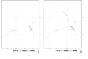
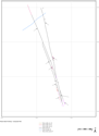
The Collins Creek fishtrap complex (east) 1:2,500; 1 - 1990s plan; 2 - Plan comparing 1990 and 2003 data | 53 Kb | |
|
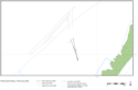
The Pewet Island fishtrap complex, combined aerial photographic plot and field survey data. 1:10,000 | 117 Kb | |
|
The Pewet Island fishtrap complex, combined aerial photographic plot and 2006 field survey data. 1:2,000 | 82 Kb | |
|
The Pewet Island fishtrap complex, combined aerial photographic plot and 2007 field survey data. 1:2,000 | 62 Kb | |
|
The Pewet Island fishtrap complex, composite plan of 2006 and 2007 field survey data. 1:500 | 50 Kb | |
|
The Nass fishtrap aerial photographic plot. | 89 Kb | |
|
All plans in one file | 2 Mb |
