Predictive Modelling of Multi-Period Geoarchaeological Resources at a River Confluence
Tony Brown, Keith Challis, Andy J. Howard, 2008.
(updated 2011)
https://doi.org/10.5284/1000174. How to cite using this DOI
Digital Object Identifiers
Digital Object Identifiers (DOIs) are persistent identifiers which can be used to consistently and accurately reference digital objects and/or content. The DOIs provide a way for the ADS resources to be cited in a similar fashion to traditional scholarly materials. More information on DOIs at the ADS can be found on our help page.
Citing this DOI
The updated Crossref DOI Display guidelines recommend that DOIs should be displayed in the following format:
https://doi.org/10.5284/1000174
Sample Citation for this DOI
Tony Brown, Keith Challis, Andy J. Howard (2011) Predictive Modelling of Multi-Period Geoarchaeological Resources at a River Confluence [data-set]. York: Archaeology Data Service [distributor] https://doi.org/10.5284/1000174
Data copyright © Prof Tony Brown, Keith Challis, Andy J. Howard unless otherwise stated
This work is licensed under the ADS Terms of Use and Access.
Primary contact
Prof
Tony
Brown
School of Geography
University of Southampton
Shackleton Building
Highfield
Southampton
SO17 1BJ
UK
Tel: 023 8059 5493
Resource identifiers
- ADS Collection: 829
- ALSF Project Number: 3357
- DOI:https://doi.org/10.5284/1000174
- How to cite using this DOI
Digital Object Identifiers
Digital Object Identifiers (DOIs) are persistent identifiers which can be used to consistently and accurately reference digital objects and/or content. The DOIs provide a way for the ADS resources to be cited in a similar fashion to traditional scholarly materials. More information on DOIs at the ADS can be found on our help page.
Citing this DOI
The updated Crossref DOI Display guidelines recommend that DOIs should be displayed in the following format:
https://doi.org/10.5284/1000174
Sample Citation for this DOI
Tony Brown, Keith Challis, Andy J. Howard (2011) Predictive Modelling of Multi-Period Geoarchaeological Resources at a River Confluence [data-set]. York: Archaeology Data Service [distributor] https://doi.org/10.5284/1000174
Downloads
Reports | Project GIS | Drawings and Photos | Spreadsheets | Geophysics | Aerial Survey
Aerial Survey
The original dataset contained lidar and ISFAR data, obtained under licence from Infoterra and Intermap respectively. the copyright for ths original data is retained by the external parties, and thus not included in the ADS archive. The archive does contain the metadata created for the datasets by the project team, as well as a series of graphics exported from the GIS.
ISFAR documentation
| IFSAR APs and RS metadata | 180 Kb | |
| IFSAR tabular data metadata | 174 Kb |
lidar documentation
| Lidar Processed APs and RS metadata | 184 Kb | |
| Lidar Raw APs and RS metadata | 191 Kb |
Graphics
| Graphics Metadata | 294 Kb |

10m Lidar simulation
10m_Lidar_simulation.jpg
[DOWNLOAD] (Full Resolution) right-click and save link |
10m Lidar simulation |
JPG
10m Lidar simulation
10m_Lidar_simulation.jpg
[DOWNLOAD] (Full Resolution) right-click and save link |
1.09 Mb |

2m Lidar simulation
2m_Lidar_simulation.jpg
[DOWNLOAD] (Full Resolution) right-click and save link |
2m Lidar simulation |
JPG
2m Lidar simulation
2m_Lidar_simulation.jpg
[DOWNLOAD] (Full Resolution) right-click and save link |
2.25 Mb |

3DRIVER
3DRIVER.jpg
[DOWNLOAD] (Full Resolution) right-click and save link |
3DRIVER |
JPG
3DRIVER
3DRIVER.jpg
[DOWNLOAD] (Full Resolution) right-click and save link |
176 Kb |

3D Lidar gpr HIGH
3D_Lidar_gpr_HIGH.jpg
[DOWNLOAD] (Full Resolution) right-click and save link |
3D Lidar gpr HIGH |
JPG
3D Lidar gpr HIGH
3D_Lidar_gpr_HIGH.jpg
[DOWNLOAD] (Full Resolution) right-click and save link |
185 Kb |
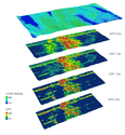
3D Lidar gpr LOW
3D_Lidar_gpr_LOW.jpg
[DOWNLOAD] (Full Resolution) right-click and save link |
3D Lidar gpr LOW |
JPG
3D Lidar gpr LOW
3D_Lidar_gpr_LOW.jpg
[DOWNLOAD] (Full Resolution) right-click and save link |
283 Kb |
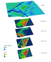
3D Lidar gpr MID1
3D_Lidar_gpr_MID1.jpg
[DOWNLOAD] (Full Resolution) right-click and save link |
3D Lidar gpr MID1 |
JPG
3D Lidar gpr MID1
3D_Lidar_gpr_MID1.jpg
[DOWNLOAD] (Full Resolution) right-click and save link |
216 Kb |

3D Lidar gpr MID2
3D_Lidar_gpr_MID2.jpg
[DOWNLOAD] (Full Resolution) right-click and save link |
3D Lidar gpr MID2 |
JPG
3D Lidar gpr MID2
3D_Lidar_gpr_MID2.jpg
[DOWNLOAD] (Full Resolution) right-click and save link |
258 Kb |

3d flood model
3d_flood_model.jpg
[DOWNLOAD] (Full Resolution) right-click and save link |
3d flood model |
JPG
3d flood model
3d_flood_model.jpg
[DOWNLOAD] (Full Resolution) right-click and save link |
309 Kb |

5m Lidar simulation
5m_Lidar_simulation.jpg
[DOWNLOAD] (Full Resolution) right-click and save link |
5m Lidar simulation |
JPG
5m Lidar simulation
5m_Lidar_simulation.jpg
[DOWNLOAD] (Full Resolution) right-click and save link |
1.80 Mb |
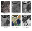
EH annual review 2
EH_annual_review_2.jpg
[DOWNLOAD] (Full Resolution) right-click and save link |
EH annual review 2 |
JPG
EH annual review 2
EH_annual_review_2.jpg
[DOWNLOAD] (Full Resolution) right-click and save link |
4.03 Mb |

FPA - IFSAR
FPA_-_IFSAR.jpg
[DOWNLOAD] (Full Resolution) right-click and save link |
FPA - IFSAR |
JPG
FPA - IFSAR
FPA_-_IFSAR.jpg
[DOWNLOAD] (Full Resolution) right-click and save link |
3.16 Mb |

GPR on lidar LPG DSM
GPR_on_lidar_LPG_DSM.jpg
[DOWNLOAD] (Full Resolution) right-click and save link |
GPR on lidar LPG DSM |
JPG
GPR on lidar LPG DSM
GPR_on_lidar_LPG_DSM.jpg
[DOWNLOAD] (Full Resolution) right-click and save link |
2.59 Mb |

GPR on lidar intensity
GPR_on_lidar_intensity.jpg
[DOWNLOAD] (Full Resolution) right-click and save link |
GPR on lidar intensity |
JPG
GPR on lidar intensity
GPR_on_lidar_intensity.jpg
[DOWNLOAD] (Full Resolution) right-click and save link |
825 Kb |

GPS Profiles location map Intensity
GPS_Profiles_location_map__Intensity.jpg
[DOWNLOAD] (Full Resolution) right-click and save link |
GPS Profiles location map Intensity |
JPG
GPS Profiles location map Intensity
GPS_Profiles_location_map__Intensity.jpg
[DOWNLOAD] (Full Resolution) right-click and save link |
829 Kb |

GPS Profiles location map lpg DSM
GPS_Profiles_location_map__lpg_DSM.jpg
[DOWNLOAD] (Full Resolution) right-click and save link |
GPS Profiles location map lpg DSM |
JPG
GPS Profiles location map lpg DSM
GPS_Profiles_location_map__lpg_DSM.jpg
[DOWNLOAD] (Full Resolution) right-click and save link |
2.60 Mb |
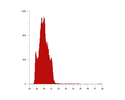
Histo 10m lpg
Histo_10m_lpg.jpg
[DOWNLOAD] (Full Resolution) right-click and save link |
Histo 10m lpg |
JPG
Histo 10m lpg
Histo_10m_lpg.jpg
[DOWNLOAD] (Full Resolution) right-click and save link |
63 Kb |
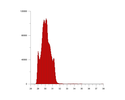
Histo 1mlpg
Histo_1mlpg.jpg
[DOWNLOAD] (Full Resolution) right-click and save link |
Histo 1mlpg |
JPG
Histo 1mlpg
Histo_1mlpg.jpg
[DOWNLOAD] (Full Resolution) right-click and save link |
62 Kb |
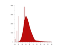
Histo IFSAR
Histo_IFSAR.jpg
[DOWNLOAD] (Full Resolution) right-click and save link |
Histo IFSAR |
JPG
Histo IFSAR
Histo_IFSAR.jpg
[DOWNLOAD] (Full Resolution) right-click and save link |
75 Kb |

IFSAR DSM
IFSAR_DSM.jpg
[DOWNLOAD] (Full Resolution) right-click and save link |
IFSAR DSM |
JPG
IFSAR DSM
IFSAR_DSM.jpg
[DOWNLOAD] (Full Resolution) right-click and save link |
2.23 Mb |

IFSAR ORI
IFSAR_ORI.jpg
[DOWNLOAD] (Full Resolution) right-click and save link |
IFSAR ORI |
JPG
IFSAR ORI
IFSAR_ORI.jpg
[DOWNLOAD] (Full Resolution) right-click and save link |
4.27 Mb |

IFSAR P1
IFSAR_P1.jpg
[DOWNLOAD] (Full Resolution) right-click and save link |
IFSAR P1 |
JPG
IFSAR P1
IFSAR_P1.jpg
[DOWNLOAD] (Full Resolution) right-click and save link |
47 Kb |

IFSAR P2
IFSAR_P2.jpg
[DOWNLOAD] (Full Resolution) right-click and save link |
IFSAR P2 |
JPG
IFSAR P2
IFSAR_P2.jpg
[DOWNLOAD] (Full Resolution) right-click and save link |
48 Kb |

IFSAR P3
IFSAR_P3.jpg
[DOWNLOAD] (Full Resolution) right-click and save link |
IFSAR P3 |
JPG
IFSAR P3
IFSAR_P3.jpg
[DOWNLOAD] (Full Resolution) right-click and save link |
41 Kb |

IFSAR P all
IFSAR_P_all.jpg
[DOWNLOAD] (Full Resolution) right-click and save link |
IFSAR P all |
JPG
IFSAR P all
IFSAR_P_all.jpg
[DOWNLOAD] (Full Resolution) right-click and save link |
246 Kb |

RF Res test 10mlpg
RF_Res_test_10mlpg.jpg
[DOWNLOAD] (Full Resolution) right-click and save link |
RF Res test 10mlpg |
JPG
RF Res test 10mlpg
RF_Res_test_10mlpg.jpg
[DOWNLOAD] (Full Resolution) right-click and save link |
289 Kb |

RF Res test 1mlpg
RF_Res_test_1mlpg.jpg
[DOWNLOAD] (Full Resolution) right-click and save link |
RF Res test 1mlpg |
JPG
RF Res test 1mlpg
RF_Res_test_1mlpg.jpg
[DOWNLOAD] (Full Resolution) right-click and save link |
1019 Kb |

RF Res test 2mlpg
RF_Res_test_2mlpg.jpg
[DOWNLOAD] (Full Resolution) right-click and save link |
RF Res test 2mlpg |
JPG
RF Res test 2mlpg
RF_Res_test_2mlpg.jpg
[DOWNLOAD] (Full Resolution) right-click and save link |
804 Kb |

RF Res test 5mlpg
RF_Res_test_5mlpg.jpg
[DOWNLOAD] (Full Resolution) right-click and save link |
RF Res test 5mlpg |
JPG
RF Res test 5mlpg
RF_Res_test_5mlpg.jpg
[DOWNLOAD] (Full Resolution) right-click and save link |
439 Kb |

Res test 10mlpg
Res_test_10mlpg.jpg
[DOWNLOAD] (Full Resolution) right-click and save link |
Res test 10mlpg |
JPG
Res test 10mlpg
Res_test_10mlpg.jpg
[DOWNLOAD] (Full Resolution) right-click and save link |
40 Kb |

Res test 1mlpg
Res_test_1mlpg.jpg
[DOWNLOAD] (Full Resolution) right-click and save link |
Res test 1mlpg |
JPG
Res test 1mlpg
Res_test_1mlpg.jpg
[DOWNLOAD] (Full Resolution) right-click and save link |
146 Kb |

Res test 2mlpg
Res_test_2mlpg.jpg
[DOWNLOAD] (Full Resolution) right-click and save link |
Res test 2mlpg |
JPG
Res test 2mlpg
Res_test_2mlpg.jpg
[DOWNLOAD] (Full Resolution) right-click and save link |
97 Kb |

Res test 5mlpg
Res_test_5mlpg.jpg
[DOWNLOAD] (Full Resolution) right-click and save link |
Res test 5mlpg |
JPG
Res test 5mlpg
Res_test_5mlpg.jpg
[DOWNLOAD] (Full Resolution) right-click and save link |
56 Kb |

Res test hs 1mlpg
Res_test_hs_1mlpg.jpg
[DOWNLOAD] (Full Resolution) right-click and save link |
Res test hs 1mlpg |
JPG
Res test hs 1mlpg
Res_test_hs_1mlpg.jpg
[DOWNLOAD] (Full Resolution) right-click and save link |
193 Kb |

ap middle unit
ap_middle_unit.jpg
[DOWNLOAD] (Full Resolution) right-click and save link |
ap middle unit |
JPG
ap middle unit
ap_middle_unit.jpg
[DOWNLOAD] (Full Resolution) right-click and save link |
302 Kb |

aps lidar
aps_lidar.jpg
[DOWNLOAD] (Full Resolution) right-click and save link |
aps lidar |
JPG
aps lidar
aps_lidar.jpg
[DOWNLOAD] (Full Resolution) right-click and save link |
689 Kb |

cm and rf plots
cm_and_rf_plots.jpg
[DOWNLOAD] (Full Resolution) right-click and save link |
cm and rf plots |
JPG
cm and rf plots
cm_and_rf_plots.jpg
[DOWNLOAD] (Full Resolution) right-click and save link |
1.51 Mb |

cm mid unit ap
cm_mid_unit_ap.jpg
[DOWNLOAD] (Full Resolution) right-click and save link |
cm mid unit ap |
JPG
cm mid unit ap
cm_mid_unit_ap.jpg
[DOWNLOAD] (Full Resolution) right-click and save link |
1.88 Mb |

cm mid unit intensity
cm_mid_unit_intensity.jpg
[DOWNLOAD] (Full Resolution) right-click and save link |
cm mid unit intensity |
JPG
cm mid unit intensity
cm_mid_unit_intensity.jpg
[DOWNLOAD] (Full Resolution) right-click and save link |
3.23 Mb |

cm mid unit intensity plus ap
cm_mid_unit_intensity_plus_ap.jpg
[DOWNLOAD] (Full Resolution) right-click and save link |
cm mid unit intensity plus ap |
JPG
cm mid unit intensity plus ap
cm_mid_unit_intensity_plus_ap.jpg
[DOWNLOAD] (Full Resolution) right-click and save link |
2.63 Mb |

dem low unit
dem_low_unit.jpg
[DOWNLOAD] (Full Resolution) right-click and save link |
dem low unit |
JPG
dem low unit
dem_low_unit.jpg
[DOWNLOAD] (Full Resolution) right-click and save link |
1.45 Mb |

dem mid unit
dem_mid_unit.jpg
[DOWNLOAD] (Full Resolution) right-click and save link |
dem mid unit |
JPG
dem mid unit
dem_mid_unit.jpg
[DOWNLOAD] (Full Resolution) right-click and save link |
1.44 Mb |

drift geol and palaeochannels kc
drift_geol_and_palaeochannels_kc.jpg
[DOWNLOAD] (Full Resolution) right-click and save link |
drift geol and palaeochannels kc |
JPG
drift geol and palaeochannels kc
drift_geol_and_palaeochannels_kc.jpg
[DOWNLOAD] (Full Resolution) right-click and save link |
1.48 Mb |

fieldwork LP
fieldwork_LP.jpg
[DOWNLOAD] (Full Resolution) right-click and save link |
fieldwork LP |
JPG
fieldwork LP
fieldwork_LP.jpg
[DOWNLOAD] (Full Resolution) right-click and save link |
1.05 Mb |

fiewldwork int
fiewldwork_int.jpg
[DOWNLOAD] (Full Resolution) right-click and save link |
fiewldwork int |
JPG
fiewldwork int
fiewldwork_int.jpg
[DOWNLOAD] (Full Resolution) right-click and save link |
849 Kb |

flood ap mosaic
flood_ap_mosaic.jpg
[DOWNLOAD] (Full Resolution) right-click and save link |
flood ap mosaic |
JPG
flood ap mosaic
flood_ap_mosaic.jpg
[DOWNLOAD] (Full Resolution) right-click and save link |
3.09 Mb |

flood ap mosaic merge flood sim
flood_ap_mosaic_merge_flood_sim.jpg
[DOWNLOAD] (Full Resolution) right-click and save link |
flood ap mosaic merge flood sim |
JPG
flood ap mosaic merge flood sim
flood_ap_mosaic_merge_flood_sim.jpg
[DOWNLOAD] (Full Resolution) right-click and save link |
2.48 Mb |

flood ap mosaic merge intensity
flood_ap_mosaic_merge_intensity.jpg
[DOWNLOAD] (Full Resolution) right-click and save link |
flood ap mosaic merge intensity |
JPG
flood ap mosaic merge intensity
flood_ap_mosaic_merge_intensity.jpg
[DOWNLOAD] (Full Resolution) right-click and save link |
3.73 Mb |

flood ap mosaic merge lidar
flood_ap_mosaic_merge_lidar.jpg
[DOWNLOAD] (Full Resolution) right-click and save link |
flood ap mosaic merge lidar |
JPG
flood ap mosaic merge lidar
flood_ap_mosaic_merge_lidar.jpg
[DOWNLOAD] (Full Resolution) right-click and save link |
2.73 Mb |

flood sim
flood_sim.jpg
[DOWNLOAD] (Full Resolution) right-click and save link |
flood sim |
JPG
flood sim
flood_sim.jpg
[DOWNLOAD] (Full Resolution) right-click and save link |
1.09 Mb |

fp lp profiles
fp_lp_profiles.jpg
[DOWNLOAD] (Full Resolution) right-click and save link |
fp lp profiles |
JPG
fp lp profiles
fp_lp_profiles.jpg
[DOWNLOAD] (Full Resolution) right-click and save link |
190 Kb |

geophys field Lidar intensity
geophys_field_Lidar_intensity.jpg
[DOWNLOAD] (Full Resolution) right-click and save link |
geophys field Lidar intensity |
JPG
geophys field Lidar intensity
geophys_field_Lidar_intensity.jpg
[DOWNLOAD] (Full Resolution) right-click and save link |
4.36 Mb |

geophys field ap
geophys_field_ap.jpg
[DOWNLOAD] (Full Resolution) right-click and save link |
geophys field ap |
JPG
geophys field ap
geophys_field_ap.jpg
[DOWNLOAD] (Full Resolution) right-click and save link |
2.00 Mb |

geophys field ap plus Lidar intensity
geophys_field_ap_plus_Lidar_intensity.jpg
[DOWNLOAD] (Full Resolution) right-click and save link |
geophys field ap plus Lidar intensity |
JPG
geophys field ap plus Lidar intensity
geophys_field_ap_plus_Lidar_intensity.jpg
[DOWNLOAD] (Full Resolution) right-click and save link |
3.40 Mb |

geophys field geophys plot
geophys_field_geophys_plot.jpg
[DOWNLOAD] (Full Resolution) right-click and save link |
geophys field geophys plot |
JPG
geophys field geophys plot
geophys_field_geophys_plot.jpg
[DOWNLOAD] (Full Resolution) right-click and save link |
751 Kb |

high unit moisture
high_unit_moisture.jpg
[DOWNLOAD] (Full Resolution) right-click and save link |
high unit moisture |
JPG
high unit moisture
high_unit_moisture.jpg
[DOWNLOAD] (Full Resolution) right-click and save link |
2.62 Mb |

histo 1m fpa
histo_1m_fpa.jpg
[DOWNLOAD] (Full Resolution) right-click and save link |
histo 1m fpa |
JPG
histo 1m fpa
histo_1m_fpa.jpg
[DOWNLOAD] (Full Resolution) right-click and save link |
54 Kb |
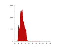
histo 2m lpg
histo_2m_lpg.jpg
[DOWNLOAD] (Full Resolution) right-click and save link |
histo 2m lpg |
JPG
histo 2m lpg
histo_2m_lpg.jpg
[DOWNLOAD] (Full Resolution) right-click and save link |
61 Kb |
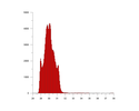
histo 5mlpg
histo_5mlpg.jpg
[DOWNLOAD] (Full Resolution) right-click and save link |
histo 5mlpg |
JPG
histo 5mlpg
histo_5mlpg.jpg
[DOWNLOAD] (Full Resolution) right-click and save link |
63 Kb |
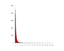
histo slope 10mlpg
histo_slope_10mlpg.jpg
[DOWNLOAD] (Full Resolution) right-click and save link |
histo slope 10mlpg |
JPG
histo slope 10mlpg
histo_slope_10mlpg.jpg
[DOWNLOAD] (Full Resolution) right-click and save link |
43 Kb |

histo slope 1m fpa od
histo_slope_1m_fpa_od.jpg
[DOWNLOAD] (Full Resolution) right-click and save link |
histo slope 1m fpa od |
JPG
histo slope 1m fpa od
histo_slope_1m_fpa_od.jpg
[DOWNLOAD] (Full Resolution) right-click and save link |
56 Kb |
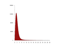
histo slope 1mlpg
histo_slope_1mlpg.jpg
[DOWNLOAD] (Full Resolution) right-click and save link |
histo slope 1mlpg |
JPG
histo slope 1mlpg
histo_slope_1mlpg.jpg
[DOWNLOAD] (Full Resolution) right-click and save link |
57 Kb |
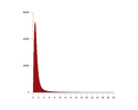
histo slope 2mlpg
histo_slope_2mlpg.jpg
[DOWNLOAD] (Full Resolution) right-click and save link |
histo slope 2mlpg |
JPG
histo slope 2mlpg
histo_slope_2mlpg.jpg
[DOWNLOAD] (Full Resolution) right-click and save link |
49 Kb |
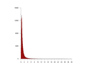
histo slope 5mlpg
histo_slope_5mlpg.jpg
[DOWNLOAD] (Full Resolution) right-click and save link |
histo slope 5mlpg |
JPG
histo slope 5mlpg
histo_slope_5mlpg.jpg
[DOWNLOAD] (Full Resolution) right-click and save link |
45 Kb |
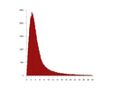
histo slope ifsar
histo_slope_ifsar.jpg
[DOWNLOAD] (Full Resolution) right-click and save link |
histo slope ifsar |
JPG
histo slope ifsar
histo_slope_ifsar.jpg
[DOWNLOAD] (Full Resolution) right-click and save link |
82 Kb |

intensity low unit
intensity_low_unit.jpg
[DOWNLOAD] (Full Resolution) right-click and save link |
intensity low unit |
JPG
intensity low unit
intensity_low_unit.jpg
[DOWNLOAD] (Full Resolution) right-click and save link |
2.39 Mb |

intensity middle unit
intensity_middle_unit.jpg
[DOWNLOAD] (Full Resolution) right-click and save link |
intensity middle unit |
JPG
intensity middle unit
intensity_middle_unit.jpg
[DOWNLOAD] (Full Resolution) right-click and save link |
2.52 Mb |

lidar FP DSM
lidar_FP_DSM.jpg
[DOWNLOAD] (Full Resolution) right-click and save link |
lidar FP DSM |
JPG
lidar FP DSM
lidar_FP_DSM.jpg
[DOWNLOAD] (Full Resolution) right-click and save link |
2.21 Mb |

lidar LPG DSM
lidar_LPG_DSM.jpg
[DOWNLOAD] (Full Resolution) right-click and save link |
lidar LPG DSM |
JPG
lidar LPG DSM
lidar_LPG_DSM.jpg
[DOWNLOAD] (Full Resolution) right-click and save link |
2.40 Mb |
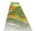
lidar fp and lp points
lidar_fp_and_lp_points.jpg
[DOWNLOAD] (Full Resolution) right-click and save link |
lidar fp and lp points |
JPG
lidar fp and lp points
lidar_fp_and_lp_points.jpg
[DOWNLOAD] (Full Resolution) right-click and save link |
495 Kb |

lidar fp and lp points profile
lidar_fp_and_lp_points_profile.jpg
[DOWNLOAD] (Full Resolution) right-click and save link |
lidar fp and lp points profile |
JPG
lidar fp and lp points profile
lidar_fp_and_lp_points_profile.jpg
[DOWNLOAD] (Full Resolution) right-click and save link |
84 Kb |

lidar fp and lp points v2
lidar_fp_and_lp_points_v2.jpg
[DOWNLOAD] (Full Resolution) right-click and save link |
lidar fp and lp points v2 |
JPG
lidar fp and lp points v2
lidar_fp_and_lp_points_v2.jpg
[DOWNLOAD] (Full Resolution) right-click and save link |
348 Kb |
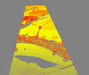
lidar fp points
lidar_fp_points.jpg
[DOWNLOAD] (Full Resolution) right-click and save link |
lidar fp points |
JPG
lidar fp points
lidar_fp_points.jpg
[DOWNLOAD] (Full Resolution) right-click and save link |
617 Kb |
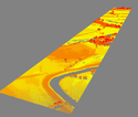
lidar fp points v2
lidar_fp_points_v2.jpg
[DOWNLOAD] (Full Resolution) right-click and save link |
lidar fp points v2 |
JPG
lidar fp points v2
lidar_fp_points_v2.jpg
[DOWNLOAD] (Full Resolution) right-click and save link |
371 Kb |

lidar intensity
lidar_intensity.jpg
[DOWNLOAD] (Full Resolution) right-click and save link |
lidar intensity |
JPG
lidar intensity
lidar_intensity.jpg
[DOWNLOAD] (Full Resolution) right-click and save link |
3.19 Mb |

lidar lp dem
lidar_lp_dem.jpg
[DOWNLOAD] (Full Resolution) right-click and save link |
lidar lp dem |
JPG
lidar lp dem
lidar_lp_dem.jpg
[DOWNLOAD] (Full Resolution) right-click and save link |
2.87 Mb |
lidar lp points
lidar_lp_points.jpg
[DOWNLOAD] (Full Resolution) right-click and save link |
lidar lp points |
JPG
lidar lp points
lidar_lp_points.jpg
[DOWNLOAD] (Full Resolution) right-click and save link |
404 Kb |
lidar lp points v2
lidar_lp_points_v2.jpg
[DOWNLOAD] (Full Resolution) right-click and save link |
lidar lp points v2 |
JPG
lidar lp points v2
lidar_lp_points_v2.jpg
[DOWNLOAD] (Full Resolution) right-click and save link |
301 Kb |

low unit moisture
low_unit_moisture.jpg
[DOWNLOAD] (Full Resolution) right-click and save link |
low unit moisture |
JPG
low unit moisture
low_unit_moisture.jpg
[DOWNLOAD] (Full Resolution) right-click and save link |
1.61 Mb |
lp surface intensity shade
lp_surface_intensity_shade.jpg
[DOWNLOAD] (Full Resolution) right-click and save link |
lp surface intensity shade |
JPG
lp surface intensity shade
lp_surface_intensity_shade.jpg
[DOWNLOAD] (Full Resolution) right-click and save link |
342 Kb |

lpd and gps
lpd_and_gps.jpg
[DOWNLOAD] (Full Resolution) right-click and save link |
lpd and gps |
JPG
lpd and gps
lpd_and_gps.jpg
[DOWNLOAD] (Full Resolution) right-click and save link |
75 Kb |

mapped geol plus cm
mapped_geol_plus_cm.jpg
[DOWNLOAD] (Full Resolution) right-click and save link |
mapped geol plus cm |
JPG
mapped geol plus cm
mapped_geol_plus_cm.jpg
[DOWNLOAD] (Full Resolution) right-click and save link |
1.77 Mb |

mapped geol plus cm detail
mapped_geol_plus_cm_detail.jpg
[DOWNLOAD] (Full Resolution) right-click and save link |
mapped geol plus cm detail |
JPG
mapped geol plus cm detail
mapped_geol_plus_cm_detail.jpg
[DOWNLOAD] (Full Resolution) right-click and save link |
1.82 Mb |

mid1 unit moisture
mid1_unit_moisture.jpg
[DOWNLOAD] (Full Resolution) right-click and save link |
mid1 unit moisture |
JPG
mid1 unit moisture
mid1_unit_moisture.jpg
[DOWNLOAD] (Full Resolution) right-click and save link |
1.33 Mb |

mid unit moisture
mid_unit_moisture.jpg
[DOWNLOAD] (Full Resolution) right-click and save link |
mid unit moisture |
JPG
mid unit moisture
mid_unit_moisture.jpg
[DOWNLOAD] (Full Resolution) right-click and save link |
2.45 Mb |

moisture standardised
moisture_standardised.jpg
[DOWNLOAD] (Full Resolution) right-click and save link |
moisture standardised |
JPG
moisture standardised
moisture_standardised.jpg
[DOWNLOAD] (Full Resolution) right-click and save link |
166 Kb |

ori mfp
ori_mfp.jpg
[DOWNLOAD] (Full Resolution) right-click and save link |
ori mfp |
JPG
ori mfp
ori_mfp.jpg
[DOWNLOAD] (Full Resolution) right-click and save link |
2.30 Mb |

ori t1
ori_t1.jpg
[DOWNLOAD] (Full Resolution) right-click and save link |
ori t1 |
JPG
ori t1
ori_t1.jpg
[DOWNLOAD] (Full Resolution) right-click and save link |
2.41 Mb |

ori villa
ori_villa.jpg
[DOWNLOAD] (Full Resolution) right-click and save link |
ori villa |
JPG
ori villa
ori_villa.jpg
[DOWNLOAD] (Full Resolution) right-click and save link |
2.17 Mb |

profile visualisation
profile_visualisation.jpg
[DOWNLOAD] (Full Resolution) right-click and save link |
profile visualisation |
JPG
profile visualisation
profile_visualisation.jpg
[DOWNLOAD] (Full Resolution) right-click and save link |
304 Kb |

soil moisture keymap
soil_moisture_keymap.jpg
[DOWNLOAD] (Full Resolution) right-click and save link |
soil moisture keymap |
JPG
soil moisture keymap
soil_moisture_keymap.jpg
[DOWNLOAD] (Full Resolution) right-click and save link |
824 Kb |

soilmoisture temp
soilmoisture_temp.jpg
[DOWNLOAD] (Full Resolution) right-click and save link |
soilmoisture temp |
JPG
soilmoisture temp
soilmoisture_temp.jpg
[DOWNLOAD] (Full Resolution) right-click and save link |
1.52 Mb |

study areas
study_areas.jpg
[DOWNLOAD] (Full Resolution) right-click and save link |
study areas |
JPG
study areas
study_areas.jpg
[DOWNLOAD] (Full Resolution) right-click and save link |
757 Kb |

villa field ap close1
villa_field_ap_close1.jpg
[DOWNLOAD] (Full Resolution) right-click and save link |
villa field ap close1 |
JPG
villa field ap close1
villa_field_ap_close1.jpg
[DOWNLOAD] (Full Resolution) right-click and save link |
1.66 Mb |

villa field ap close2
villa_field_ap_close2.jpg
[DOWNLOAD] (Full Resolution) right-click and save link |
villa field ap close2 |
JPG
villa field ap close2
villa_field_ap_close2.jpg
[DOWNLOAD] (Full Resolution) right-click and save link |
1.67 Mb |

villa field cm plot
villa_field_cm_plot.jpg
[DOWNLOAD] (Full Resolution) right-click and save link |
villa field cm plot |
JPG
villa field cm plot
villa_field_cm_plot.jpg
[DOWNLOAD] (Full Resolution) right-click and save link |
995 Kb |

villa field cm plot close1
villa_field_cm_plot_close1.jpg
[DOWNLOAD] (Full Resolution) right-click and save link |
villa field cm plot close1 |
JPG
villa field cm plot close1
villa_field_cm_plot_close1.jpg
[DOWNLOAD] (Full Resolution) right-click and save link |
603 Kb |

villa field cm plot close2
villa_field_cm_plot_close2.jpg
[DOWNLOAD] (Full Resolution) right-click and save link |
villa field cm plot close2 |
JPG
villa field cm plot close2
villa_field_cm_plot_close2.jpg
[DOWNLOAD] (Full Resolution) right-click and save link |
918 Kb |

villa field cropmarks
villa_field_cropmarks.jpg
[DOWNLOAD] (Full Resolution) right-click and save link |
villa field cropmarks |
JPG
villa field cropmarks
villa_field_cropmarks.jpg
[DOWNLOAD] (Full Resolution) right-click and save link |
2.04 Mb |

villa field cropmarks v2
villa_field_cropmarks_v2.jpg
[DOWNLOAD] (Full Resolution) right-click and save link |
villa field cropmarks v2 |
JPG
villa field cropmarks v2
villa_field_cropmarks_v2.jpg
[DOWNLOAD] (Full Resolution) right-click and save link |
2.13 Mb |

villa field intensity
villa_field_intensity.jpg
[DOWNLOAD] (Full Resolution) right-click and save link |
villa field intensity |
JPG
villa field intensity
villa_field_intensity.jpg
[DOWNLOAD] (Full Resolution) right-click and save link |
2.02 Mb |

villa field intensity Plus apv2
villa_field_intensity_Plus_apv2.jpg
[DOWNLOAD] (Full Resolution) right-click and save link |
villa field intensity Plus apv2 |
JPG
villa field intensity Plus apv2
villa_field_intensity_Plus_apv2.jpg
[DOWNLOAD] (Full Resolution) right-click and save link |
3.29 Mb |

villa field intensity close1
villa_field_intensity_close1.jpg
[DOWNLOAD] (Full Resolution) right-click and save link |
villa field intensity close1 |
JPG
villa field intensity close1
villa_field_intensity_close1.jpg
[DOWNLOAD] (Full Resolution) right-click and save link |
2.40 Mb |

villa field intensity close2
villa_field_intensity_close2.jpg
[DOWNLOAD] (Full Resolution) right-click and save link |
villa field intensity close2 |
JPG
villa field intensity close2
villa_field_intensity_close2.jpg
[DOWNLOAD] (Full Resolution) right-click and save link |
2.46 Mb |

villa field intensity plus ap close1
villa_field_intensity_plus_ap_close1.jpg
[DOWNLOAD] (Full Resolution) right-click and save link |
villa field intensity plus ap close1 |
JPG
villa field intensity plus ap close1
villa_field_intensity_plus_ap_close1.jpg
[DOWNLOAD] (Full Resolution) right-click and save link |
2.21 Mb |

villa field intensity plus ap close2
villa_field_intensity_plus_ap_close2.jpg
[DOWNLOAD] (Full Resolution) right-click and save link |
villa field intensity plus ap close2 |
JPG
villa field intensity plus ap close2
villa_field_intensity_plus_ap_close2.jpg
[DOWNLOAD] (Full Resolution) right-click and save link |
2.25 Mb |

villa field intensity v2
villa_field_intensity_v2.jpg
[DOWNLOAD] (Full Resolution) right-click and save link |
villa field intensity v2 |
JPG
villa field intensity v2
villa_field_intensity_v2.jpg
[DOWNLOAD] (Full Resolution) right-click and save link |
4.01 Mb |


