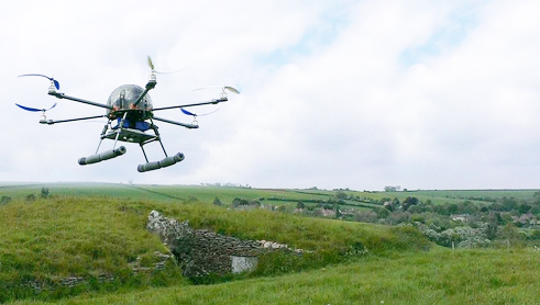
Unmanned Aerial Vehicles (UAVs) are a ‘disruptive technology’, a technology that forces us to rethink how we do (or used to do) things – from protecting white rhino to delivering pizza. Everyone who needs a bird’s eye view is now wondering how this technology can help them; farmers, structural engineers, ecologists and, of course, archaeologists.
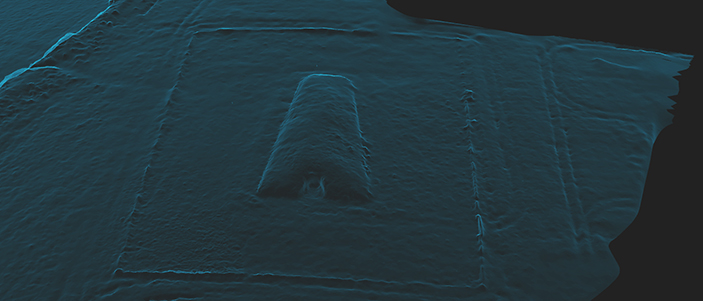
In theory, even a very minor archaeological site can now benefit from its very own aerial survey. But while the possibilities for archaeology are immensely exciting, many of the actual results are still disappointing; blurry aerial photos, images which may be pretty but which can’t be georeferenced and expensive cameras hitting the ground at terminal velocity.
Stephen Gray from the University of Bristol’s Department of Archaeology has written a much-needed good practice guide to conducting an archaeological survey using a UAV. The guide is the result of months of research and field work; it sets out a standard and safe approach which can be carried out using inexpensive equipment.
Part One of the guide, produced in collaboration with Jisc, suggests good practice when collecting data. Part Two is published by the Archaeology Data Service and is focused on the sharing and preservation of low-altitude aerial survey data.


See http://www.rupestrian.com/quadcopter.html
http://www.rupestrian.com/stitching-air-photos.html
http://www.rupestrian.com/3d-models.html
Try using a kite for some great shots in a planed way.