ADS blog
Welcome to Ingest – our new deposit system for heritage data
We at the ADS and HSDS are excited to announce the launch of our new deposit system – Ingest. Ingest enables researchers, field archaeologists, heritage scientists…
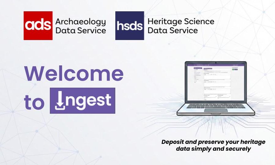
We at the ADS and HSDS are excited to announce the launch of our new deposit system – Ingest. Ingest enables researchers, field archaeologists, heritage scientists…
Introduction Back in May 2025, we at the ADS issued a survey to explore the possibility of implementing APIs (Application Programming Interfaces) to allow our users…
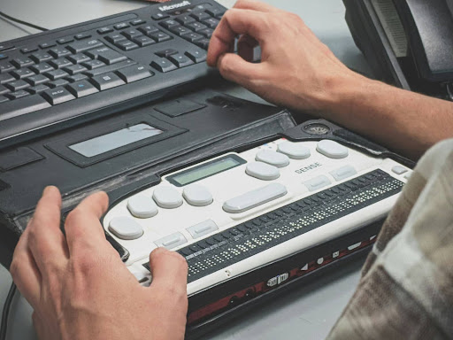
Accessibility… Who is it good for? … Absolutely everyone. That’s right. Everyone. Everyone can benefit from improved accessibility in the digital content we all produce. But…
Over the last year the ADS has seen some significant changes, including a massive increase in staff and an influx of archives being deposited. As a…

During autumn 2024 the Archaeology Data Services (ADS) Collections team undertook a survey of current depositors to understand individuals’ experiences of depositing digital archives with the…

The Council for British Archaeology’s Festival of Archaeology launched this year on the 19th of July, with a theme centred around Archaeology and Wellbeing. This year’s…
Last week, ADS CATS (Curatorial and Technical Staff) gathered for our annual strategy week; a dedicated time to focus on archival workflows and how we preserve…

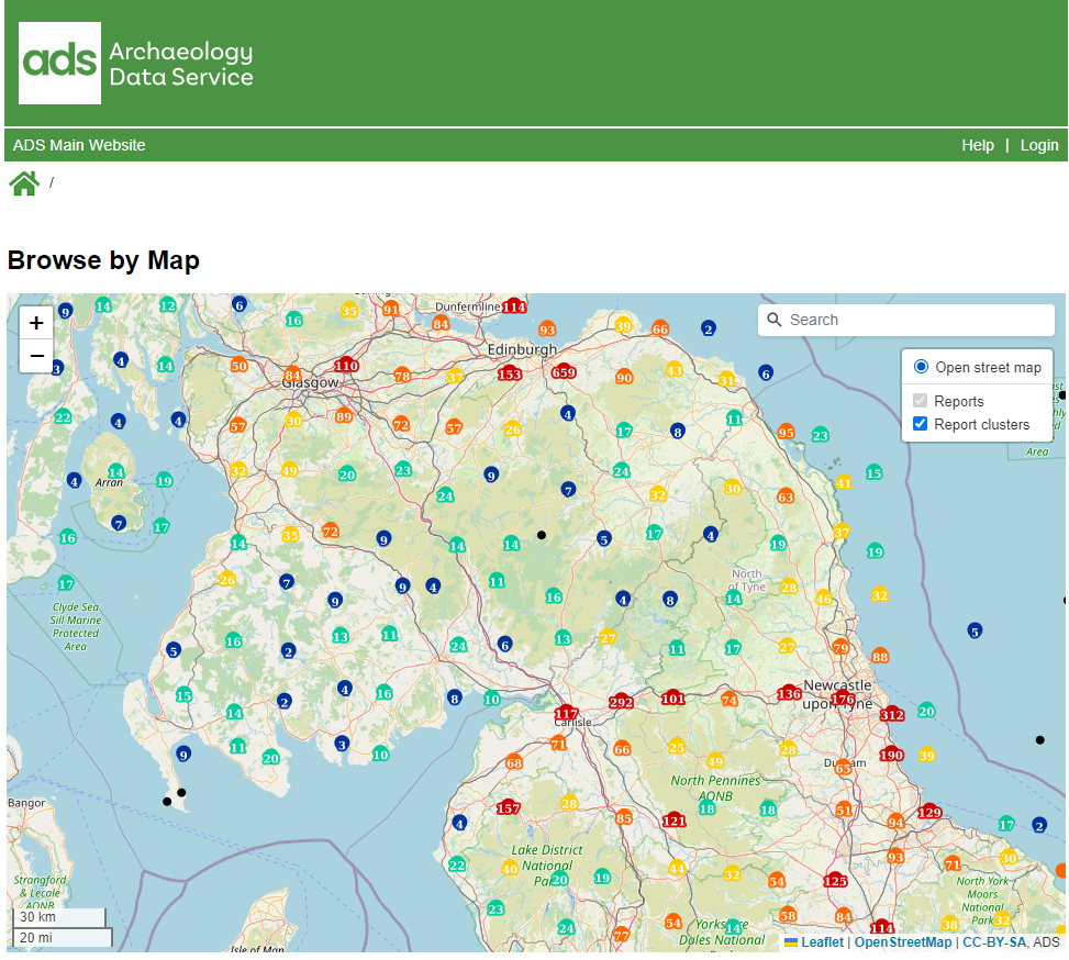
As archaeological research continues to evolve, the need for efficient access to digital resources has never been greater. At the ADS, we’re constantly looking for ways…

It has been two months since I started as a digital archives assistant at the ADS. This time has focused on getting to grips with how…
Content warning: This blog post contains images of human remains. During my MSc in Digital Archaeology at the University of York in 2022, I decided that…
During my time on the Online AcceS to the Index of archaeological investigationS (OASIS) helpdesk, I encountered a wide range of queries from users across the…

All resources archived with the ADS are Open Access and delivered through our website to facilitate re-use by the heritage sector and wider community. But how…
One of our top priorities at the ADS is to make our collections findable, accessible, interoperable, and reusable. This includes utilising sustainable referencing methods such as…
Following on from our announcement of receiving funding from the University of York’s Partnership for Academic and Commercial Engagement initiative, the ADS has been pleased to…

DigiPres North is a recently established interest group initiated by Bryony Hooper (Digital Preservation Manager at the University of Sheffield) and Dorothy Waugh (Digital Preservation Archivist…
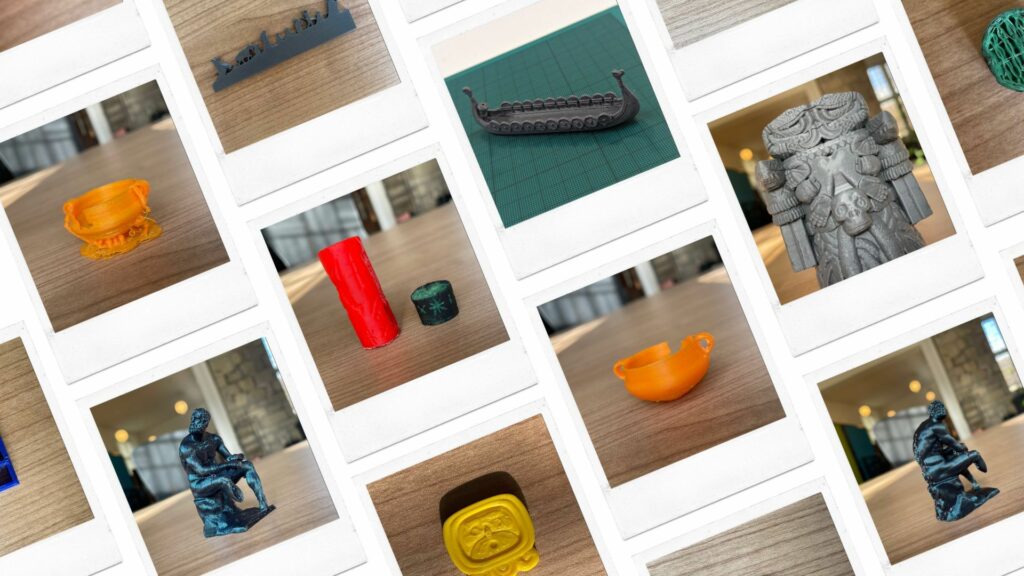
As the use of three-dimensional digitisation technologies is adopted more frequently by commercial archeology companies and independent researchers, the number of 3D objects accessioned, ingested, and…
It has been a busy start to the year at ADS, hence why I now find myself writing about what Curatorial staff did way back in…
As we announced back in March, the ADS is due to launch a series of new features for the ADS Archives templates that provide an accessible…
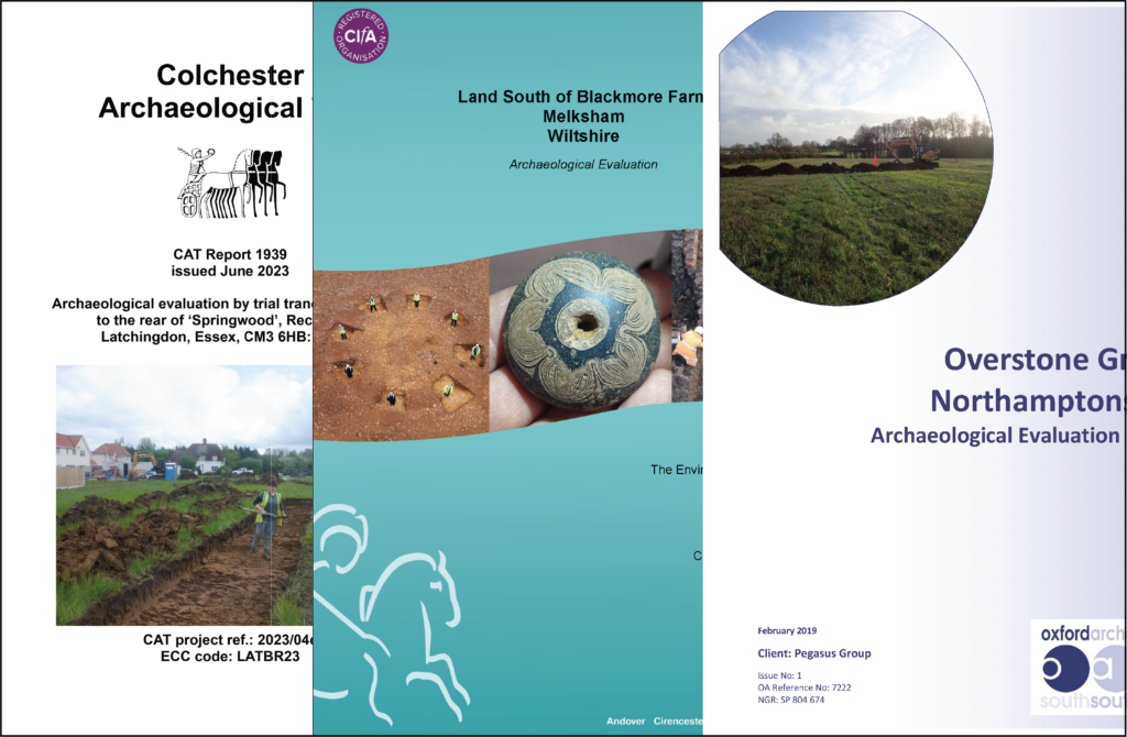
Towards the end of 2023 the ADS Library passed a considerable milestone of 80,000 fieldwork reports. This corpus is now one of the largest collections of…

This year’s CAAUK conference, organised by the British chapter of CAA (Computer Application & Quantitative Methods in Archaeology), was held in Edinburgh on Friday 24th and…
The work of the ADS is overseen by a Management Committee made up of representatives of key stakeholders, funders, and user communities. The Committee meets once…
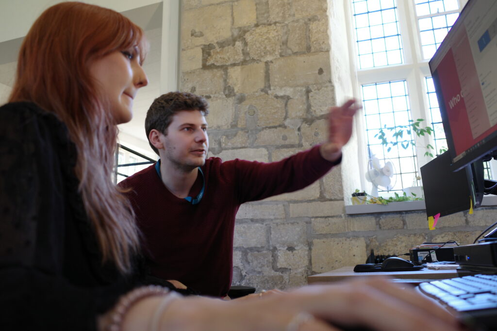
Editor Intro: This week’s blog post is written by Richard Paxford, an ADS digital archives assistant who recently joined us in York. Below Richard writes about…
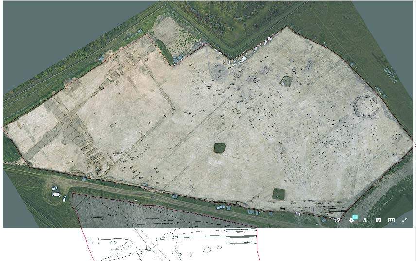
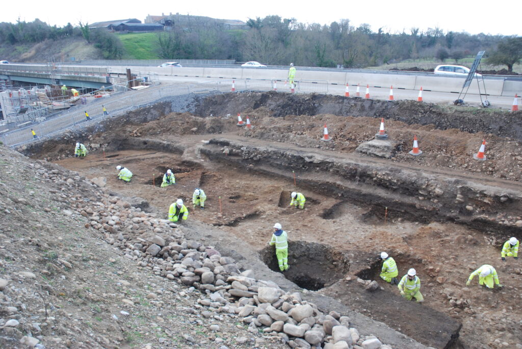
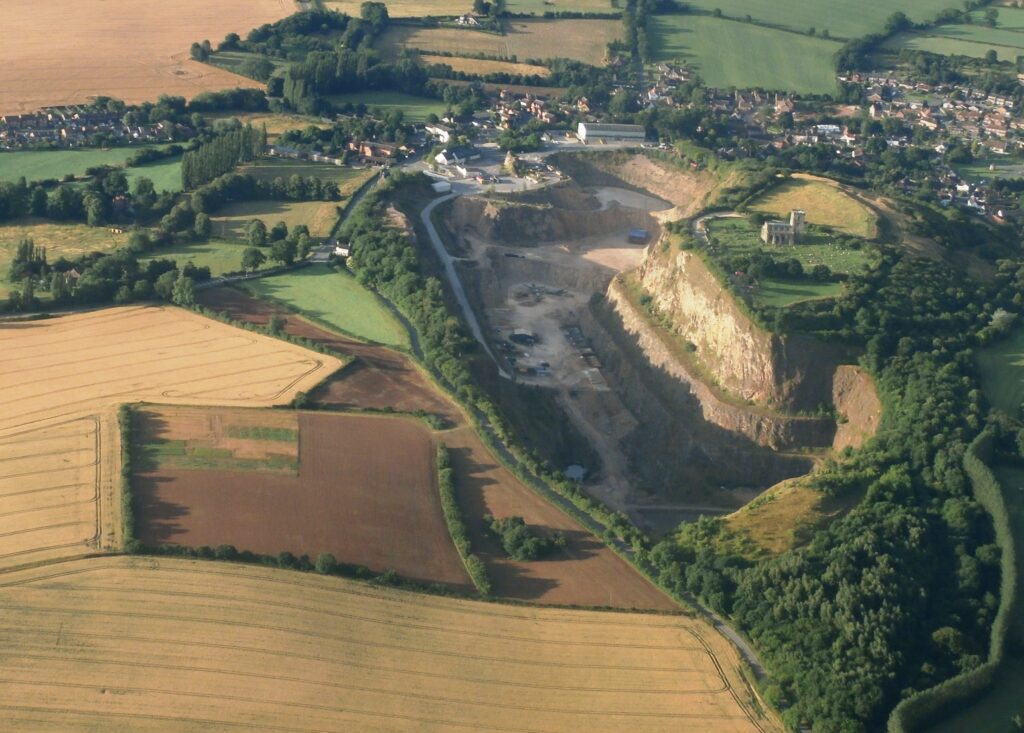
High Speed Two’s groundbreaking archaeology programme is currently not just Europe’s largest excavation but also a treasure trove of insights into the lives that shaped modern…
Editor Intro: This week’s blog post is written by Marco Brunello, an ADS Digital Archives Assistant who recently joined us in York. Below Marco talks about…
Last month, our team of archivists were busy with another ‘Archives Sprint’, a week dedicated to processing digital archives deposited through our website’s ADS-easy interface. Over…
The Council for British Archaeology’s Festival of Archaeology launched this year on the 15th July. In celebration of this event, we at the ADS and Internet…
The ADS team is delighted to announce the recent release of our 3000th data collection! This milestone represents significant growth in the number of Collections deposited…

The annual Computer Applications and Quantitative Methods in Archaeology (CAA) Conference was held this year from 3rd to 6th of April in Amsterdam, Netherlands. 2023 marked…
Our sibling publisher, The Internet Archaeology Journal has recently published the latest Europae Archaeologiae Consilium (EAC) symposium proceedings – ‘Archaeology and the Natural Environment’. IA has…
We at the ADS are excited to announce the launch of the new ADS website! The new website will go live at 8am on Monday 6th…
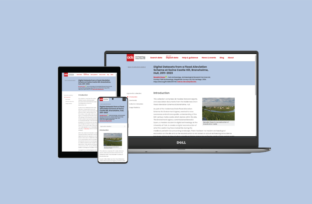
The ADS is an accredited digital repository and data that’s deposited with us is available open access via our archives or library but what actually happens…
At the best of times starting a new job can be a nerve-racking experience. So starting a new job during a pandemic should therefore be worse,…
I’m Becky Hirst and I started working as a Digital Archives Assistant with the Archaeology Data Service in August 2021. Since completing Undergraduate and Postgraduate studies…
Hello! I’m Evelyn, and I started my role as a Digital Archives Assistant for the Archaeology Data Service at the beginning of August. Having previously worked…
This case study describes the background and behind the scenes work that has gone into archiving the Day of Archaeology Project. The final digital archive for…
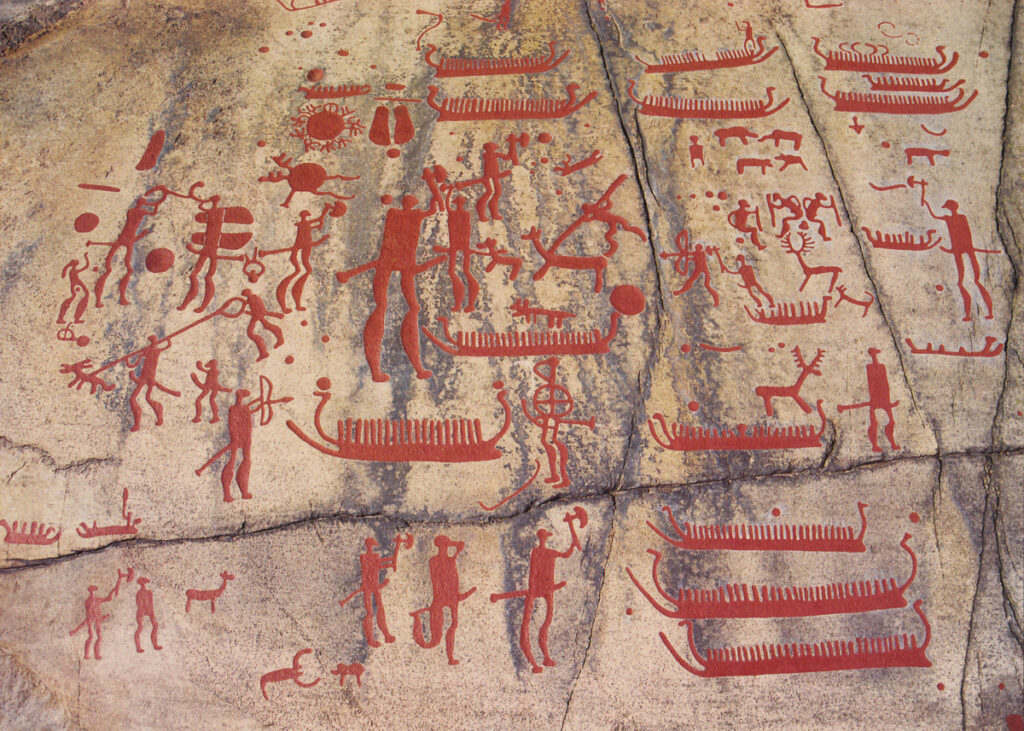
Several users have been in touch concerned over the future of England’s Rock Art website. Suffice to say that users should rest easy that no data…

In early 2020, it was decided to take a closer look into what impact our social media accounts were having on our archives. Did what we…

Once a year here at the ADS we let all of our cats free for a week into the world. There they do whatever fills their…

By Andrew Reinhard On August 11, 2017, a community of a few hundred people awoke to find their homes and farms destroyed, the air too toxic…

Throughout the month of May, the ADS has been investigating and debunking some of the myths and misconceptions that surround archives, digital preservation and the Archaeology…
Anastasia Akerman here again, as it’s almost the weekend so obviously this was the right time have fun with some of the beautiful images to be…
Over the last few weeks (ether side of Christmas) As part of the HERALD project we’ve been making some progress on the part of the new…
Following the closure of Birmingham Archaeology (BUFAU), a project was initiated to identify and secure important born-digital archival material, and latterly to arrange transfer to the…
To mark the 2017 Open Access week, we thought it would be a good time to introduce the winner of our first Open Access Archaeology fund…
Nine months ago, we launched our Open Access Archaeology Fund. We have sent our little USB trowels all over the globe by way of a ‘thank…

In December of last year (2016), I completed the final stage of the digital archive and dissemination for the The Rural Settlement of Roman Britain project. The first…
It’s hard to believe, but next week will mark my 10 year anniversary at the ADS. I originally started on a one-year contract to oversee the archiving of…
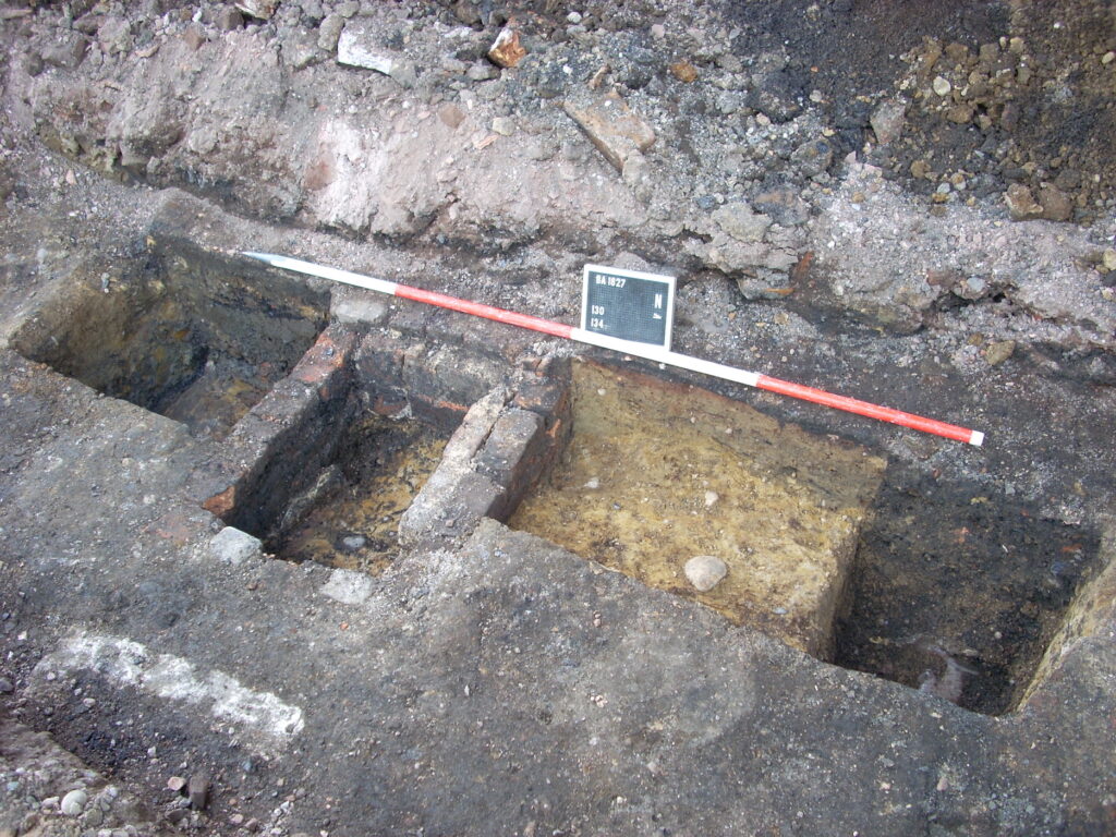
Tim Evans In June 2013 I wrote the first in what I planned to be a two part blog describing my work on the Rural Settlement of Roman…
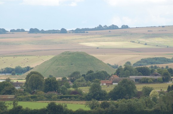
Re-posted from Day of Archaeology Two years after posting about my work on the Silbury Hill digital archive, in ‘AN ADS DAY OF ARCHAEOLOGY’, and I’m still busy…
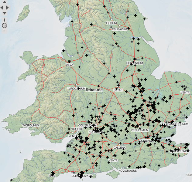
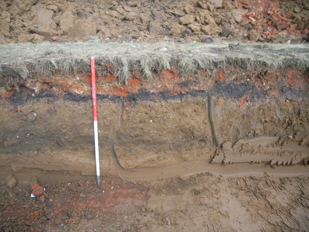
Since April 2012 I have been fortunate enough to be the ADS lead in the Roman Rural Settlement of Britain project, undertaken by Mike Fulford and a small team…
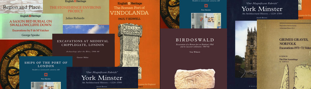
English Heritage has a long tradition of producing high quality, well illustrated archaeological monographs about key sites and topics of importance to the understanding of the…
We were very pleased to recently release our first archive which was deposited with us via ADS-easy. Oxford Archaeology (South) deposited a small archive of the…
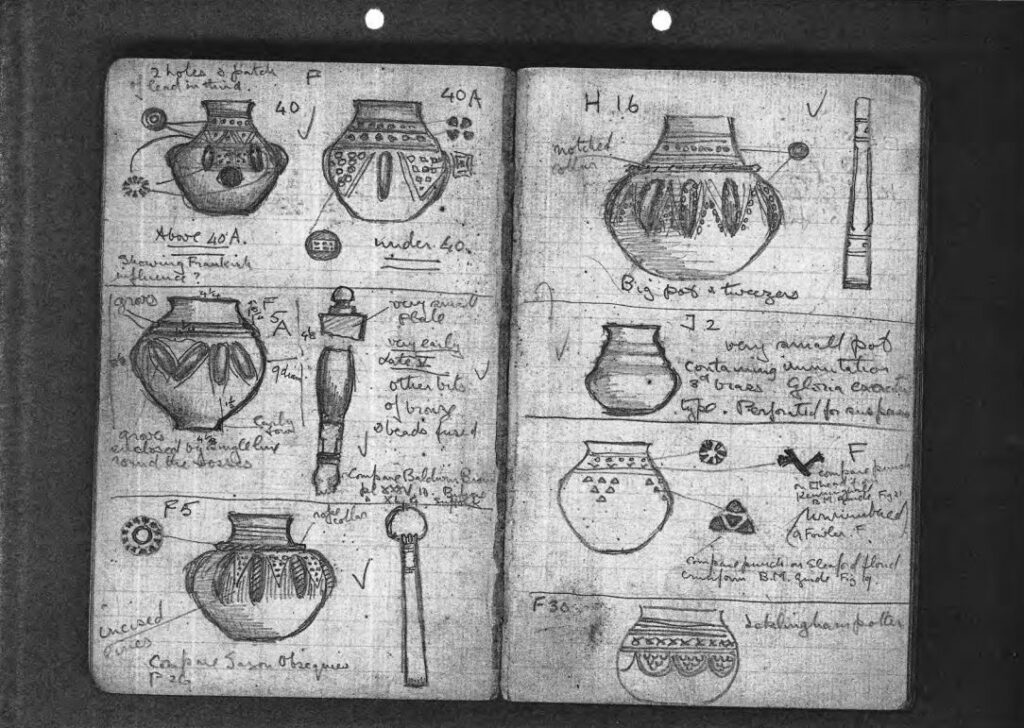
With the release last year of two more Anglo-Saxon archives, ‘A Corpus of Early Anglo-Saxon Buckets’ and ‘Anglo-Saxon Grave Goods of the 6th and 7th Centuries AD:…
ADS is pleased to announce the release of three new digital archives exploring the history of settlement in Yorkshire, carried out under the auspices of the…
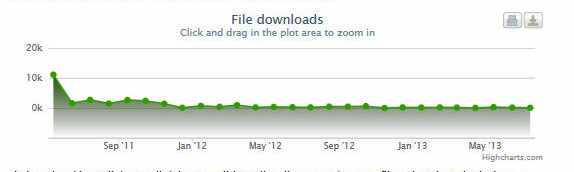
ADS is pleased to announce that it has added a Usage Statistics page to all our archive collections, including Journal Series, Bibliographies and Theses. The usage…
Here it is, my Day of Archaeology 2013 and after a routine check of my emails and the daily news I’m ready to begin! I am…
This is the first of a two-part blog reporting on the progress of my work in preparing the digital data from the English Heritage Silbury Hill…
This is the first of a two-part blog – the second will be a more detailed overview of the technologies involved in the digital dissemination –…