Anastasia Akerman here again, as it’s almost the weekend so obviously this was the right time have fun with some of the beautiful images to be found in the HMJ Underhill archive, compiled by Oxford University and available in our archives. Also I felt like brushing up on the old QGIS skills. So I decided to georeference some of these images and see how they match up with modern maps.
These images all come from the Underhill Archive available on the ADS Archive. The archive was put together by Deborah Harlan and Megan Price at the University of Oxford. It consists of hand painted glass slides of British megaliths as well as maps of ancient Britain and the areas surrounding prehistoric monuments.
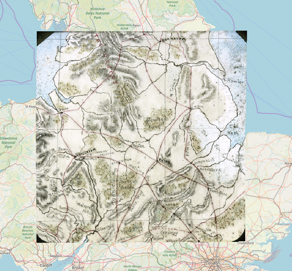
First up I used the maps of Roman Britain created by Underhill probably in 1895. There are two maps in the archive, one of the South and East and another of the North and West. Using the georeferencer plugin I matched up the old Roman towns (Venta Bulgarum, Camuludonum, Venta Icenorum, Erducorum and a few others) with their modern equivilents on my OpenStreetMaps base map.
Times like these is when I think about how awesome it is to have open access data. Combined with open source software like QGIS it’s pretty easy to remix and reuse data and do basic research at home.
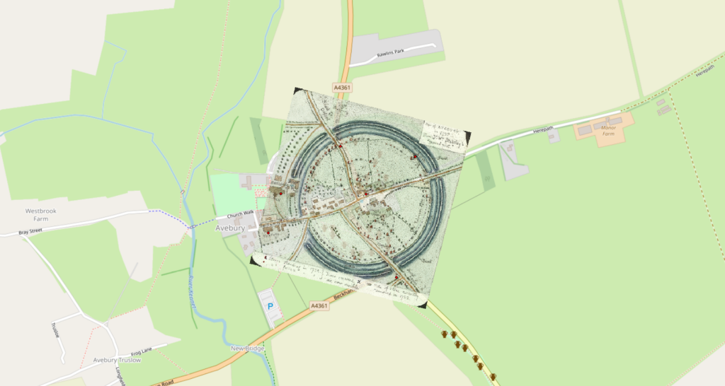
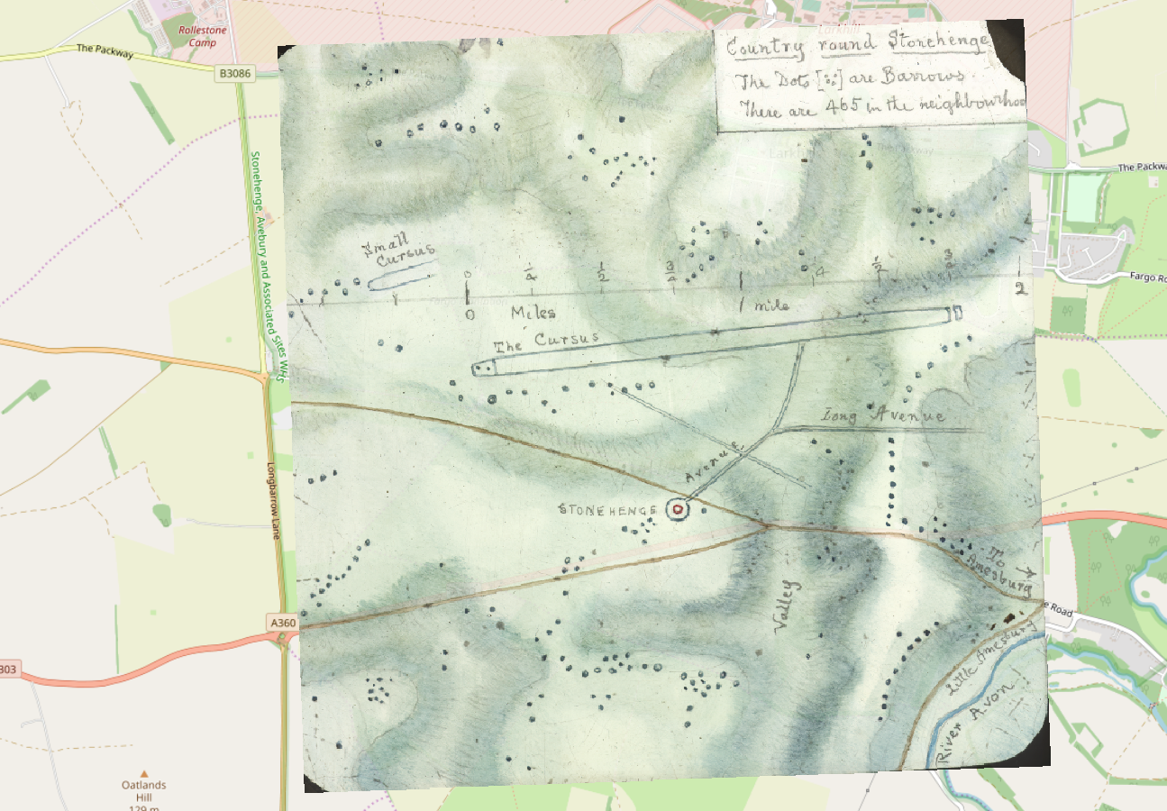
I used QGIS 3.2 Bonn with the georeferencing plugin and played around with the different transform types. For points on the stone circle sites I enlisted the used of google maps and tried to pin point the exact stones represented in the maps.
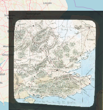
What I find interesting here is the amount of wetland depicted in the East Midlands.
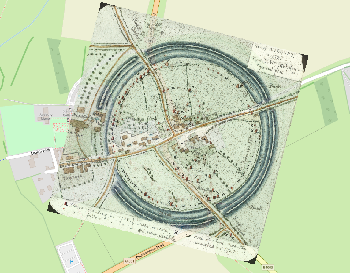
It was also interesting seeing how the surrounding landscape around Avebury has changed, but the road system is still basically the same. We see the same thing on the Roman Britain maps with the survival of the roman road system into the modern day, oh the old Londinium to Venta Belgarum commute….
Deborah Harlan, Megan Price (2013) HMJ Underhill Archive [data-set]. York: Archaeology Data Service [distributor] https://doi.org/10.5284/1000234