D: How do you compile, maintain and enhance an HER?
- D.1 Compilation - the beginnings
- D.2 How does your recording policy fit in?
- D.3 Compilation from basic sources
- D.3.1 National heritage datasets
- England
- Wales
- Scotland
- D.3.2 Compilation from documentary sources
- Commonly used documentary sources
- D.3.3 Recording Maritime Heritage
- Background
- The coastal zone
- Adding maritime data to an HER
- Conclusion
- D.3.4 Compilation from digital sources
- Heritage data sets
- Non-Heritage data sets
- D.3.5 Approaches to compilation from basic sources
- D.4 Keeping up to date with fieldwork
- D.4.1 Existing digital resources
- D.4.2 Planning guidance and new fieldwork
- Formats for data collection
- D.4.3 Importing digital data from external sources
- Strategies for physically moving data between geographically removed locations
- Strategies for importing data into existing databases
- D.5 HERs and enhancement projects
- D.5.1 National projects and programmes
- Research frameworks
- National Mapping Programme (NMP) England
- Monuments Protection Programme (MPP) England
- Burgh surveys Scotland
- Intensive and extensive urban strategies
- Historic landscape characterisation (HLC) England
- Historic Landscape Characterisation Wales
- Historic Land Use Assessment (HLAMAP) Scotland
- The Scottish Wetland Archaeology Database
- The Scottish Palaeoenvironmental Archive
- D.5.2 Local authority partnerships
- Partnerships with corporate IT sections
- Corporate GIS
- Multimedia
- Integration
- D.5.3 Local groups and societies
- D.5.4 Universities
- D.5.5 National Thematic Recording Projects
- Special-interest groups
- D.5.6 Finding out more
- D.6 Case studies of HER enhancement projects
- D.6.1 Creating an event record and GIS layer
- D.6.2 Providing historic mapping for the HER : the Worcestershire Tithe Map Project
- D.6.3 Creating a deposit model for the Palaeolithic in Worcestershire
- Using the BGS data
- Adding the HER data
- The result
- D.6.4 Prehistoric funerary and ritual sites
- Introduction
- Methodology
- Results
- D.6.5 The Shorewatch (SCAPE) Project
Maintaining and developing an HER is a continuous process that involves various types of work. At any one time, new information may be received from recent fieldwork about changes or additions to the lists of protected sites, or through project work. Numerous different organisations and individuals are involved in the process of collecting and supplying information, and with the increasing use of GIS and on-line access, new ways of making a wide range of data accessible to HERs are beginning to emerge.
This section of the manual gives general guidelines for maintaining and developing the information resources of an HER and suggests some new approaches to recording information from development-led fieldwork and some ideas for enhancement projects. For the purpose of this manual this topic has been broken down into three areas:
- Compilation from standard digital and documentary sources of information
- Fieldwork and digital data collection
- Enhancement projects such as national projects and programmes, local partnerships, universities and special interest groups
Case studies of some recent HER enhancement projects are also included.
D.1 Compilation - the beginnings#
The information in most HERs has been compiled over a long period of time. Much of it was collected before the use of databases let alone GIS and this has greatly affected how we can use it in the present.For most HERs compilation has been a complex process involving collecting information from a wide range of sources including national agencies, local bodies and private individuals. When SMRs were developing in the 1970's and 1980's three stages of information collection were envisaged: compilation, enhancement and ongoing maintenance.
In reality, the development of the information base held by HERs has been more ad hoc. The resources available for compiling information have varied considerably from one HER to another and also over time. A mixture of permanent and temporary staff (funded from, for example, local authorities, English Heritage, Historic Scotland, Cadw, RCHME, RCAHMS, RCAHMW and the Manpower Services Commission, National Trust), volunteers and students have been involved in compiling and enhancing SMRs and HERs. In many of the present HERs increasing responsibilities for development control activities, the pressure of work arising from planning guidance and limited resources have given rise to backlogs of information waiting to be compiled and input into the HER database. The purpose of this section is to step back from the backlogs and take a fresh look at the range of information sources that is available and to consider old and new approaches to incorporating it into HERs.
D.2 How does your recording policy fit in?#
Section B.4.1 recommends HER officers to prepare a recording policy. This document should identify both the sources of information that are locally available to the HER and also provide a framework to identify gaps or weaknesses in the information base (this may have already been provided by an HER Audit, see section B.2.4). HER officers are recommended to make reference to their recording policy when planning programmes of work to maintain or enhance the record. When planning to incorporate either new material or information held in backlogs, some key issues to consider are:- Does the information provided lie within the sphere of interest of the HER, or has the information a more natural home elsewhere?
- Does the information provided by a source contain enough detail to meet the HER's requirements and the HER Basic Compliance Specification set out in Annex 1 of Benchmarks for Good Practice? (Chitty 2002).
- Does the information duplicate existing material in the HER?
- Could the information be more easily acquired from another source?
- Can the information be incorporated into the HER without extensive additional work?
- How high a priority is this new information in relation to your research framework?
- Does the material involve the acquisition of physical archive? If so is it original material, in which case is the HER the most appropriate body to hold it after incorporation? Is digital archiving required? Reference should be made to the HERs collection and disposal policy for archive material.
D.3 Compilation from basic sources#
There are several standard sources of information that all HERs should incorporate. The OS record cards provided the basic starting point for most. In some cases SMRs recasting projects created computer records from the OS cards, in other cases digital data was supplied from the appropriate National Monuments Record.D.3.1 National heritage datasets#
A key information source for HERs is details of sites in their areas that are either under some form of statutory protection or that are registered as being of special interest or at risk. This information is maintained by English Heritage as part of its statutory functions (Historic Scotland and CADW within their respective countries). HERs and Historic Buildings Records should all routinely receive paper notifications of changes and additions to schedulings or listings (in Scotland this information is supplied digitally by Historic Scotland).England#
Digital data from the national heritage datasets will be available to HERs in the future under licence from the NMR. These datasets include:- AMIE: a historic environment database of sites, monuments, buildings, archives, archaeological/architectural interventions and surveys in England and its territorial waters
- Record of Scheduled Monuments (RSM): a database of scheduled monuments in England
- Listed Building System (LBS): a database of the lists of buildings of special architectural and historic interest in England maintained by English Heritage on behalf of the DCMS
- Parks and Gardens Registration System (PaG): a database of the register of parks and gardens of historical interest in England
- Battlefields Register: the register of battlefields of historical interest (http://www.english-heritage.org.uk/battlefields)
- Buildings at Risk (BAR) Register: a database of grade I and II* listed buildings and upstanding scheduled monuments identified as being at risk of deterioration or loss (http://www.english-heritage.org.uk/bar
 ). Many local authorities keep their own BAR register for grade II listed buildings.
- Protected Wrecks: a list of protected wreck sites in English coastal waters
- Desk GIS: provides a corporate Geographical Information System with integrated access to historic environment data such as the RSM, LBS, AMIE and PaG both spatially and textually. HSIS enables the capture, display and analysis of statutory and non-statutory data in context with other geographic data
- Controlled Sites and Protected Places: Designated under the 1986 Military Remains Act. NB All crashed military aircraft are covered by this Act.
- List of World Heritage Sites: a list of World Heritage Sites in England.
- National reference datasets managed by the Data Standards Unit: includes the Thesaurus of Monument Types, Thesaurus of Building Materials, administrative area lists.
The adoption of nationally agreed data standards and indexing terminology by HERs, means that it is becoming easier for digital data to be provided in a standard format ready for incorporation into HER databases (see D.4.3).
The are also a number of key web-based initiatives aimed at the online dissemination of historic environment data:
LB Online (http://lbonline.english-heritage.org.uk/) provides up-to-date access to the statutory Lists of Buildings of Special Architectural and Historic Interest and is made available by English Heritage and the DCMS. The site is currently for the staff of Local Planning Authorities, National Amenity Societies and some other authorised government agencies.
Images of England (http://www.imagesofengland.org.uk/) Images of England is a groundbreaking heritage initiative funded by the Heritage Lottery Fund and English Heritage. The project aims to create a 'point in time' photographic record of every listed building in England. The photographs, taken by hundreds of volunteer photographers, are being posted alongside existing list descriptions for each building to create what will be one of the largest free to access digital image libraries in the world with over 300,000 images when complete.
PastScape (http://www.pastscape.org/homepage/index.html) is a prototype web site developed by English Heritage's National Monuments Record (NMR), which provides an easy-to-use method of accessing information taken directly from the NMR's national historic environment database (AMIE) containing nearly 400,000 records on the archaeology, monuments and buildings of England and its territorial waters. These records contain descriptions of any interesting archaeological details, pictures (where available), and links to maps and aerial photographs on other websites.
MAGIC (http://www.magic.gov.uk) this interactive map-based site, launched in July 2002, combines information on key environmental schemes and designations. The site is the result of a partnership project between seven government organisations with responsibilities for rural policy-making and management. Users are able view and query the available data sets through the use of standard GIS tools.
ArchSearch (http://archaeologydataservice.ac.uk/archsearch/) or http://archaeologydataservice.ac.uk/archives/provides an online search catalogue to collections containing details of around 1,000,000 sites, monuments and interventions in the UK, or other locations where UK-based archaeologists work. It also links to a growing number of digital archives and electronic publications.
Wales#
Similarly a number of national digital data sets are available to HERs in Wales. These include:- Scheduled Ancient Monuments database: a database of scheduled monuments in Wales maintained by Cadw on behalf of the Welsh Assembly Government.
- Listed Building database: a database of the lists of buildings of special architectural and historic interest in Wales maintained by Cadw on behalf of the Welsh Assembly Government.
- Parks and Gardens Register: a database of the register of parks and gardens of historical interest in Wales maintained by Cadw.
- Historic Landscapes Register: a database of the register of parks and gardens of historical interest in Wales maintained jointly by Cadw and the Countryside Council for Wales. The Register can be viewed on the CCW web site.
- Protected Wrecks: a list of protected wreck sites in Welsh coastal waters.
The Extended National Database for Wales (END). http://www.rcahmw.org.uk/nmrw/extdbs.shtml, The END is based on a partnership of Welsh heritage bodies, including the RCAHMW, the Archaeological Trusts of Wales, Cadw and the National Museums and Galleries of Wales (NMGW). who have created a national index of archaeological and architectural information. The information encompasses NMRW's site database, the Sites and Monuments Records held by each of the four Archaeological Trusts, and Cadw's scheduled monument and listed building database. CARN (http://www.rcahmw.org.uk/data/carn.shtml) is being developed as the entry point to the END.
The RCAHMW has made a selection of information from the NMRW available on the Internet through the on-line Coflein database. This is currently available only in English but a Welsh Language version is planned.
Scotland#
Historic Scotland provides a digital version (in Shape File format) of the Scheduled Ancient Monument designations for use within a GIS. This information provides an indication of the legally protected extent, the statutory designation remaining within the paper document. Listed building information is available via Pastmap (see below).Pastmap (http://jura.rcahms.gov.uk/PASTMAP/start.jsp) is a map enabled query system for Scottish National Archaeological and Architectural Datasets (Listed Buildings, Scheduled Ancient Monuments, National Monuments Record of Scotland, Historic Gardens and Designed Landscapes and some Sites and Monuments Records). This site, curated for the Scottish Ministers, is a partnership project between Historic Scotland and the RCAHMS, and also incorporates a dataset managed by Historic Scotland (Inventory of Historic Gardens and Designed Landscapes).” Scottish Ministers have just transferred sole responsibility for compiling and maintaining the Inventory to HS. Pastmap is being further developed with the Scottish SMRs as active partners, and the site hosts GIS data from several SMRs, with a view to having full coverage within 3 years time. A link to HLA data is also available through this portal (See case study in E.5.11).
D.3.2 Compilation from documentary sources#
In common with the OS record cards and the National Archaeological Record (NAR), most English SMRs were first compiled by trawling through information published in specialist local and national journals, monographs and thematic gazetteers to identify references to sites and monuments. Additional information was obtained from local museum and society records and from documentary archives, including the archives of local researchers, such as antiquarians, OS correspondents and others. Documentary and cartographic archives remain valuable sources for HER revision and enhancement. In Scotland where initial compilation in most cases took place later than in England, it was generally undertaken via a download of digital data from the National Monuments Record for Scotland.Commonly used documentary sources#
It is not possible to include a complete list of the many publications that are specific to an area or research topic. However, the following list provides a summary of documentary sources commonly used in HERs:- Local monographs and journals
- Antiquarian monographs specific to the county
- Domesday book by county
- English Place Name Society: place names of the county
- Monographs specific to the county
- Local archaeology society(ies) journal series
- Local historical and local studies groups journal series
- Leaflets and pamphlets relating to local sites and areas
- RCHME county inventories
- RCAHMS Inventories
- RCAHMW county inventories
- Victoria County History: volume specific to the county
- Pevsner's The Buildings of England and Wales series: volume specific to the county
- The Rutland Press Illustrated Guides Scotland (The Rutland Press is the publishing division of the Royal Incorporation of Architects in Scotland)
- Regional monographs and journals
- BAR British Series: topical research related to the region
- CBA Regional Group publications
- Regional archaeology and history society journal series
- National monographs
- National thematic publications
- Medieval Towns
- Margaray's Roman Roads of Britain
- English Heritage/RCHME topical publications
- English Heritage Batsford series
- CBA research reports
- Scottish Burgh Survey
- Historic Scotland Batsford series
- Cambrian Archaeological Association Monographs
- National journals
- BAR national series
- Antiquity
- Britannia
- Archaeologia
- Antiquaries Journal
- Journal of Roman Studies
- Archaeologia Cambrensis
- Studia Celtica
- Medieval Archaeology
- Medieval Settlement Research Group
- Post Medieval Archaeology
- Vernacular Architecture Group
- After the Battle
- Landscape History
- Association of Industrial Archaeologists Journal
- Current Archaeology
- International Journal of Nautical Archaeology
- Proceedings of the Society of Antiquaries of Scotland
- Scottish Archaeological Journal
- Discovery and Excavation in Scotland
- Other
- Hydrographic Office Wreck Index.
- Lloyds List
- Parliamentary Papers
- State Papers
- Shipwreck Index of the British Isles
- Air Britain publications
- Aerial Photographs
- Vertical and Oblique coverage from 1945 onwards from the Cambridge University Collection of Air Photos (CUCAP)(http://venus.uflm.cam.ac.uk/)
- Vertical coverage from c 1940 onwards: available from the NMRs
- Oblique coverage from 1930 to the present: available from the NMRs/HER/others
- Vertical and Oblique coverage from 1945 onwards from the Cambridge University Collection of Air Photos (CUCAP)(http://venus.uflm.cam.ac.uk/
- Maps
- OS 1st edition, early editions and large-scale town maps
- Enclosure, Tithe and estate maps for the area
- Historical maps for the area where available
D.3.3 Recording Maritime Heritage#
Background#
The United Kingdom has the third longest coastline in Europe and comprises some of the most varied historic landscapes in the British Isles. From the Prehistoric to the present our coastline and its waters have served as a source of food, transport, trade, industry and means of defence. Rising sea levels from the end of the last Ice Age, subsequent coastal erosion and high numbers of ship wrecks have led to a large proportion of our coastal heritage disappearing beneath the waves. In the past maritime and marine aspects of the historic environment have been generally poorly represented on HERs,which were focused on terrestrial features.The coastal zone#
The coastal zone comprises three important sub-divisions: -- Zone 1 - Dry Land: This lies above high water mark. Archaeological remains typically include such coastal installations as docks, jetties, harbours, coastal settlements and defences.
- Zone 2 – Intertidal: This lies between the high and low water marks. Remains that might be recorded here include stranded vessels, fish traps, piers and partly exposed ancient landscapes.
- Zone 3 - Sub-tidal: This stretches from the low water mark to the boundary of territorial waters, currently set at 12 nautical miles. This is a vast area of almost completely unknown potential, principally consisting of submerged landscapes and shipwrecks.
Many HERs will have good coverage for Zones 1 and 2 within their existing data sets. Archaeological remains in these areas can be easily identified using traditional methods such as beach walking and map regression and can be investigated between the window of the tides using standard techniques including survey and excavation. However, given that local authorities have no jurisdiction beyond the mean Low Water Mark, very few HERs will have coverage for Zone 3. This was the situation for Teesside in the early 1990s. To redress the balance a project was instigated in 1994 to enhance the existing coastal dataset with particular regard to sub-tidal information.
Adding maritime data to an HER#
There are a number of key factors to consider when planning a maritime element to an HER.- Defining Boundaries – The sea is not divided into convenient administrative areas like the land and local authorities do not have powers below low water mark However, some HERs are developing maritime components and becoming involved in providing advice on marine archaeological features. Neighbouring Local Authority HERs should discuss how County/District boundaries will be extended in the form of arbitrary quasi-administrative areas Planning powers in Scotland do not currently extend beyond the low watermark – see http://www.scotland.gov.uk/environment/coastalforum/scotscoast.asp#4 for a discussion of the current framework for coastal management in Scotland)
- Data structure – Traditional HER data structures can be used to cover the majority of remains in Zones 1-2 adequately and drowned landscapes in Zone 3. However problems arise when attempting to enter shipwreck sites that require additional or extended glossary controlled fields to record new units of data not associated with terrestrial sites. In the Tees HER this was achieved by adding supplementary tables to create 'vessel' specific data fields. The supplemental data is split in to three broad categories: -
- Locational information - new fields include, Latitude, Longitude and Admiralty Chart Number.
- Voyage information – new fields include, 'Sailed from', 'Bound for', 'Cargo', 'Owner' and 'Master'.
- Construction information – new fields include, 'Construction method', 'Where built' and 'Tonnage'.
- Data sources – To create a sub-tidal HER source material should be identified and assessed, after consultation of the maritime component of the NMR for English HERs. As a baseline HERs should seek to consult: -
- Hydrographic Office Wreck Index
- Lloyds Shipping Registers
- Parliamentary Returns
- Lighthouse Returns
- 19th and 20th century local newspapers
- Previously published and archive material at local museums, archives and libraries
- Wreck Diving guides
- Larn and Larn, Shipwreck Index of the British Isles. (Larn and Larn 1995a, 1995b, 1997, 1998 and 2000).
The vast majority (95 per cent) of vessel data in the Tees HER was derived from these sources.
To enhance the initial dataset the HER may consider:
- Contacting local sub-aqua clubs and the fishing community
- Checking pilot and lifeboat records
- Carrying out data collection in the field
Conclusion#
Prior to the start of this project there were three recognised 'maritime' sites on the Tees HER: two prehistoric canoes from the Tees and a 19th century vessel stranded on a local beach. At the end of the project a total of 2,243 new records had been entered into the database for the short 30 kilometres stretch of Teesside coastline. Other English coastal HERs should also endeavour to capture such datasets and combine sub-tidal data into their systems to form a 'seamless' archaeological record.In Scotland the RCAHMS gathers maritime information centrally and distributes it to the relevant SMRs as part of the on-going data exchange programmes.
D.3.4 Compilation from digital sources#
The number of digital sources available to HERs is expanding rapidly. By using GIS digital sources data can be displayed against traditional HER information and the relevant data can be included without the whole dataset being recast. Digital sources vary enormously but can be divided into two main typesHeritage data sets#
In addition to statutory datasets (SMs and LBs) noted above, these can include the results of projects such as the Portable Antiquities Scheme or large scale survey projects for example funded by the Aggregates Levy Sustainability Fund, English Heritage or Historic Scotland In the past individual HERs had little influence over the data structure of such digital sources, limiting their effective integration. Many HERs did not have the staff time to allow them to recast the data correctly, resulting in backlogs. This meant that the resources created by such projects were underused. This problem has been recognised and is now being addressed in England by greater consultation with the EH NMR Data Standards Unit and HERs at the project planning stage and by the development of interoperability standards such as the FISH toolkit.In Scotland in 2004 all Scottish SMRs, RCAHMS, Historic Scotland and the Scottish archaeological contracting units took a joint decision that reporting of archaeological events should conform to a standard form and procedure. The result is ASPIRE, an Archaeological Standard Protocol for the Integrated Reporting of Events. ASPIRE rigorously specifies data structure, data type and required fields for reporting new archaeological information to SMRs and the RCAHMS. This specification includes databases and GIS layers and encourages their use. From late 2005 the use of the ASPIRE protocol is enforceable via the development control process nationally as well as being a condition of grant/contract for HS funds. In addition its use is actively promoted and encouraged for non-commercial archaeological events such as academic and amateur surveys and excavations.
In addition HERs may wish to incorporate digital information from other HERs to provide a better context for the data they manage. Examples of this might include the incorporation of a city UAD into a county HER or a buffer zone of HER data from adjacent local authorities around a county or district HER boundary. Such information would be viewed but not curated by the receiving HER and would not affect the management responsibilities of the reciprocating organisations.
In Wales the vast majority of such datasets arise from Cadw and RCAHMW sponsored projects and in general have been better integrated into HERs from the outset. However, similar data exchange issues do exist here.
See also section C.8.1 on online sources.
Useful Web sites for heritage data sets
Archaeology Data Service, ArchSearch: http://archaeologydataservice.ac.uk/
Great Britain Historical GIS Project: http://hds.essex.ac.uk/gbh.asp, http://www.visionofbritain.org.uk/
MAGIC: http://www.magic.gov.uk/
For Scotland many historical maps are available online on the National Library of Scotland web site http://www.nls.uk/digitallibrary/map/index.html.
Roy's Military Survey of Scotland 1747-55 (surveyed) is available online on the SCRAN website subject to subscription http://www.scran.ac.uk/
Non-Heritage data sets#
Through a corporate GIS HERs may have access to a range of other digital datasets which can be used in conjunction with HER data without needing incorporation into the record (see also Part E). These could include information produced by national bodies such as the National Soil Survey and the British Geological Survey or information produced by local or regional government such as habitat maps, hedgerow surveys, aerial photographic surveys. It is worth speaking to colleagues in other departments to see what they hold. In many cases different services within one authority would benefit from access to the same digital data and the cost of purchasing data sets can be split.Useful web sites for non-heritage data sets
http://www.bgs.ac.uk/products/digitalmaps/digmapgb.html
http://www2.getmapping.com/home.asp
http://www.magic.gov.uk/
http://www.old-maps.co.uk/
http://www.ordnancesurvey.co.uk/oswebsite/
D.3.5 Approaches to compilation from basic sources#
In most areas, there is an almost endless supply of potential documentary and digital sources. New journals and archives become available, new datasets are created or the breadth of the HER information base is extended to cover new topics. Many HERs have identified large quantities of sources that might be trawled, but it is difficult to estimate how any particular source will benefit the scope and information content of the HER without accessing the material.A better approach might be to plan to maintain the HER incorporating information from field projects and to enhance the breadth and scope of the HER through enhancement projects. Both strategies will use documentary and digital sources.
D.4 Keeping up to date with fieldwork#
D.4.1 Existing digital resources#
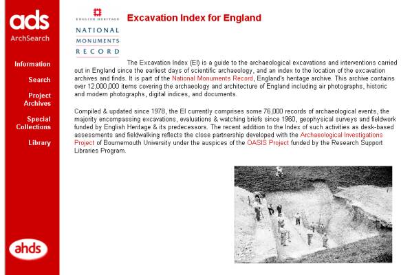
Since 1978, the NMR (England) has been compiling its Excavation Index, which currently holds records for over 76,000 archaeological interventions in England. These include interventions dating from the earliest episodes of scientific archaeology to the present day (see C.7.3). Information has been collected from a variety of sources (including HERs) and combines bibliographic recording with direct input from reports, recording forms and microfilm archives. The scope of the Index covers both invasive (excavation, evaluation, watching brief) and non-invasive (geophysical survey, desk-based assessment, field-walking and measured survey) methods of investigation. The Index provides both a record of the event that has taken place and acts as a signpost to the archaeological features identified and the associated documentary and archive sources. Since 1998 a sub-set of the Index has been made available on the internet (Figure 27) via the ADS Catalogue (see http://archaeologydataservice.ac.uk/archives/).
 |
Since 1990, English Heritage has sponsored Bournemouth University to conduct an annual data-collection exercise, the Archaeological Investigations Project (AIP). The results of the exercise have been published as The Gazetteer of Archaeological Investigations in England, issued as an annual supplement to the British and Irish Archaeological Bibliography. The database compiled to produce these printed volumes has been deposited with the NMR (England).
The merger of the RCHME and English Heritage in April 1999 brought with it an opportunity to integrate the Excavation Index and The Gazetteer of Archaeological Investigations into a single resource. This concordance was made possible through the OASIS project, an alliance between English Heritage, the AIP and the ADS, with funding from the Research Support Libraries Program (RSLP). OASIS aims to create a single index to the grey literature of archaeological assessment reports and excavation archives in England, which will be delivered via the ADS ArchSearch catalogue The OASIS project has developed an on-line recording form and aims to promote its use by contractors so that they can submit index-level records of archaeological investigations to the NMR and the relevant HER. (See section C 7.3)
Useful website:
OASIS project http://oasis.ac.uk/
There is currently no equivalent Excavation Index covering Scotland. Currently fieldwork is reported annually through the Council for Scottish Archaeology's Discovery and Excavation in Scotland publication. Some SMRs transfer Discovery and Excavation data into an Events module, but data is also transferred into the RCAHMS NMRS database and supplied to the relevant SMR as part of an on-going data exchange programme. The current extension of OASIS to Scotland will help develop indexes both locally and nationally.
D.4.2 Planning guidance and new fieldwork#
Since the advent of planning policy guidance for archaeology (PPG16 England, Circular 60/96 Wales, and NPPG 5 and PAN 42 in Scotland), archaeological consultants and field units have carried out much of the archaeological fieldwork in Britain on the basis of competitive tendering. The contractors operate to briefs or specifications developed by archaeologists working alongside the HER in local government planning offices. As well as specifying the archaeological research, briefs will normally include recommendations covering the deposit of material resulting from the research. In England this includes data and reports to be deposited in the HER, finds and archives deposited in local museums or other repositories and computer-based information to be deposited in a recognised digital archive. In Scotland the SMRs by custom and practice require the deposition of the original site archive (for example the paper, photographic and digital records) for long-term preservation with the RCAHMS, whilst copies of all reports are deposited in the SMR. For artefacts the Treasure Trove Advisory Panel (who provide independent advice to the Queen's and Lord Treasurer's Remembrancer) decides the appropriate depository.HER officers should work with planning archaeologists to make sure that their requirements are taken into account in specifying how, when and in what format information will be deposited with the HER.
Formats for data collection#
Creating an index record to an event or archive should not place a new burden on units - it is work that many already do and that since 1997 has been supported by the Standing Conference of Archaeological Unit Managers (SCAUM). Standard record forms for collecting information from units have been developed by the Greater London HER, SCAUM, the English NMR, the AIP, Northamptonshire HER and others. Where used, these paper forms have met with some success in improving the flow of information from data collector to HER.However, using paper forms means that HER officers often have to re-key the information provided by the units. To minimise duplication and decrease data-entry backlogs, the use of digital forms has been explored. The OASIS form is one example, another was recommended in the ADS Guide to Good Practice for Excavation and Fieldwork Archives (http://guides.archaeologydataservice.ac.uk/). Digital versions of the paper forms described above have also been produced either as tables in word-processed documents, spreadsheets or simple databases.
The use of digital forms is not trouble free and several factors should be taken into account in agreeing specified formats for digital data in briefs. These include:
- agreeing guidelines on how the standard recording form is to be completed
- agreeing guidelines about the collection and provision of metadata
- the format in which digital data is to be supplied, for example, ASCII delimited text, Access.
- the electronic media on which data is to be transferred (see also B.10.7).
The ADS can offer advice on digital data transfers ([email protected]). The NMRE offer guidance on the use of the OASIS form ([email protected]).
HER officers should set aside time to validate and enhance data. This may include:
- confirming that the data is being supplied in accordance with core HER data standards
- checking that the data supplied has not been corrupted during transfer and is readable
- checking for spelling or data-input errors
- checking the data supplied against the written reports
- adding additional indexing information and other details.
While such forms are being introduced HER officers may need to allow time to work with both planning archaeologists and contractors to make sure that information is flowing efficiently from data collector to the HER.
For Scotland see section above (D.3.4) re ASPIRE
D.4.3 Importing digital data from external sources#
Strategies for physically moving data between geographically removed locations#
Various forms of electronic storage media are used to move data around. An important consideration is that both sender and receiver need to use a shared technology for successful data transfer:- Tape has now been largely superseded as a transfer medium, mainly because few systems contain Digital Audio Tape (DAT) machines today.
- Standard 3.5 inch floppy disks can be used to transfer small amounts of data (1.44mb).
- Compression software can be used to produce zip files (for PCs) and tar files (for Unix systems) which increase the capacity of floppy discs. See http://www.pkware.com for information about PKZIP.
- CD ROMs and DVDs can transfer up to 650mb of data for CDs and 4.7 Gb for DVDs and are becoming commonplace as CD and DVD writers become more widespread. See http://cd-info.com for information about CDs and DVDs.
- High-capacity floppy and Zip drives may also be used. For information see http://www.winzip.com/winzip.html.
- Files may be transferred between users as attachments to email messages. File transfer is not without its problems as many mail servers refuse files over a certain size and 'bounce' messages back to the sender. There are also security implications as e-mall attachments are notoriously vulnerable to viruses.
- File Transfer Protocol (FTP) is an efficient way of transferring data but requires technical support. FTP is a communications program used to link source and destination systems, in which either the sender or receiver logs on to a remote system to effect a transfer. Security issues mean that many system administrators restrict access from outside although they may set up an area where files can be placed for transfer. For information about FTP see http://www.ftpplanet.com/ftpresources/basics.htm
Strategies for importing data into existing databases#
Where the data is to be imported into an existing dataset there are a number of concordance issues:- The new data need to be in a format acceptable for import to the software maintaining the existing database. ASCII delimited text is a standard export format for transfer into databases. In this format, a delimiting character separates the contents of the fields in a database record, for example a comma, percent or hash. Care must be taken to select a delimiter that is not present in the data. Most database applications support a number of import and export formats to facilitate the transfer of data between packages: for example as well as delimited text, Microsoft Access also supports import of data from other Access databases, Excel, Lotus, Paradox, Foxpro, dbase, Btrieve and SQL.
- There needs to be a clear mapping between the new data and the fields that define the structure of the existing database. Where possible, the HER should specify the fields for data capture.
- The new data should conform to any vocabulary control or data standards that have been agreed for the main database. Vocabulary lists should be supplied with the new data, particularly where codes are used. Candidate terms identified in the new data may need to be put forward for addition to existing wordlists or thesauri.
- The new data needs to be validated and may need to be edited or manipulated to conform with agreed core-data standards for the HER using search and replace functions.
Much of this can be achieved through the use of FISH Tools MIDAS Schema (see Section B 6, 7 for details). The Forum for Information Standards in Heritage (FISH) has undertaken a project to develop a toolkit of formats schema and protocols for data held in historic environment information resources (HEIRs).
These tools will help with:
- The provision of digital data from one organisation to another,
- The provision of data to the public,
- The archiving of digital data,
- The migration of data to new systems,
- Conformance to national standards.
The 'FISH interoperability toolkit' development project will provide the heritage data community with an essential infrastructure of shared standards. It has the potential to improve access to information for all.
Useful Websites:
FISH: http://www.fish-forum.com/
FISH Interoperabilty Toolkit http://www.heritage-standards.org
D.5 HERs and enhancement projects#
For HERs the maintenance of the basic information base from standard sources and fieldwork is a continuous process. As well as this day-to-day work, HER managers are recommended to plan enhancement projects to fill gaps and enhance the quality of their records. Such gaps in content or issues concerning quality are often identified by HER Audits (see B.2.4). In some cases the need for enhancement to comply with national standards will be considered to be so important that it is made a priority and funded from core budgets. An example of such a project can be found in Section D.6.1. In other cases different strategies for record enhancement can be adopted, some involving participation in national projects and programmes, some working with other departments within local authorities, others working with local societies and specialist-interest groups.Grants for SMR enhancement from Historic Scotland currently prioritise fulfilment of PASTMAP objectives. Historic Scotland may also provide initial start-up funds for the provision of an archaeological service at a Local Authority that was previously without one.
This section aims to present examples of some types of projects and programmes that are currently collecting information about aspects of the historic environment. Some case studies of projects run by HERs are also included.
D.5.1 National projects and programmes#
At any one time, English Heritage, Cadw and Historic Scotland may be involved in a number of projects and programmes which are developed in response to research and knowledge of the resource. Many of these involve partnerships with local authorities and others and some carry funding and offer opportunities to enhance HERs (either through work carried out in-house by HERs or from data available from the English NMR/NMRS).Research frameworks#
A research framework may identify weaknesses in knowledge of the resource for a particular period or theme and suggest strategies for addressing the gap. They include national and regional frameworks. Regional research frameworks aim to provide an assessment of land use, settlement, environment, economy and society in a regional context and to provide a framework for curation, decision-making and research. HER enhancement might be planned in the light of a regional research framework or national thematic frameworkUseful websites
English Heritage: http://www.english-heritage.org.uk/server/show/nav.8652
Regional Research frameworks – England:
East of England: http://www.eaareports.demon.co.uk/research_framework.htm
East Midlands http://www.le.ac.uk/archaeology/research/projects/eastmidsfw/index.html
North East http://www.durham.gov.uk/durhamcc/usp.nsf/pws/Archaeology+2001+-+Archaeology+Regional+Research+Framework
West Midlands http://www.arch-ant.bham.ac.uk/research/fieldwork_research_themes/projects/wmrrfa/index.htm
National Research frameworks – Wales:
http://www.cpat.org.uk/research/index.htm
There are no current initiatives in Scotland.
National Mapping Programme (NMP) England#
This is a long-term programme to map the archaeological resource known from aerial photography and to provide a more reliable framework for classifying and dating sites.Monuments Protection Programme (MPP) England#
This was a site-evaluation programme which added to the schedule of nationally important sites and to revised, confirmed or (in some cases) de-scheduled existing sites.Burgh surveys Scotland#
Historic Scotland commissions the Burgh surveys series. The main objective of the Burgh surveys is to identify those areas, which are of archaeological and historic interest and require sensitive treatment in the event of proposed development. However the series is also of more general interest in that it examines the geography and topography of each town, its historic buildings and the origins of its street names.Intensive and extensive urban strategies#
This programme of intensive and extensive archaeological surveys aims to provide up-to-date assessments of the surviving resource in urban areas and to improve databases. The intensive urban surveys, covering major historic towns and cities, are leading directly to the creation of Urban Archaeological Databases (UADs). The information derived from extensive surveys, covering the smaller historic towns of England (with similar surveys to also cover major conurbations) is held within the local HER A growing number of the town assessment reports from the extensive surveys are appearing on the ADS web site (see list at http://archaeologydataservice.ac.uk/archives/).
Historic landscape characterisation (HLC) England#
This programme aims to inform landscape conservation strategies in the context of planning and agricultural policies (see also E.5). One aim is to help landowners to commission historic landscape surveys to inform 'whole farm management plans' under the Countryside Stewardship (now Environmental Stewardship) and Environmentally Sensitive Area (ESA) programmes of Department of Environment, Food and Rural Affairs (DEFRA). HLC can also provide useful input to DEFRA's Environmental Stewardship Entry Level and Higher Level Schemes.
Historic Landscape Characterisation Wales#
Historic landscape characterisation in Wales has taken a different form to that in England, but its aims are similar in informing landscape planning agri-environment schemes such as Tir Gofal. Information about the mechanics of the HLC and its implementation can be seen on the Cadw web site at http://www.cadw.wales.gov.uk/
Historic Land Use Assessment (HLAMAP) Scotland#
The Historic Land-use Assessment by the RCAHMS is an analysis of past and present land-use. HLAMAP is a web-based presentation of this data that allows the user to view the data by Historic Land-use Type, Period or Category as well as by Relict Period, and to print out a report of any selected area. To date almost 45 per cent of Scotland has been analysed. As with HLC in England and Wales, HLAMAP can help to inform land management initiatives such as Rural Stewardship(Scotland). http://www.rcahms.gov.uk/search.html(See also E.5.11)
The Scottish Wetland Archaeology Database#
The Scottish Wetlands Archaeological Database (SWAD) is an Historic Scotland (HS) commissioned project designed primarily to produce a fuller understanding of the potential of Scottish wetland archaeology. As it now stands there are over 6,000 records in the database. http://www.geo.ed.ac.uk/swad/
The Scottish Palaeoenvironmental Archive#
A national archive (funded by Historic Scotland and Scottish Natural Heritage), to serve four main purposes:- To identify and protect from destruction sites of key scientific interest and value.
- Inform decision makers such as the government, conservation bodies, scientists.
- Enhance public awareness of palaeoenvironmental sites in Scotland.
- Help to direct research in Scotland.
D.5.2 Local authority partnerships#
Most HERs have the opportunity to enhance their information resources through partnerships with other departments within their local authorities. There are three principal forms of partnership which are of potential benefit. These are: collaborative working with staff within corporate Information Technology sections; corporate GIS systems and interdepartmental collaborative projects to develop multimedia resources for public benefit. Another development in many authorities is the integration of archaeology, historic buildings and natural environment records.Partnerships with corporate IT sections#
Many local authorities or national bodies have specialist IT sections. Collaboration with the specialists in these sections can help to ensure appropriate use of IT resources and input to developing specific IT aspects of HERs. An example of a collaboration between an HER and an IT section can be seen in Section D.6.2.Corporate GIS#
Many departments within local government maintain GIS layers. These normally include archaeology, Rights of Way, ecology and strategic planning and may also include minerals extraction and flood risk areas. Often this means that different spatial layers are available across a corporate network, some intended for general use by the various departments (for example OS map layers), some maintained for a specific purpose.Multimedia#
Many HERs have good links with other information providers based in local libraries, museums, record offices and archives. All these contain information in their catalogues and accession registers that provide useful sources for enhancing HER databases. Perhaps more exciting to potential users are the photographs, historic maps and documentary archives that they hold.In some areas, collaborative projects are creating multi-disciplinary cultural-heritage resources drawing on materials from different locations. This may involve digitisation projects to scan and capture historic maps and documents, images of sites and museums objects and associated database development about the sites, catalogues and bibliographic material. For an example of such a project see Section D.6.2. or 6.3.
Integration#
In some authorities, HERS, Historic Buildings Records and, sometimes, natural environment records are being brought together. This means that a range of new information is accessible about:- Listed buildings and conservation officers' reports
- Regionally Important Geological Sites (RIGS) for geological and geomorphological sites
- SSSIs (for example ancient woodland and grassland, water meadows, peat-filled kettle holes, etc) also often have an historic landscape implication
- Information available from English Nature or Scottish Natural Heritage
- Sites managed by local wildlife trusts.
D.5.3 Local groups and societies#
Many local societies have programmes of research, some of which lead to the publication of site gazetteers and the deposit of materials with local HERS. Local societies may also be provided with copies of HER maps and print-outs which they update based on their knowledge. As with the national thematic recording programmes, an important consideration for HERs is the form in which information will be deposited.Where possible, HER officers should aim to work with local societies to agree a standard recording form that incorporates the HER's core standards and reflects national data standards (in Scotland ASPIRE compliant). Ideally, guidance should be offered to society members on how to complete the recording forms, possibly through training days. HER officers should allow time to check the quality of information while it is being collected. In England and Scotland Local Societies have received grants to undertake archaeological projects from the Local Heritage Initiative fund, but this scheme has now come to an end. These grants have enabled local groups and HER staff to work together on enhancement projects. For an example of this see Section D.6.2.
Useful Websites
Local Heritage Initiative England http://www.lhi.org.uk/
Local Heritage Initiative Scotland http://www.snh.org.uk/wwo/communities/comm-grants.asp
D.5.4 Universities#
University research excavations and fieldwork continue to be an important source of information about the historic environment. HER managers are recommended to establish good contacts with any universities that are active in their areas and, as with other fieldwork programmes, to discuss arrangements for the deposit of information and archive. HER managers may also wish to work with their university contacts to identify possible research topics for students interested in working in the local. area. Liaison with the ADS may be useful as a source of information about university-based archaeology. An example of HER enhancement resulting from partnership between a university and an HER can be seen in Section D.6.5.D.5.5 National Thematic Recording Projects#
A number of thematic records have been or are being created at a national level by special interest groups. Some of these involve major programmes of fieldwork and trawls of documentary sources in response to a perceived threat to an element of a resource that is under-represented in HERs. Others have arisen in response to the interests and enthusiasms of specialist societies. Many have the potential to attract funding from the Heritage Lottery Fund because of their potential for involving members of the public as volunteer fieldworkers and researchers.Many of these recording projects start with the collection of information from HERs and the NMR but go on to include original fieldwork and research. Most are willing to share the information that they compile with HERs, sometimes by providing digital data, record cards or reports or alternatively by publishing their results in print or on the internet. By complying with data standards (including recording metadata), these recording projects are enabling interoperability between different database systems mounted on the internet (see B.9 and D.4).
An important consideration for HERs is how far they will be able to specify the format in which any information is to be deposited with them. Ideally, thematic projects would collect data in accordance with the data standards laid out in MIDAS and use the reference-data lists that make up INSCRIPTION (ASPIRE in Scotland). This general principle has already been achieved for a number of projects (undertaken with collaboration from the NMR, CBA, the MDA and ADS) which plan to offer digital data to (or have already made their data available to) to HERS, for example:
- the Defence of Britain Project: http://www.britarch.ac.uk/projects/dob
- Portable Antiquities Scheme: http://www.finds.org.uk
The Countryside Agency's Local Heritage Initiative (LHI) is another example of a scheme that has the potential to result in new sources of information to enhance the HER. As the scope of LHI projects covers both the natural and the man-made environment, HER managers may need to consider their collecting policies before deciding which information to incorporate into their records. However, the LHI will come to and end on 31st March 2007, when it will be subsumed into the broader Heritage Lottery Fund programmes. Applications for projects were still being accepted until the end of June 2006.
See http://www.lhi.org.uk(England)
http://www.snh.org.uk/wwo/communities/comm-grants.asp(Scotland)
Special-interest groups#
A well-known feature of British life is the number of societies and special interest groups that exist around the country. Many of these have now begun to compile databases and to create records about sites of special interest to them. Although many of them have been working outside the main focus of interest of most HERs, some of their activities are increasingly becoming recognised as important. Examples include:- the Survey of the Jewish Built Heritage http://www.jewish-heritage-uk.org
- the Airfield Research Group http://www.airfield-research-group.co.uk
- the Association for the Study and Preservation of Roman Mosaics http://www.asprom.org
- the Corpus of Romanesque Sculpture http://www.crsbi.ac.uk
- the National Inventory of War Memorials http://collections.iwm.org.uk/server/show/nav.00g00c
- the Public Monuments and Sculpture Association http://www.pmsa.org.uk
- the Tiles and Architectural Ceramics Society http://www.tilesoc.org.uk
Details of these and other projects can be found on the HEIRNET register. http://ads.ahds.ac.uk/heirnet/index.cfm
An email discussion list exists to promote discussion and colaboration between these groups. HER managers can also use this list to promote cooperation between HERs and recording projects. http://www.jiscmail.ac.uk/lists/helps
D.5.6 Finding out more#
HERs may benefit from using the research tools described below as a starting point to find out more about the information that is available and to help to devise enhancement projects:- the English NMR maintains a list of contacts working with national thematic projects and in special interest groups
- the BIAB provides a useful search tool
- the ADS Catalogue provides an information gateway to archives and data and is developing pointers to special-interest datasets
- the CBA website is a useful starting point for information (see also Council for Scottish Archaeology)
- the Public Record Office can provide information about the archival network.
Useful websites:
Archaeology Data Service (ADS) http://archaeologydataservice.ac.uk/
Council for British Archaeology http://britarch.ac.uk
Council for Scottish Archaeology http://www.scottisharchaeology.org.uk/
HEIRNET register http://ads.ahds.ac.uk/heirnet/index.cfm
HEIRPORT http://ads.ahds.ac.uk/heirport/
Society of Antiquaries Library catalogue http://sal.ads.ahds.ac.uk/
Heritage Lottery Fund http://www.hlf.org.uk
National Monuments Record (England) http://www.english-heritage.org.uk
Royal Commission on the Ancient and Historical Monuments of Scotland http://www.rcahms.gov.uk
Royal Commission on the Ancient and Historical Monuments of Wales http://www.rcahmw.org.uk/
D.6 Case studies of HER enhancement projects#
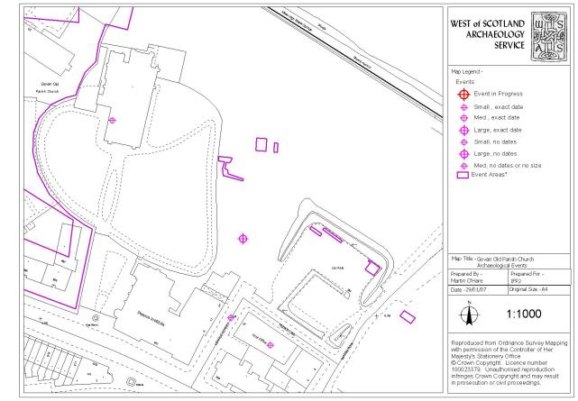
D.6.1 Creating an event record and GIS layer#
Stuart Jeffrey, West of Scotland Archaeology Service (WoSAS)The recommended Event Monument Source (EMS) model for SMR management has meant that those SMR databases that have been historically developed with these three elements undifferentiated have required extensive restructuring. At WoSAS this process was seen as an opportunity to develop a more sophisticated GIS polygon layer representing archaeological events that could inform development control directly as well as offering a further resource to be supplied as baseline data to contracting units. The project to remove and restructure existing event records from the SMR and to enter unrecorded events from the existing paper archive as well as defining them in the GIS was carried out over a period two years. However, this does not represent full time work by a single individual, as the work was conducted as intermittent work by a number of WoSAS staff and volunteers.
The resulting Events recording system has a database record and GIS point for every known event in the record from the nineteenth century to the present and range from forestry surveys to geophysical surveys to area excavation. Each Event is directly related to the relevant Sources and Monuments. “Live Events”, that is those that have been started but not yet completed are also represented in the Events database as well as WoSAS's development control management (Consultation) system. The definition of archaeological events in a polygon layer in the GIS was complicated by various ambiguities and variations in precision in the available spatial descriptions, which ranged from poor textual references to highly accurate digital data derived from GPS survey. A series of metadata fields were incorporated into the Event polygon layer in order to inform users of the accuracy of the source data. This allows Events defined accurately to, for example trench level, to share a layer with Events such as poorly defined unsystematic reconnaissance surveys. These fields are Feature, Source, Confidence and Results, their contents are constrained by a list of specific values. An example of polygon attributes in the GIS might be:
| Event ID | 1076 |
| Compiler | MO'H The initials of the staff member who created the polygon. |
| Map_scale 2500 | The scale of the base map used in digitising if appropriate. |
| Dig_scale 1500 | The scale at which the map was displayed for digitising. |
| Entry date | 13/05/2004 The date the polygon was created. |
| Name | Archaeological Field Evaluation and Watching Brief at Tollpark, Cumbernauld, North Lanarkshire* |
| Director | Duffy, P* |
| Organisation | GUARD* |
| Year | 1998* |
| Context_comment | Work carried out during construction of a car park to the north of a factory (and trenching at camp), to check if there are any archaeological remains. Condition attached to the planning consent. |
| Results_comment | No archaeological remains were found. |
| Sub_Event | Trench 1 The designation of this polygon where the event is represented by more than one polygon |
| Source Code | (1) Digital data from contractor (EDM survey) |
| Feature Code | (5) Trench extent – Trial Trench |
| Confidence Code | (6) Accurate to within 1m |
| Results Code | (8) Entirely negative |
All elements are derived from the GIS Layer attribute table except those marked with an asterisk, which are derived from the SMR database Event Record via an ODBC link. Although the vast majority of polygons represent site/survey extents, where good data is available down to trench level, as in the above example, it can be incorporated into the GIS layer. This most often happens when survey data is supplied digitally by the contracting unit or when it can be digitised satisfactorily from a paper report.
 |
Currently the WoSAS Event record comprises c.1500 archaeological events, represented in the GIS by c.1500 points (one centred on each event) and c.1000 polygons. The next phase in enhancing the Events record is to develop XML download scripts working directly with OASIS as it is implemented in Scotland. This should allow the population of the SMR record directly from the contractor's on-line record (after validation) as well as the up-loading of contractor supplied geo-referenced survey data. Work is also under way in partnership with the RCAHMS to specify geospatial data standards in Scotland, including an examination of the applicability of existing standards. It is also hoped to generate and incorporate new event polygons derived from information contained in past journals under the auspices of a museum led project to develop a Local History and Archaeology Strategy for the Clyde Valley.
This enhancement to the system has proved enormously valuable, both as an improvement to WoSAS's own suite of business tools and as a more usable source of events information for contractors working in the WoSAS area. This is often crucial in making archaeological decisions on the ground and overcomes the occasional lack of communication between commercial archaeological contractors regarding their most recent work (commercial sensitivities are always respected). An additional benefit of having carried out this process is that it has encouraged archaeological contractors to deposit digital geospatial data directly with WoSAS in the knowledge that it will be rapidly incorporated into the SMR datasets.
 |
D.6.2 Providing historic mapping for the HER : the Worcestershire Tithe Map Project#
Neil Lockett, Worcestershire Historic Environment RecordDuring the eighteenth and nineteenth centuries much of the English landscape was undergoing significant change. The surveys of the Tithe Commissioners have helped to document this process through the detailed maps of land-holdings and their associated lists which provide details of each land parcel: its owners, tenants, and how it was used. These maps offer a fascinating insight into the agricultural landscape of the day, and clues, through place-names, to earlier settlement patterns.
The Worcestershire Tithe Map Project has been investigating original tithe maps, held by the County Record Office, for the past twelve years. This investigation, undertaken by volunteers, has produced tracings of the original maps to a uniform scale of 1:10,000 so that they can be overlain onto modern Ordnance Survey paper maps. Place-name evidence, derived from the accompanying documentation has also been added.
This early stage of the project emphasised the value of tithe maps in any study of historic landscape and demonstrated a demand for easy access to this information from individuals, local groups and heritage professionals. In response to this, in 2002 it was decided to digitise the data held within the maps and associated apportionment books.
 |
Since 2002, the project has used a Geographic Information System (GIS) to trace the maps as digital cartographic documents, which can be used in a more sophisticated manner than the paper tracings. Each parish tithe map is traced as a single, multi-layered document, so that field-parcels, buildings, roads, and other features can be easily isolated and displayed at will (Figure 30). The resultant digital coverage can be used alongside other tithe maps, estate maps, or modern and historic Ordnance Survey maps. Other digital information, such as Public Rights of Way or Historic Environment information can be displayed and analysed in conjunction with the tithe maps.
As well as tracing the maps, details of the contemporary Schedule of Apportionment listing: ownership, tenancy, rentable value, land-use and placename has been compiled onto a database. The combination of the digital maps and this database enables the data to be displayed in a variety of ways allowing researchers to readily visualise early nineteenth century land-use, ownership and tenancy patterns. In addition, individual parish maps can be combined to view larger historic settlement patterns and, when the project is completed it will be possible to search for, amongst other data fields, placenames or personal names across the whole county.
The project has been funded by Worcestershire County Council, and by Local Archaeological and Historical Societies who received grants from the Local Heritage Initiative scheme. The current coverage for transcribed tithe maps stands at 138 parishes, held as 1:10,000 copies suitable for overlay onto paper Ordnance Survey maps. Of these transcriptions, 42 have been converted to digital coverages. In addition fourteen late eighteenth century Enclosure maps are available, together with five maps documenting two estates in Worcestershire. The project intends to complete all available tithe maps for Worcestershire as digital coverages, and hopes to extend the enclosure and estate map coverages in the near future. All of the completed maps can be consulted at the HER and will be published to the web site (http://www.worcestershiremaps.org.uk/) in order to promote research, at all levels, into Worcestershire's past and aid understanding of how the landscape has changed over the past 160 to 170 years.
 |
D.6.3 Creating a deposit model for the Palaeolithic in Worcestershire#
Neil Lockett, Worcestershire Historic Environment Record and The Shotton Project, University of BirminghamNationally the Lower and Middle Palaeolithic periods have had a high profile over the last decade. In the Midlands, however, there has been a general lack of research and a shortage of finds.
The Shotton Project, www.arch-ant.bham.ac.uk/shottonproject developed by the University of Birmingham and funded by the Aggregates Levy Sustainability Fund, was an attempt to address this lack of research. From the outset it was clear that the results of the Project, both new data and assessments of archive material, would be of more use to archaeological curators and researchers if they were integrated into the relevant HERs. At the time, no such integrated record existed for Quaternary and Palaeolithic material in Britain.
Worcestershire HER saw the benefit of this process and its staff were involved in a pilot project to test the integration of Shotton Project data into an HER. This pilot project involved creating a deposit model for the Lower Palaeolithic
Two main datasets were used:
- Digital geological mapping from the British Geological Survey (BGS) mapped at a base scale of 1:50,000 (DigMap50). This was used to provide a base from which Palaeolithic deposits could be derived.
- Search results from the HER for all sites or find spots of a Palaeolithic date (500,000 to 10,001 BC).
Using the BGS data#
The ten 'tiles' of vector data, corresponding to the original BGS 1:50,000 paper map sheets were merged into a single vector layer. This data was then reprocessed to focus on the features relevant to the Palaeolithic. The completed theme contained all terraces of the Severn and Midland Avon as individual features.At the same time a literature study provided background information to the current geological interpretation of the Midlands. This study covered two main sources:
- the BGS Sheet Memoirs – books written to accompany the drift geological sheets providing interpretative discussions on the geology.
- geological correlations for the Quaternary recently published by the Geological Society. This provided information on the correlations, formations and terrace sequences for the County. From these sources it was possible to add additional attributes to Palaeolithic deposits to enabled querying and display of the theme based on the following fields:
- Lexicon Name
- Formation Name
- Member Name
- Terrace
- Date Range (Figure 32)
- Minimum Date
- Maximum Date
- Marine Oxygen Isotope Stage
- Period
 |
To clarify the importance of the Quaternary aspects of the record, type sites were included (Figure 33). These type sites provide important information on date ranges and evidence of vertebrates and invertebrates through organic deposits. Only one of the type sites used here had archaeological material within associated contexts. This demonstrates the importance of using non-heritage data sets to make a more complete Palaeolithic and Quaternary HER.
Adding the HER data#
Once the background geology had been established, it was possible to add in the information held in the HER. Information from the enhanced drift geology coverage was linked to the HER data using a spatial join. This provided refined date ranges for many sites contained within the HER and also gave the specific terrace deposit and formation information which could be used to enhance the core HER data (Figure 34).The result#
The creation of county-wide coverage, containing period and date-range information forms the basis of a Palaeolithic interpretative model which can be incorporated into future research and management programmes. The layer will form the basis of a testable model for the survival of deposits of this period within the county. |
The GIS work involved in the creation of the predictive model took four days work. This partnership project has proved, therefore, a cost-effective way of producing such models for inclusion within the HER. The project has highlighted that the successful completion of this type of enhancement project requires a detailed understanding of data sources, both strength and weaknesses, but most importantly a multidisciplinary team.
 |
D.6.4 Prehistoric funerary and ritual sites#
Jeff Spencer, Clwyd-Powys Archaeological TrustIntroduction#
In 1997 the Clwyd-Powys Archaeological Trust (CPAT) started a Prehistoric Funerary and Ritual Sites project, a comprehensive study of Neolithic and Bronze Age sepulchro-ritual monuments in east and north east Wales. The initial stage of the survey in the Upper Severn Valley, Powys, served as a pilot for what has evolved into a pan-Wales project involving all four Welsh Archaeological Trusts.The work has been funded by grant aid from Cadw, as part of a national assessment and survey project, and is one of a number of similar themed or period specific projects run by Cadw over the past 10 years. Such projects are designed to audit, assess and report on the condition of a particular aspect of the archaeological resource and to identify management issues and suggest solutions to resolve these. As well as specifically producing management prescriptions and recommending sites for scheduling, one of the key ways in which improved management is delivered is through the systematic enhancement of the HER - thereby improving its various heritage management functions including development control, advice to agri-environment schemes and forestry proposals.
Since 1997 CPAT have studied 7 geographical areas in a series of annual projects, details of which can be found at www.cpat.org.uk\projects\longer\pfr\pfr.htm. By its expected end in March 2006 the project will have run across Wales. Completion would have been achieved sooner but for the serious disruption caused by the outbreak of foot and mouth disease in 2000/01.
Methodology#
The HER was interrogated to extract a digital project database of all sites which potentially fell into the category of Neolithic or Bronze Age funerary and ritual sites. It included sites where the most likely interpretation was not necessarily either prehistoric, or funerary or ritual, but where other, less likely interpretations fell within the scope of the study. For example, cairns which were likely to be clearance cairns, but which may alternatively be burial cairns.The initial extract of sites was reassessed, taking into account the HER description and any readily available written sources. As a result some sites were excluded from the study on the grounds that they were not considered to be prehistoric in date, belonged to a category of monument other than funerary or ritual, or because they were duplicate records. Records generated from placenames and fieldnames (such as maen, carreg, carnedd, domen and gorsedd which in Welsh may denote the site of a burial mound, standing stone or stone circle, for example) were checked and, where site visits over the years had failed to produce evidence of an archaeological site, were also excluded.
Rapid visits were made to as many sites on the project database as possible, records completed, and their form and condition of the monument assessed, and the project database enhanced. A photographic record was also made and linked to the database.
 |
Results#
- Existing HER entries for all sites in the initial project database were enhanced by improving the detail and accuracy of records, or by adding new information.
- Previously unknown sites were discovered, recorded and subsequently added to the HER.
- Significant groupings of previously recorded sites were recognised, for example round barrow cemeteries and prehistoric monument complexes.
- A consolidated list of site types and site type definitions for prehistoric funerary and ritual monuments was developed, and the list of revised site types applied to the database entries.
- A wide range and large number of sites were recommended for scheduling. Cadw has subsequently granted this status to many of them.
- Specific management data was prepared to support the heritage management functions of the HER.
- A range of publications detailing the work for a variety of audiences have been prepared, including a volume in Cadw’s Caring for . . . series of heritage management advice booklets.
D.6.5 The Shorewatch (SCAPE) Project#
Tom Dawson, University of St AndrewsWith one of the longest coastlines in Europe, Scotland has a great number of archaeological sites in distant and exposed locations. The remoteness of much of the coast means that there are large tracts that have not yet been systematically surveyed by archaeologists. Additionally, in many areas the coast is changing rapidly due to sea and wind erosion, leading to previously unrecorded archaeological sites being revealed on a regular basis.
In order to gather information on this vulnerable heritage resource, Historic Scotland has commissioned coastal surveys at a number of locations, and approximately twenty five percent of the coast has now been explored. Professional units have undertaken the work and all new surveys since 2000 have been managed by SCAPE (Scottish Coastal Archaeology and the Problem of Erosion), a charitable organisation concerned with promoting work on Scotland’s coastal heritage.
SCAPE is also co-ordinating shorewatch, a project aimed at encouraging members of local communities to locate, record and monitor sites on the coast. Groups have been established around Scotland, including on many of the far-flung islands. The groups have received training in how to identify and describe sites and are provided with a resource pack that explains how to work on the project. Many groups have also been provided with basic equipment, including hand-held GPS receivers to help with recording site locations.
Shorewatch participants use pro forma sheets to record details about sites, designed in consultation with staff from the National Monuments Record of Scotland and local SMRs, and conforming to guidelines laid out in the MIDAS manual (Lee 1998). The forms are used to record details about new sites and provide a basis for future monitoring. The completed forms are sent to the Shorewatch co-ordinator for initial checking, which includes entering the details into a database linked to GIS to verify grid references. The forms prompt the group members to record all essential details, and as part of their initial training, group members are asked to record a monument on a blank piece of paper. They are subsequently given a form to record the same monument and then compare the results, allowing them to see how much more information is usually noted down when following the prompts.
The Shorewatch project has been adopted by pre-existing local heritage, history and archaeology societies, and new groups have also been set up specifically to work on the project. Additionally, the SCAPE managed coastal surveys have included a necessity for the professional units involved to provide training to Shorewatch groups. In areas where no groups previously existed, the units, together with the Shorewatch co-ordinator, have either contacted existing heritage organisations or have written articles in local papers and held meetings in halls in order to set up new groups from scratch.
As well as recording sites located in remote places, the use of local groups has proved extremely useful for reporting remains found eroding after a storm or similar event. Some Shorewatch groups are also well-placed to investigate the intertidal zone, being able to visit during low spring tides. Health and Safety is an obvious concern and risk assessment forms and a section of the resource pack help to make participants aware of potential dangers.
In many cases, Shorewatch group members had been monitoring sites over a number of years prior to participation in the project, but had been unaware of how to report their findings. Involvement in the project has helped the groups to understand the workings of local and national records and has provided a mechanism for reporting their findings.
The number of records returned by groups range from occasional notes about a handful of sites to the results of intensive surveys. An example of the latter is the two seasons of work completed by volunteers from the North of Scotland Archaeology Society (NoSAS). They have been surveying the very remote Loch Hourn, walking its shore and immediate hinterland. They have located over four hundred sites that were previously unrecorded in local or national records, and have changed our understanding of human interaction at the loch. Many of the sites relate to the herring fishing industry and include quays, terraces and the footings of buildings. After completion of each season of survey work, group members have compiled a comprehensive report, with summaries for Discovery and Excavation in Scotland. They have also added details of the sites to the Highland Council SMR, after verification of the records by an SMR officer.
 |
Many groups have developed a sense of responsibility for sites in their locality, and have adopted some of these for further study. Such work can include making detailed plans and arranging regular monitoring visits. A few groups have started more intensive work at sites that are threatened with imminent destruction. In collaboration with SCAPE and the local authority Archaeologists, they have begun recording projects aimed at rescuing information that would otherwise be lost. At Brora, Sutherland, the Clyne Heritage Society has been investigating the substantial masonry remains of sixteenth century saltpans eroding on the beach and from dunes. Members of the Society have monitored the great damage that storm tides have done to the walls and are uncovering masonry hidden below drifted sand, drawing plans and making a photographic record of the buildings.
 |
The Unst Heritage Society, based in Shetland on Britain’s most northerly inhabited island, has been working with professional archaeologists to record an eroding prehistoric dwelling. They had been monitoring the destruction of the structure over a number of years and have recently completed a geophysical and topographic survey of the site, together with limited excavation of the eroding face. The professional archaeologists have provided formal training for the group and have helped them with the recording. Society members have arranged a display in the local heritage centre about their recent work, using this as a means of informing the entire island community of their activities and further stimulating local interest in heritage recording.
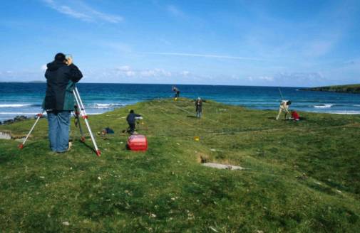 |