We are thrilled to announce that the ADS have just surpassed 4,000 archive collections!
This major milestone was achieved just before the new year and is a testament to all the hard work our team have provided throughout the years. Since its inception in 1996, the ADS has worked hard to ensure all the archives in our care are accessible, meaning all 4000 archives are Open Access and available through our website to facilitate re-use by the heritage sector and wider community.
To celebrate this achievement we want to highlight some of our collections from just this past year!
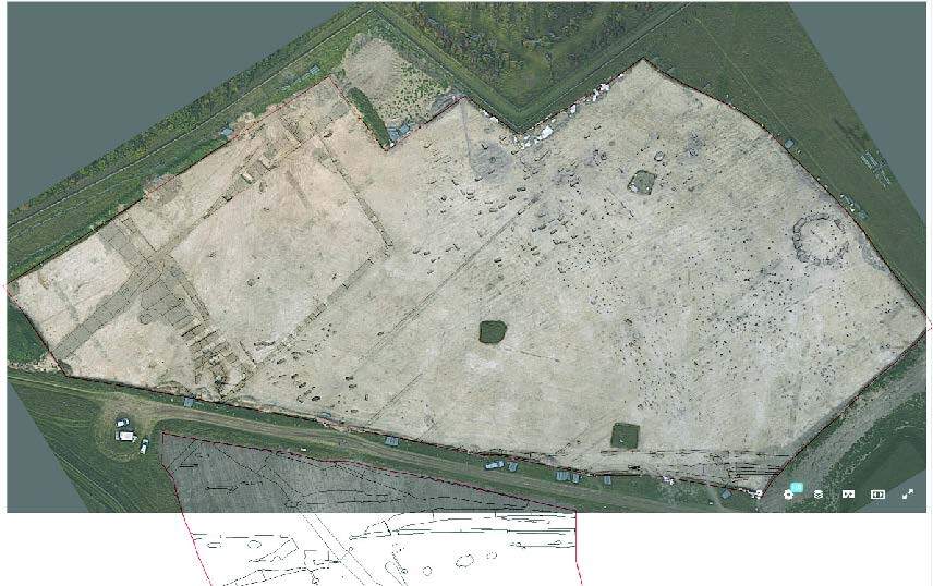
Wendover Green tunnel is a collection of almost 140 Anglo-Saxon graves with associated grave goods, excavated by INFRA Archaeology as part of the HS2 project. The collection includes an interactive map, created by Dr Solange Bohling as part of her Digital Archaeology MS, that links spatial data to images and 3d models of each of the burials excavated across the site. This collection provides an extraordinary dataset for the future analysis of Anglo-Saxon burials. To find out more about good practice for large digital graves read Solange’s recent blog post. Alternatively, you can watch Solange speaking about this collection and her project at the 46th Theoretical Archaeology Group through the Archaeodealth blog.
Funded by the National Lottery Heritage Fund, WallCAP aimed to use the principles of community archaeology to meet the key aims of archaeology research, conservation, and management of Hadrian’S Wall. This research consisted of two stages of activity. The first focused on field work at six sites along the wall that were part of the Heritage at Risk agenda, with the aim of better understanding the risk at specific sites. The second focused on understanding the ‘stone biographies’ of Hadrian’s wall through analysing the geology to find the origin and which quarries would have been used, and which post-roman structures used stone from the wall. A key output from this project was a bespoke GIS for Hadrian’s Wall, with the underlying database and tables constructed to capture details and features specific to the Wall.
For further information, see the accompanying Internet Archaeology paper:
Murphy, K. and Collins, R. 2024 ‘WallGIS: A Database and GIS for Hadrian’s Wall (Data paper’, Internet Archaeology 67. https://doi.org/10.11141/ia.67.24

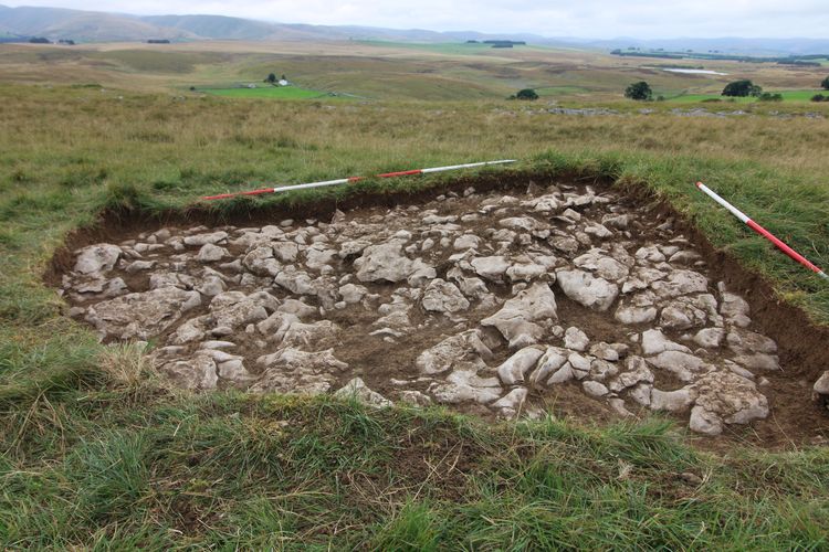
Keyhole Community Archaeological Excavation
In March 2020, Oxford Archaeology was commissioned by the Westmorland Dales Landscape Partnership to undertake a programme of community archaeological excavation on Little Asby Common, Cumbria over two seasons of fieldwork. The work, Little Asby Through the Keyhole, was funded by a grant from the National Lottery Heritage Fund, and aimed to provide training for volunteers in excavation techniques, promote knowledge of local landscape history and to gain a wider academic understanding of one of the more significant upland landscapes in the North West.
For further information, see the accompanying OASIS report at: Sanderson, K., Phelps, A. (2023). Little Asby Through the Keyhole, Community Archaeological Excavation. Oxford Archaeology (North): Lancaster. https://doi.org/10.5284/1125277.