Wharram Percy Digital Archive
Stuart Wrathmell, 2012. (updated 2022) https://doi.org/10.5284/1000415. How to cite using this DOI
Data copyright © Wharram Research Project, English Heritage unless otherwise stated
This work is licensed under the ADS Terms of Use and Access.
Primary contact
Dr
Stuart
Wrathmell
Divisional Manager, Heritage
West Yorkshire Archive Service
PO Box 5
Nepshaw Lane South
Morley
LS27 0QP
England
Resource identifiers
- ADS Collection: 1031
- DOI:https://doi.org/10.5284/1000415
- How to cite using this DOI
Volume XIII: Supplementary Data and Reports
The links below refer to material that could not be published with the original printed volume commissioned for Wharram XIII and includes reports, figures, plates and tables. This material is arranged according to the chapter outline of the original volume.
- Chapter 3: Earthwork Survey at Wharram Percy in Retrospect and Prospect.
- Chapter 4: Geophysical Survey at Wharram Percy.
- Chapter 6 and 17: The Evidence of Air Photography.
- Chapter 10: The Iron Economy of Wharram Percy - Modelling the Anglo-Saxon Iron Working Landscape.
- Chapter 11, 13, 19 and 20: The Animal Bones from the Wharram Excavations.
- Chapter 15: New Understanding of the Church Fabric.
- Chapter 17: Field Systems in the Wharram parishes and elsewhere in the study area.
Chapter 3: Earthwork Survey at Wharram Percy in Retrospect and Prospect.
Text
| Oswald, A. 2012: Earthwork Survey at Wharram Percy in Retrospect and Prospect. | 196 Kb |
Figures

|
Figure 3.1 - Ordnance Survey plan of the village, surveyed 1850-1. | 2 Mb | |

|
Figure 3.10 - English Heritage interpretative phase plan of the North Manor. | 1 Mb | |

|
Figure 3.11 - English Heritage plan of the South Manor. | 943 Kb | |
|
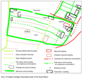
Figure 3.12 - English Heritage interpretative plan of the South Manor. | 1 Mb | |
|
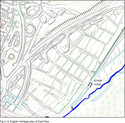
Figure 3.13 - English Heritage plan of East Row. | 1 Mb | |
|
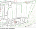
Figure 3.14 - English Heritage plan of North Row. | 1 Mb | |
|
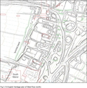
Figure 3.15 - English Heritage plan of West Row (north). | 1 Mb | |

|
figure 3.16 - English Heritage plan of West Row (south). | 1 Mb | |

|
Figure 3.2 - Ordnance Survey plan of the village, surveyed 1888. | 2 Mb | |

|
Figure 3.3 - Plan of the earthworks surveyed by RT Porter, GL Worsley and WJ Hopkins. | 1 Mb | |

|
Figure 3.4 - English Heritage plan of the village (reduced from original at 1:1000 scale to 1:2500). | 3 Mb | |
|
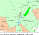
Figure 3.5 - Extract from William Dyke's 1836 estate map of Wharram Percy. | 2 Mb | |

|
Figure 3.6 - English Heritage schematic plan of the village. | 7 Mb | |

|
Figure 3.7 - English Heritage schematic plan of the network of roads and tracks. | 4 Mb | |

|
Figure 3.8 - Plan of the North Manor by WJ Hopkins surveyed 1976 (reduced from original at 1:20 scale), with interpretation. | 1 Mb | |

|
Figure 3.9 - English Heritage plan of the North Manor (reduced from original at 1:500 scale), with schematic plan, without phasing. | 4 Mb |


