Downloads
Files
. as a JPG image")
|
|||
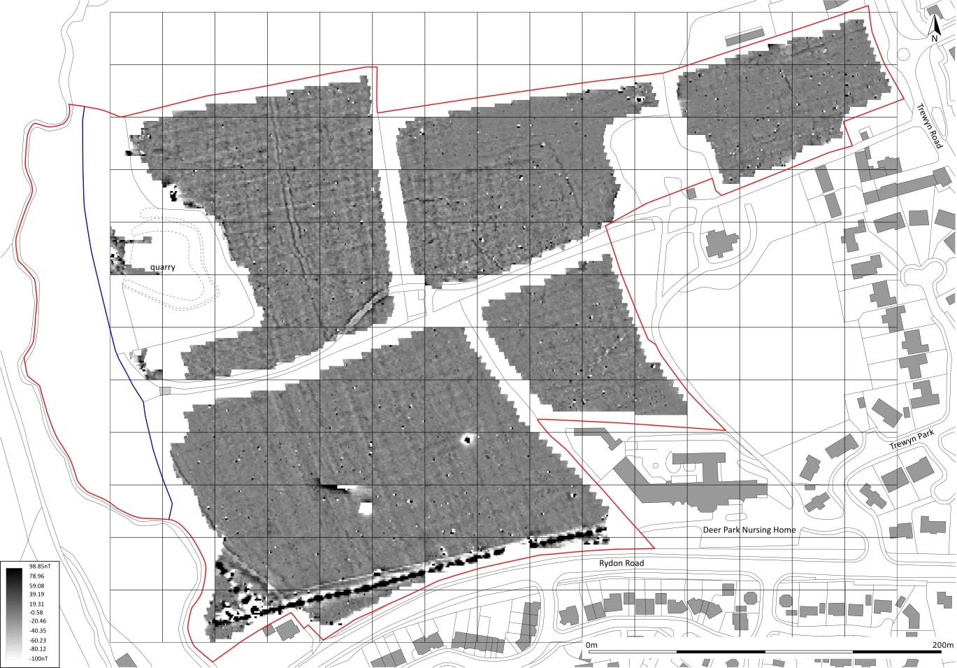
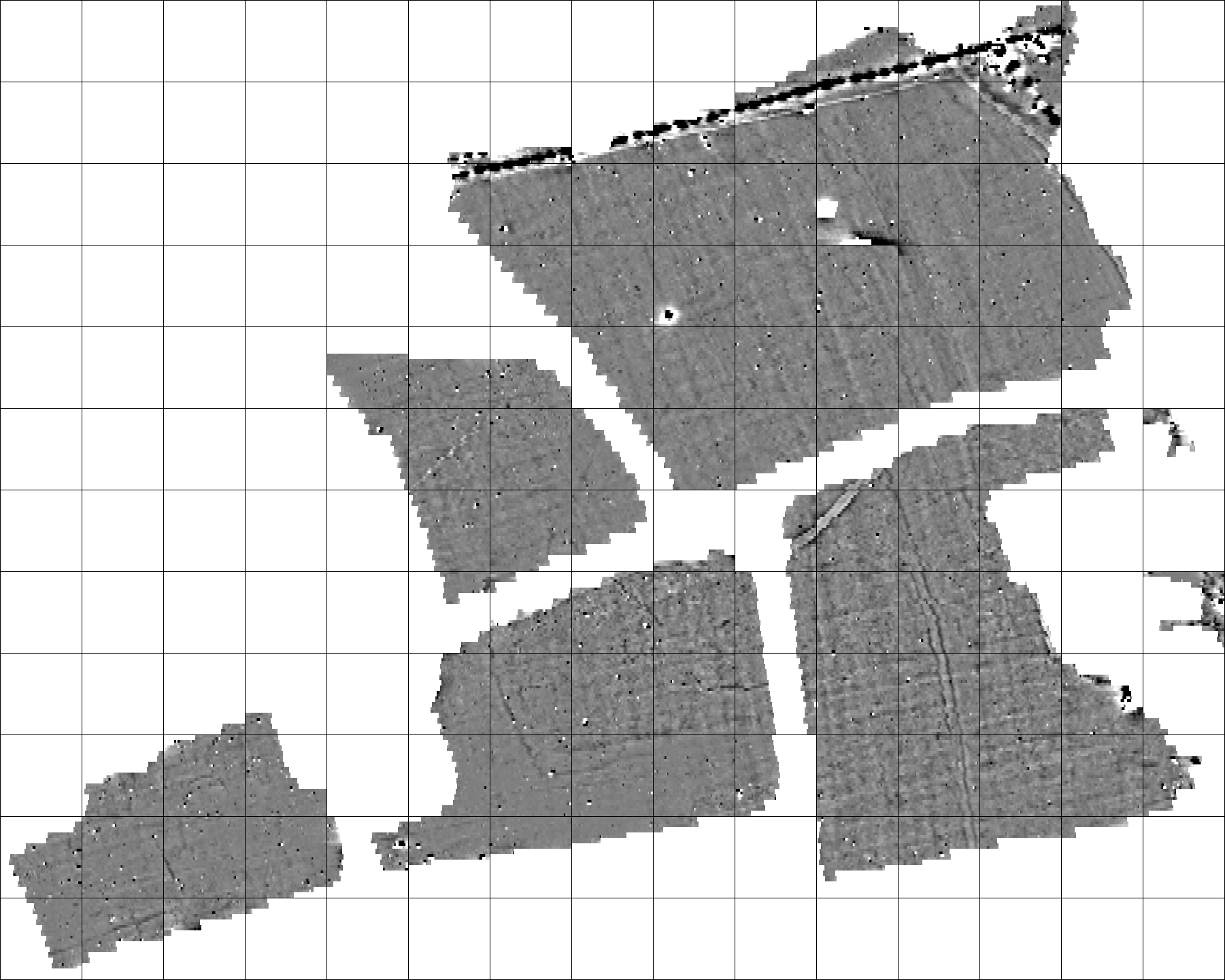
| A greyscale shade plot of the gradiometer survey data (Minimal Processing). | |||
|---|---|---|---|
| Filename | HRR20_greyscale_shade_plot_001.jpg (259 kB) |
JPG |
Info
Download |
. as a JPG image")
|
|||
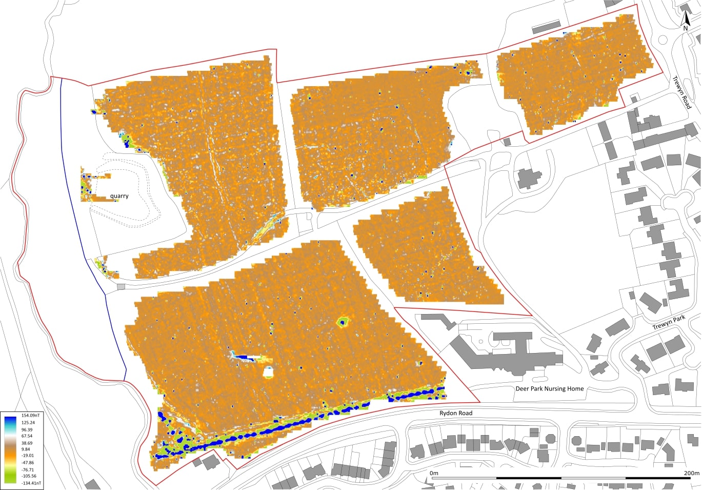
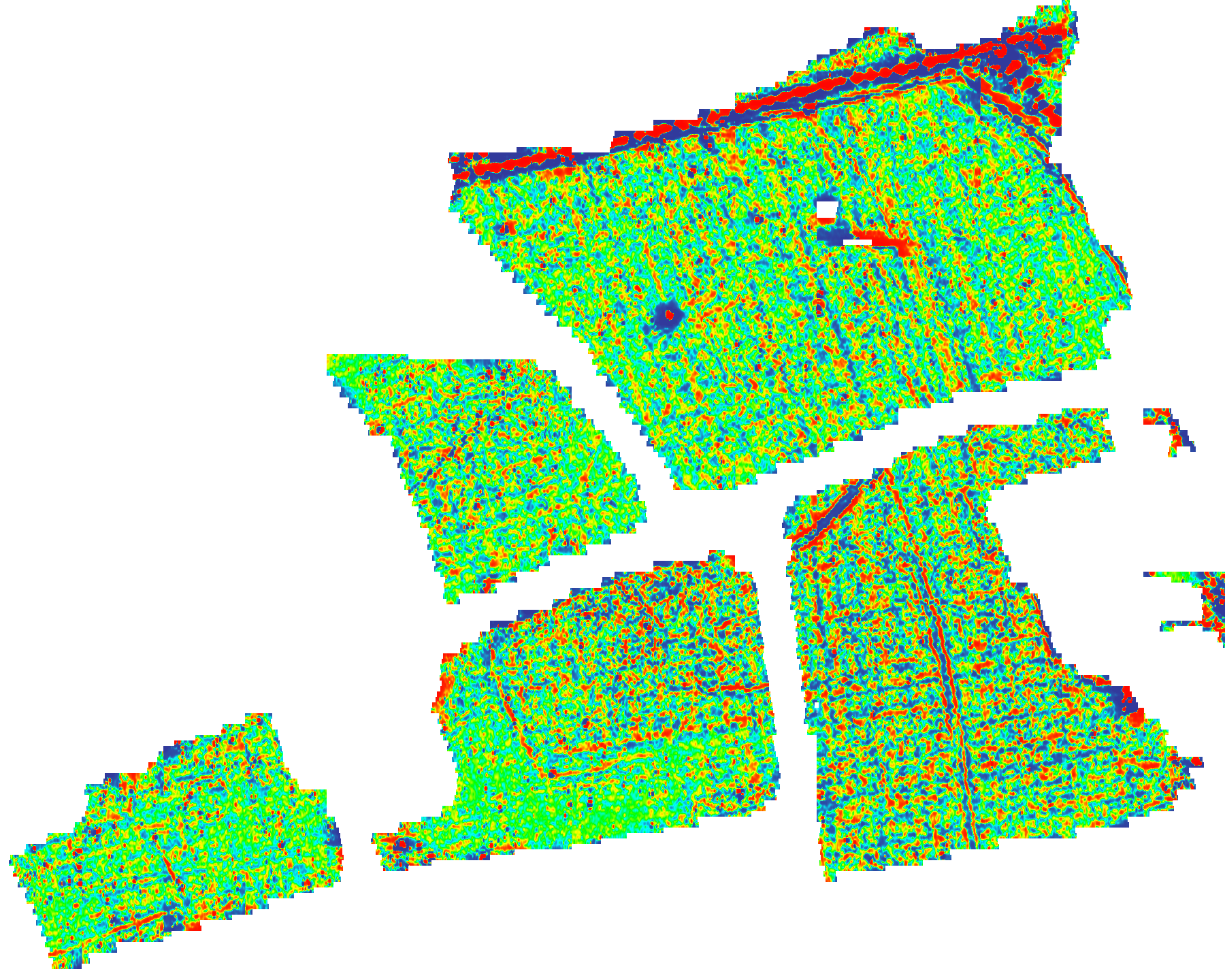
| A red-green-blue shade plot of the gradiometer survey data (Band Weight Equalised). | |||
|---|---|---|---|
| Filename | HRR20_red_green_blue_shade_plot_001.jpg (375 kB) |
JPG |
Info
Download |
. as a JPG image")
|
|||
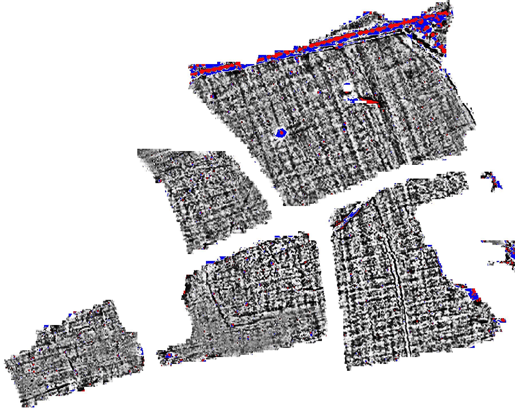
| A red-grey-blue shade plot of the gradiometer survey data (Band Weight Equalised). | |||
|---|---|---|---|
| Filename | HRR20_red_grey_blue_shade_plot_001.jpg (324 kB) |
JPG |
Info
Download |
. as a JPG image")
|
|||
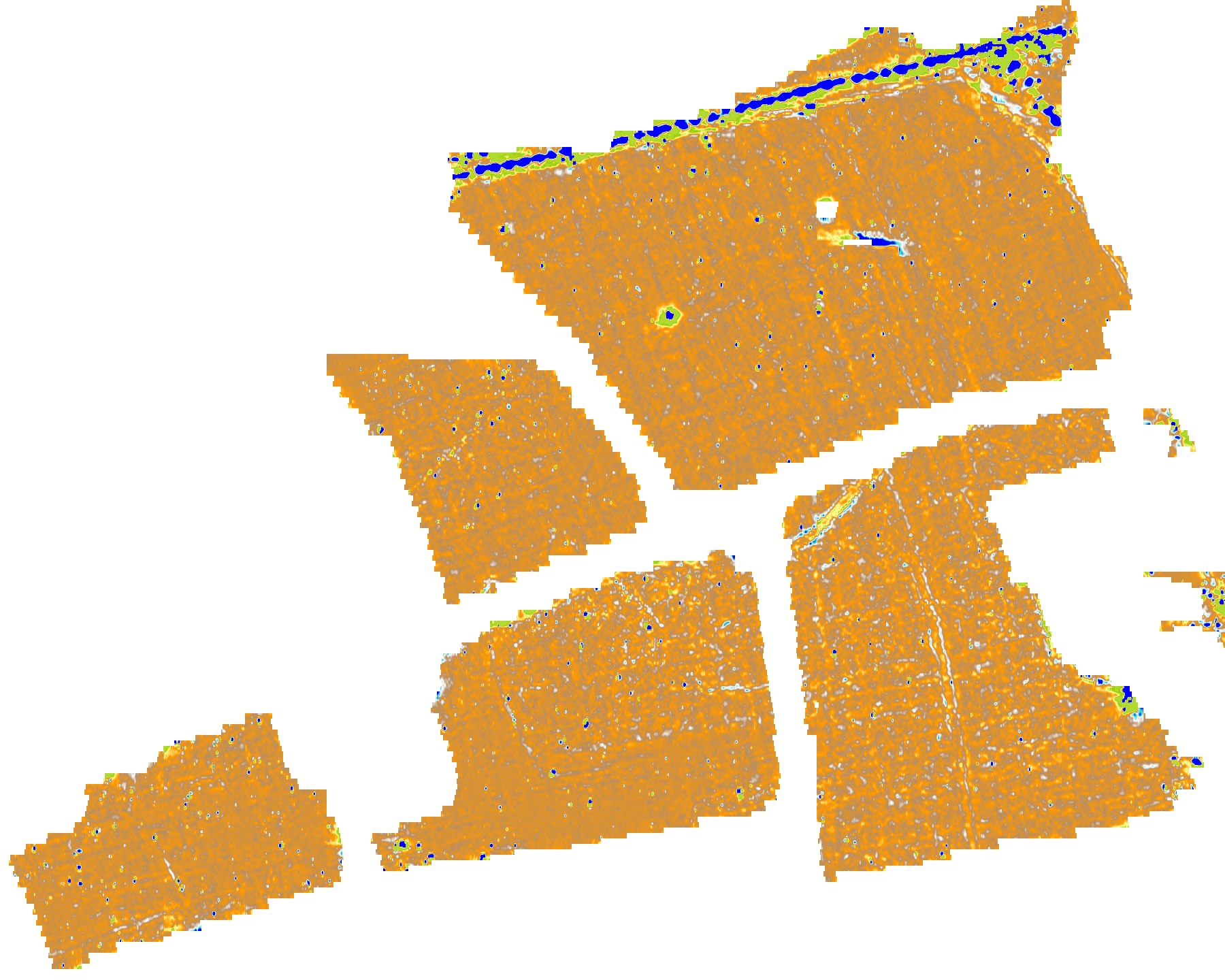
| A terrain shade plot of the gradiometer survey data (Minimal Processing). | |||
|---|---|---|---|
| Filename | HRR20_terrain_shade_plot_001.jpg (274 kB) |
JPG |
Info
Download |

|
|||
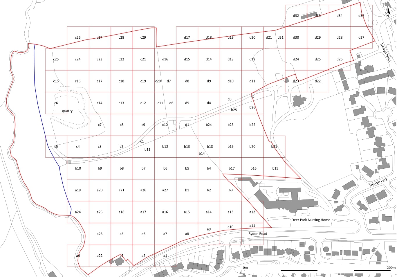
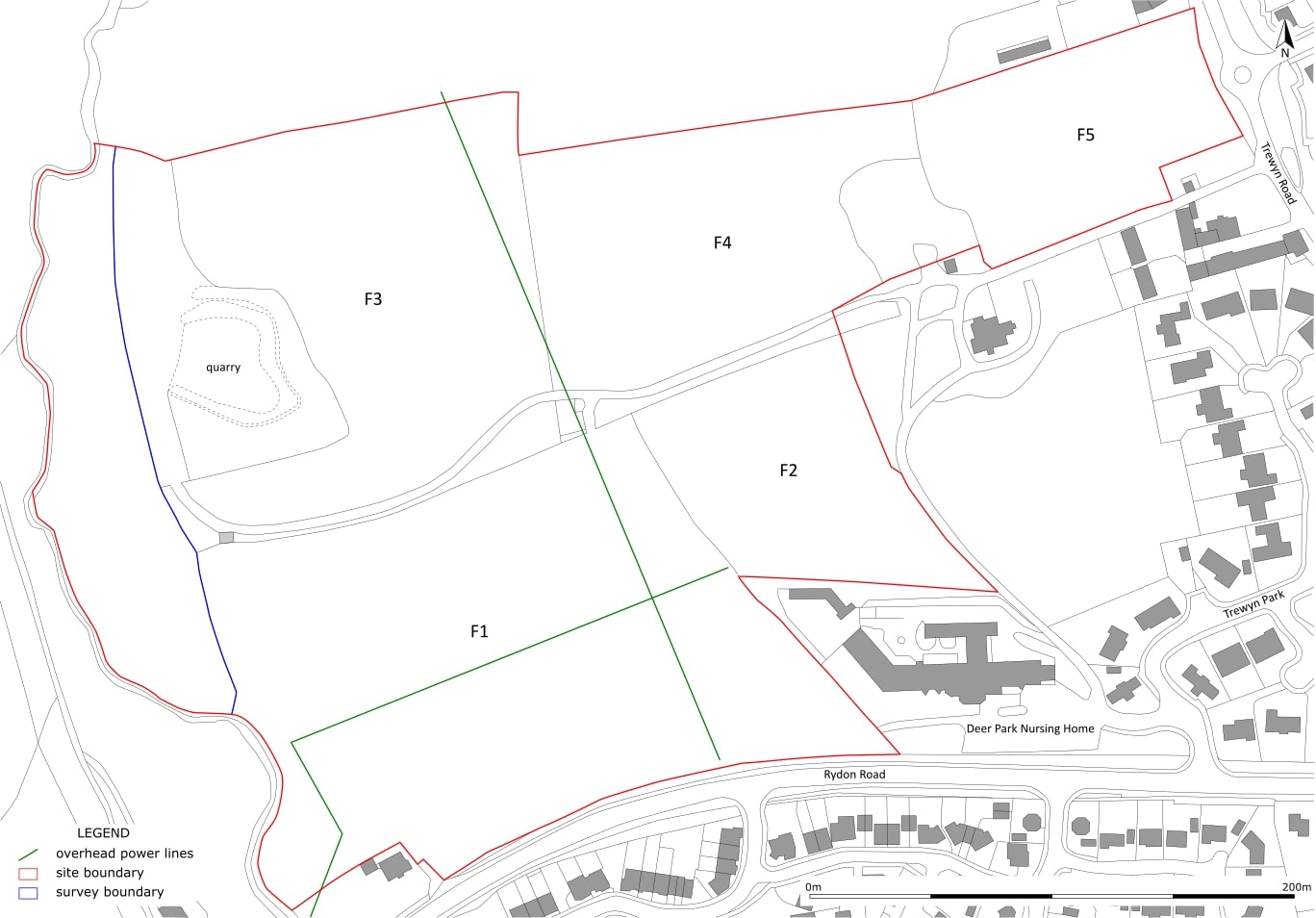
| An illustrated copy of the grid layout. | |||
|---|---|---|---|
| Filename | HRR20_grid_layout_001.jpg (196 kB) |
JPG |
Info
Download |

|
|||
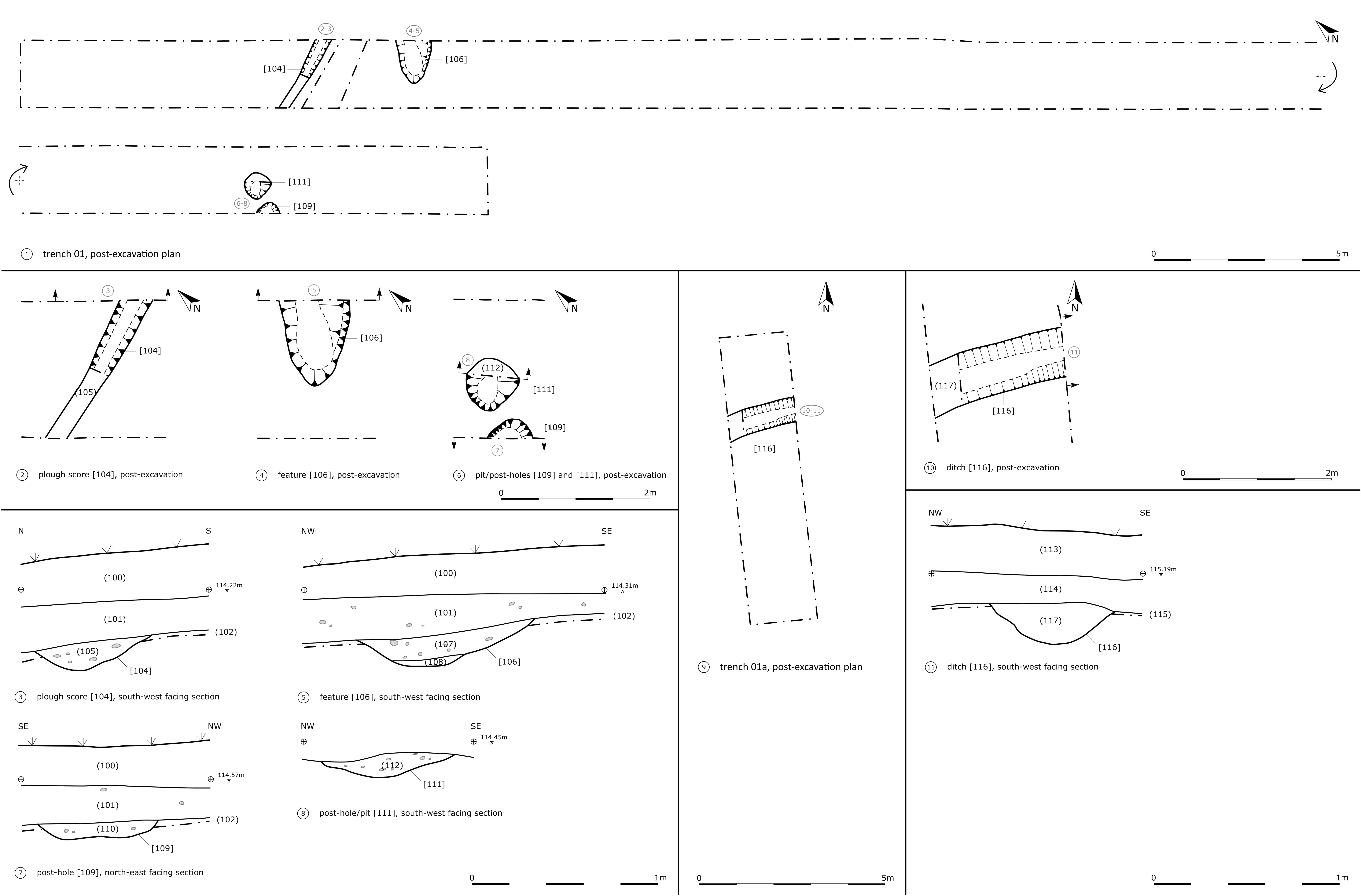
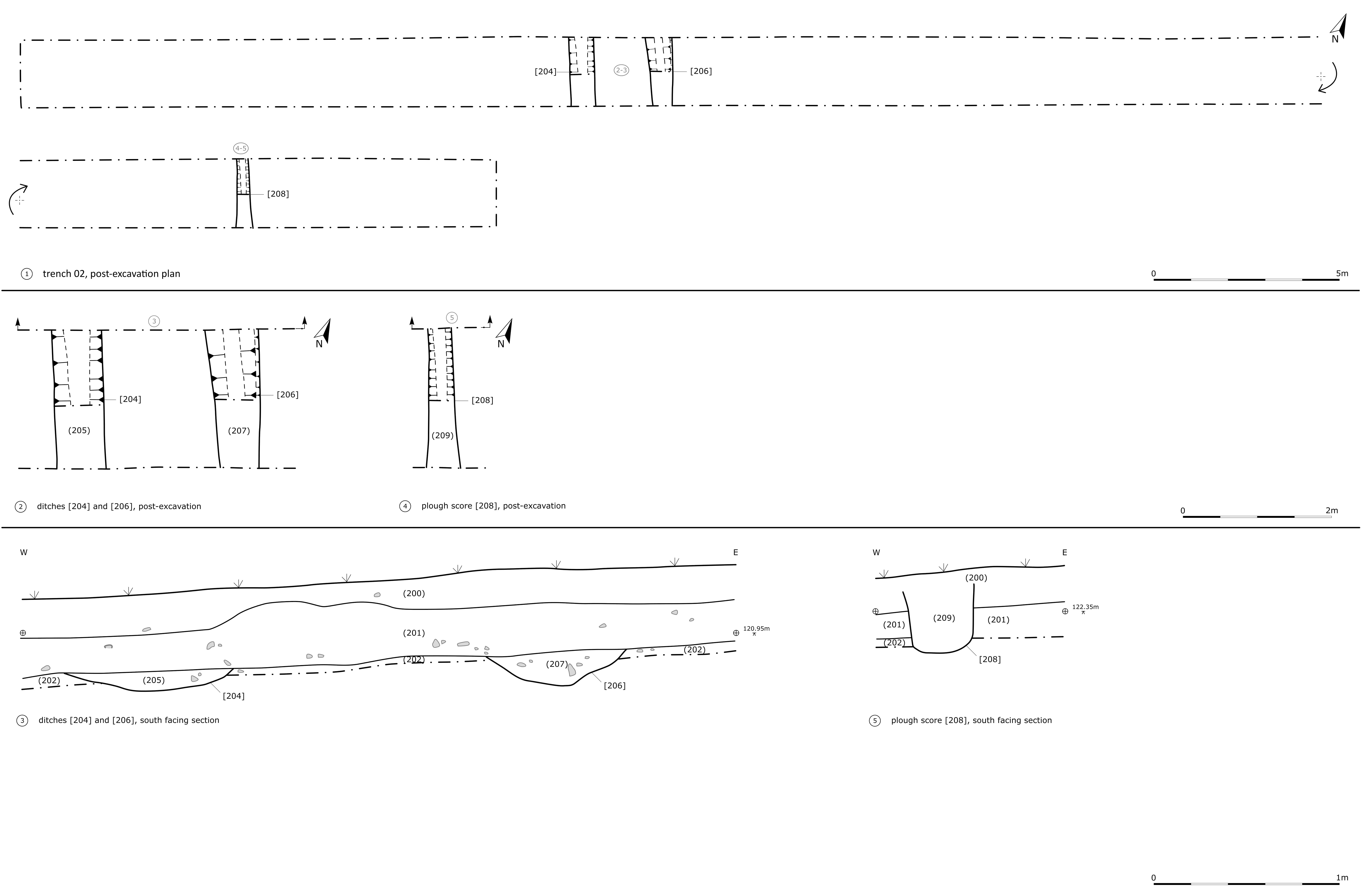
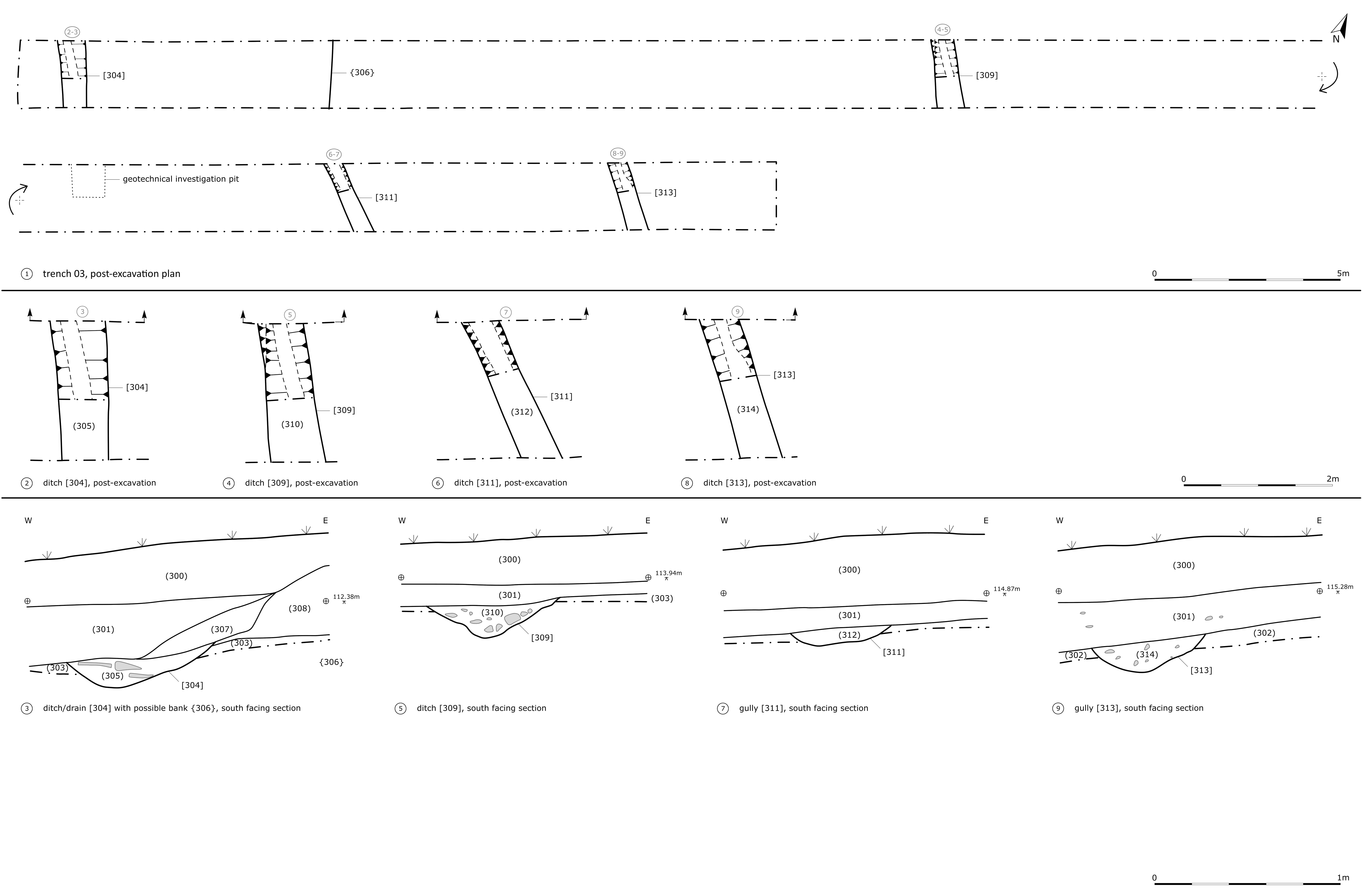
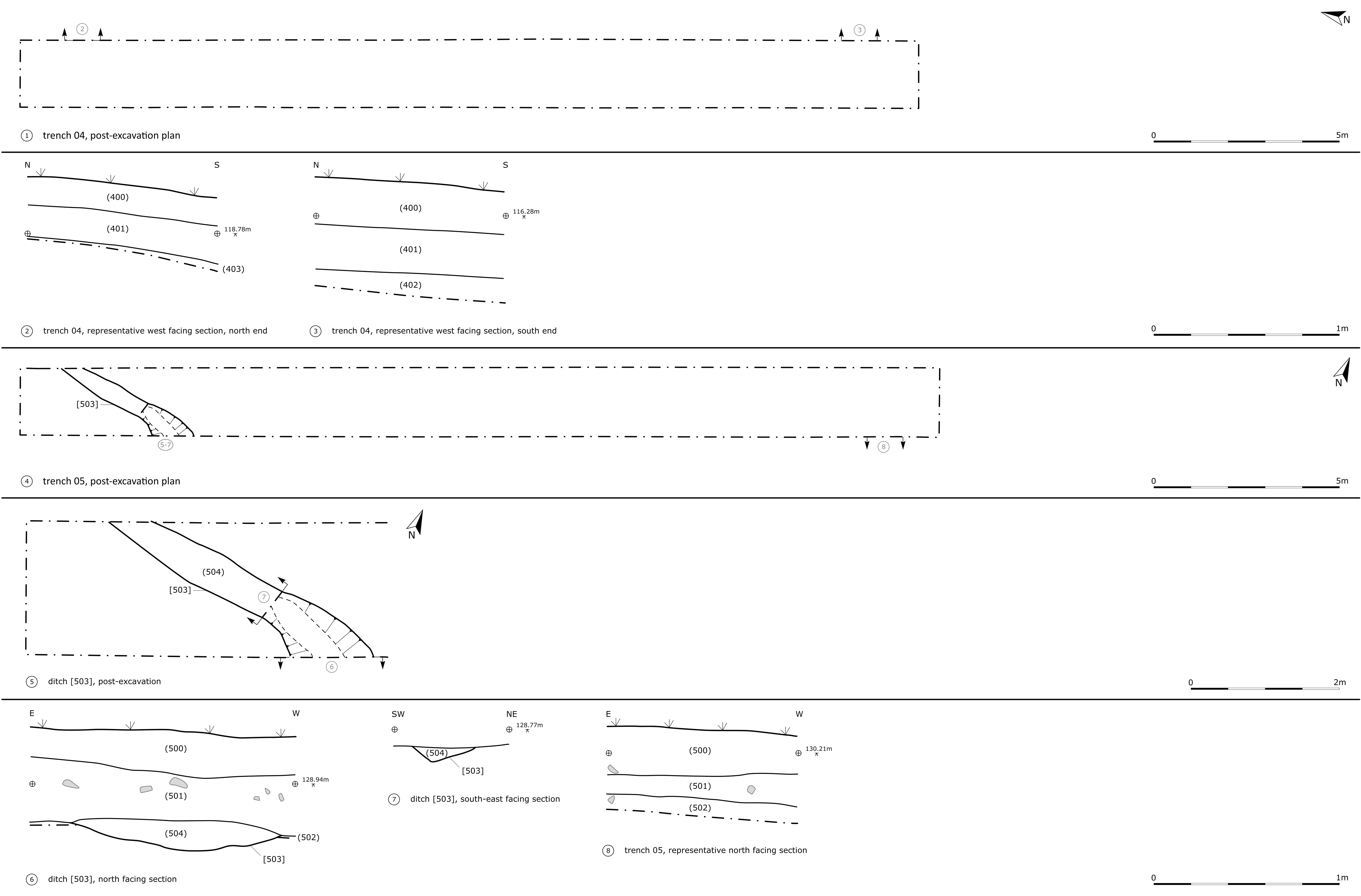
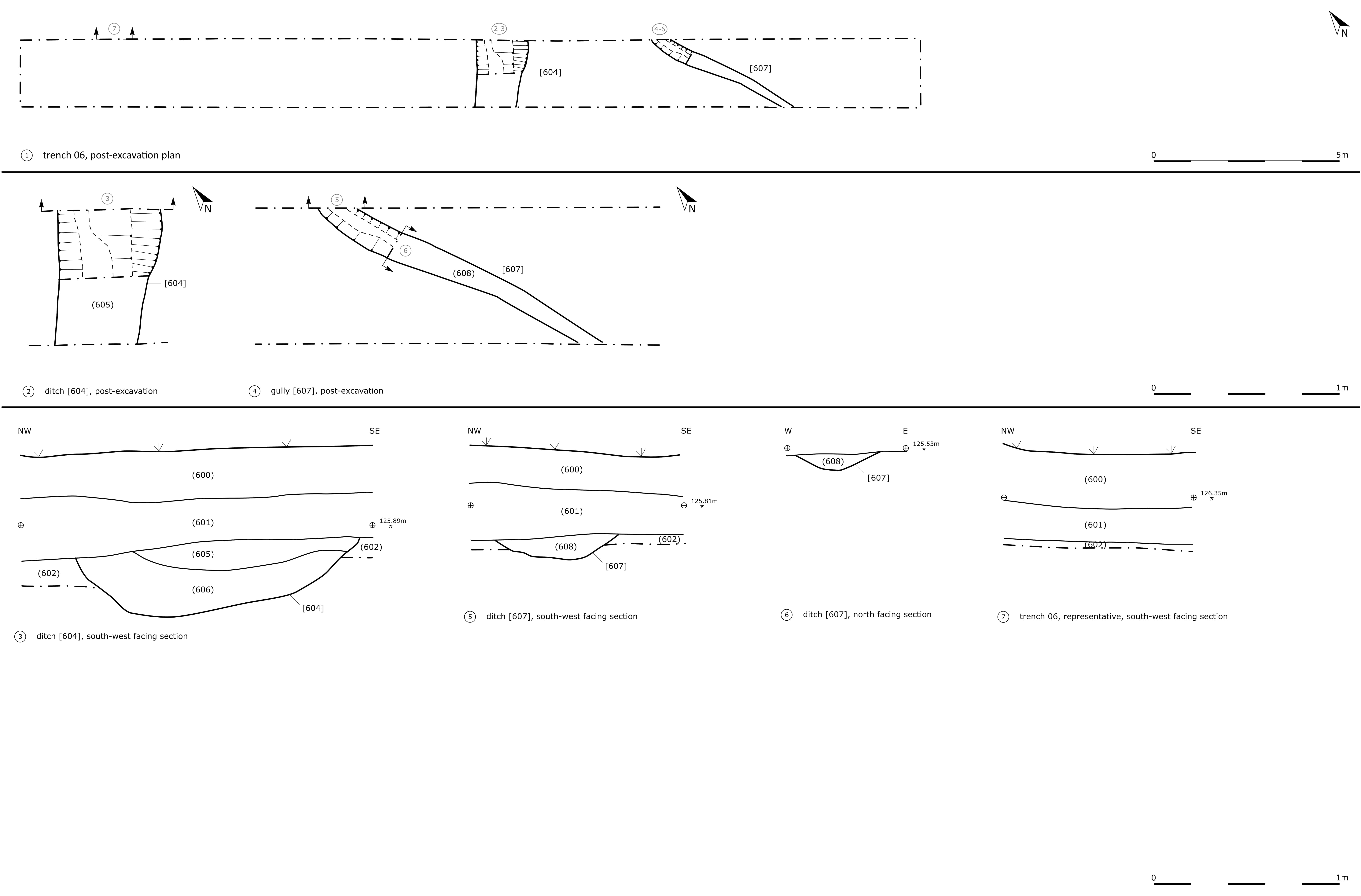
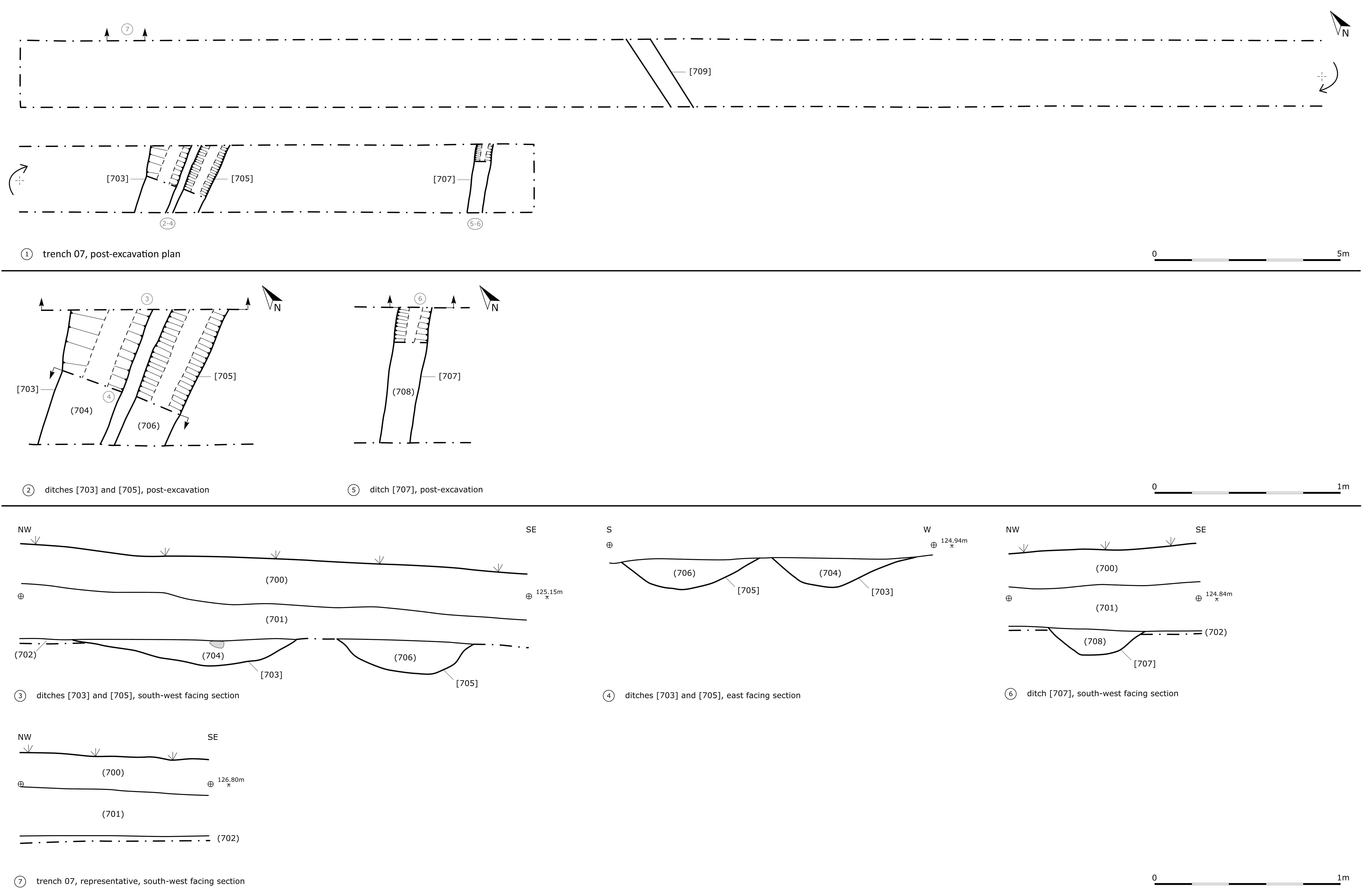
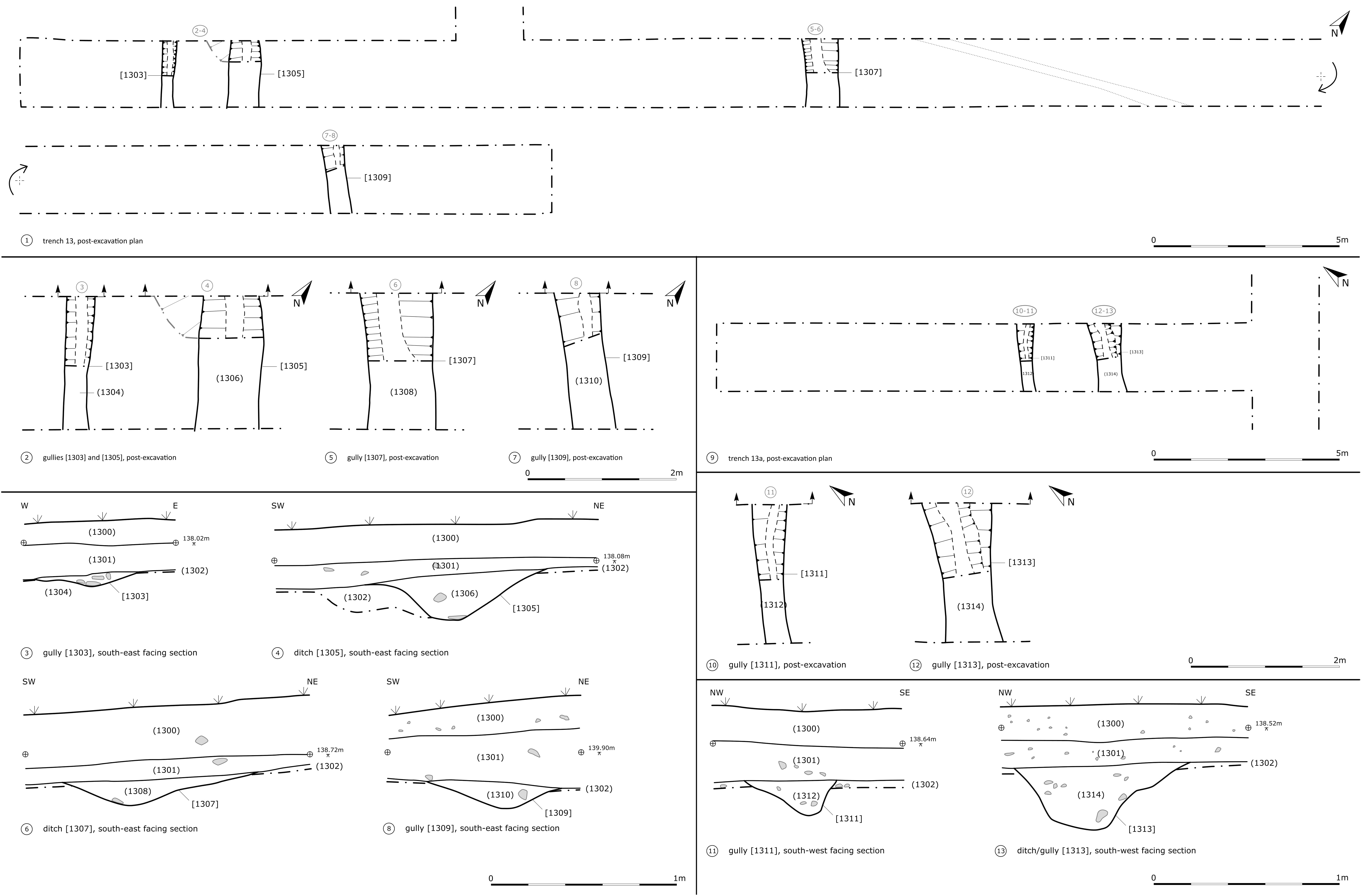
| An illustrated copy of the plans and the sections. | |||
|---|---|---|---|
| Filename | HRR20_plans_and_sections_001.jpg (425 kB) |
JPG |
Info
Download |

|
|||
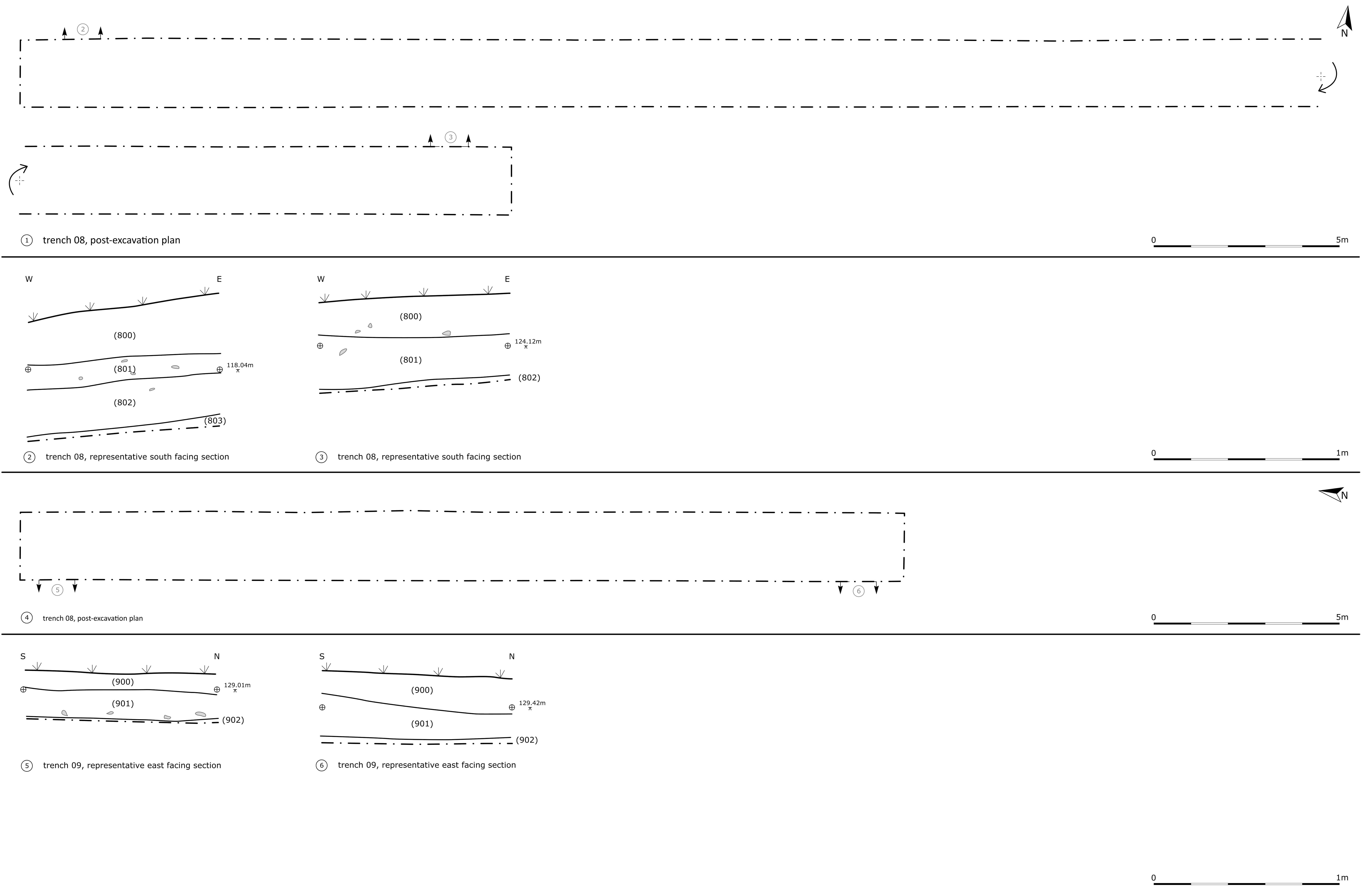
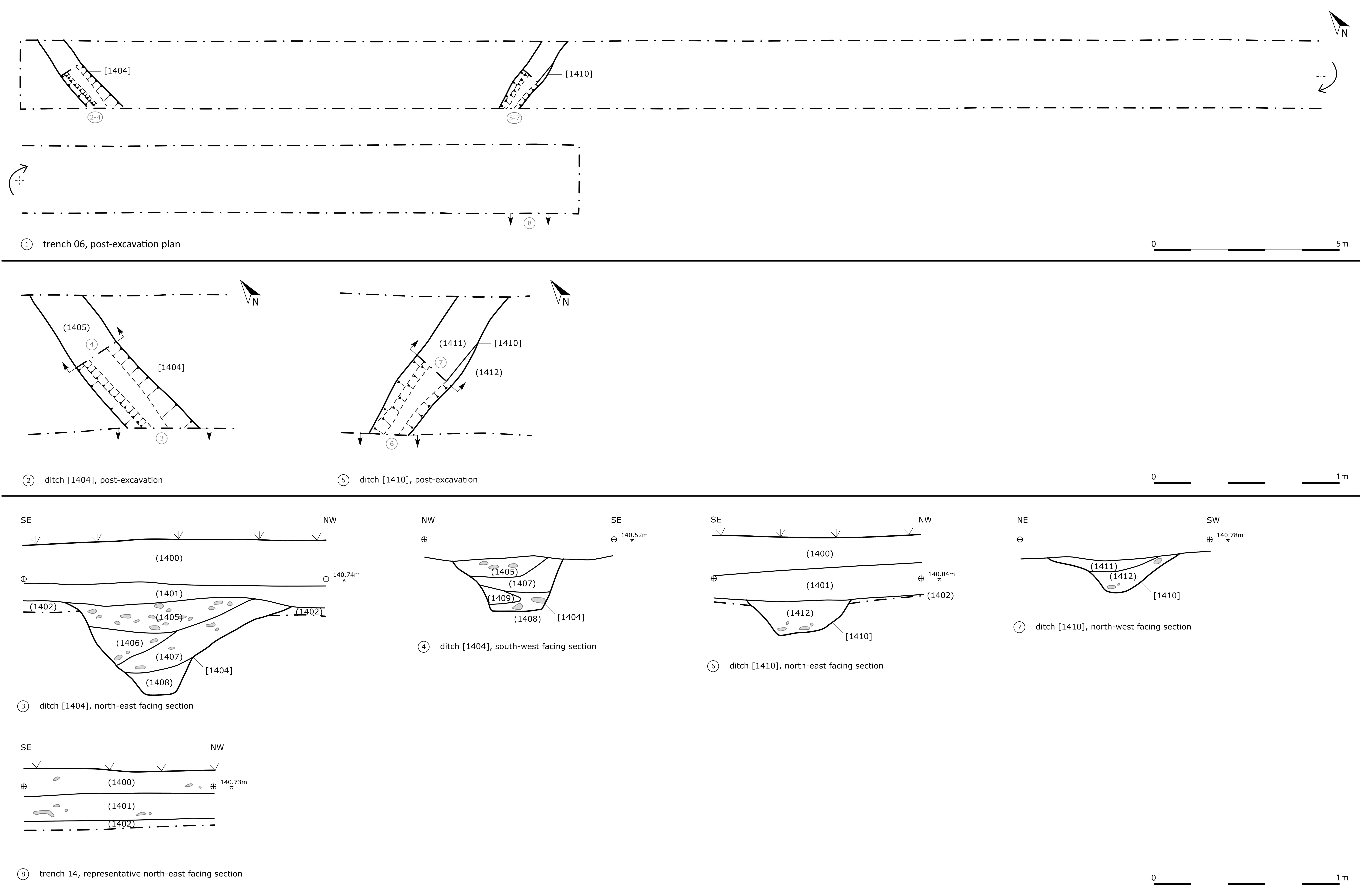
| An illustrated copy of the plans and the sections. | |||
|---|---|---|---|
| Filename | HRR20_plans_and_sections_002.jpg (302 kB) |
JPG |
Info
Download |

|
|||
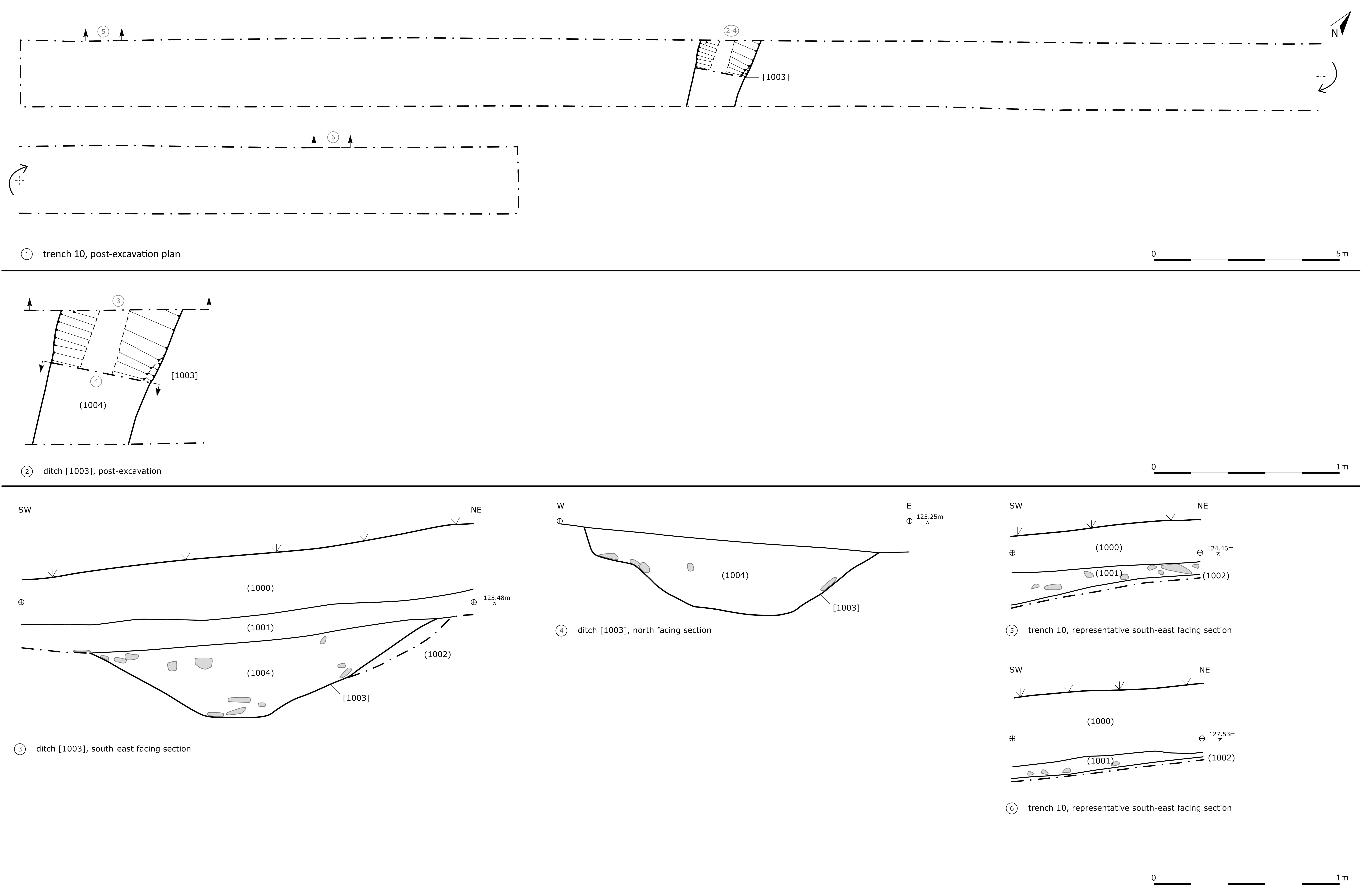
| An illustrated copy of the plans and the sections. | |||
|---|---|---|---|
| Filename | HRR20_plans_and_sections_003.jpg (385 kB) |
JPG |
Info
Download |

|
|||
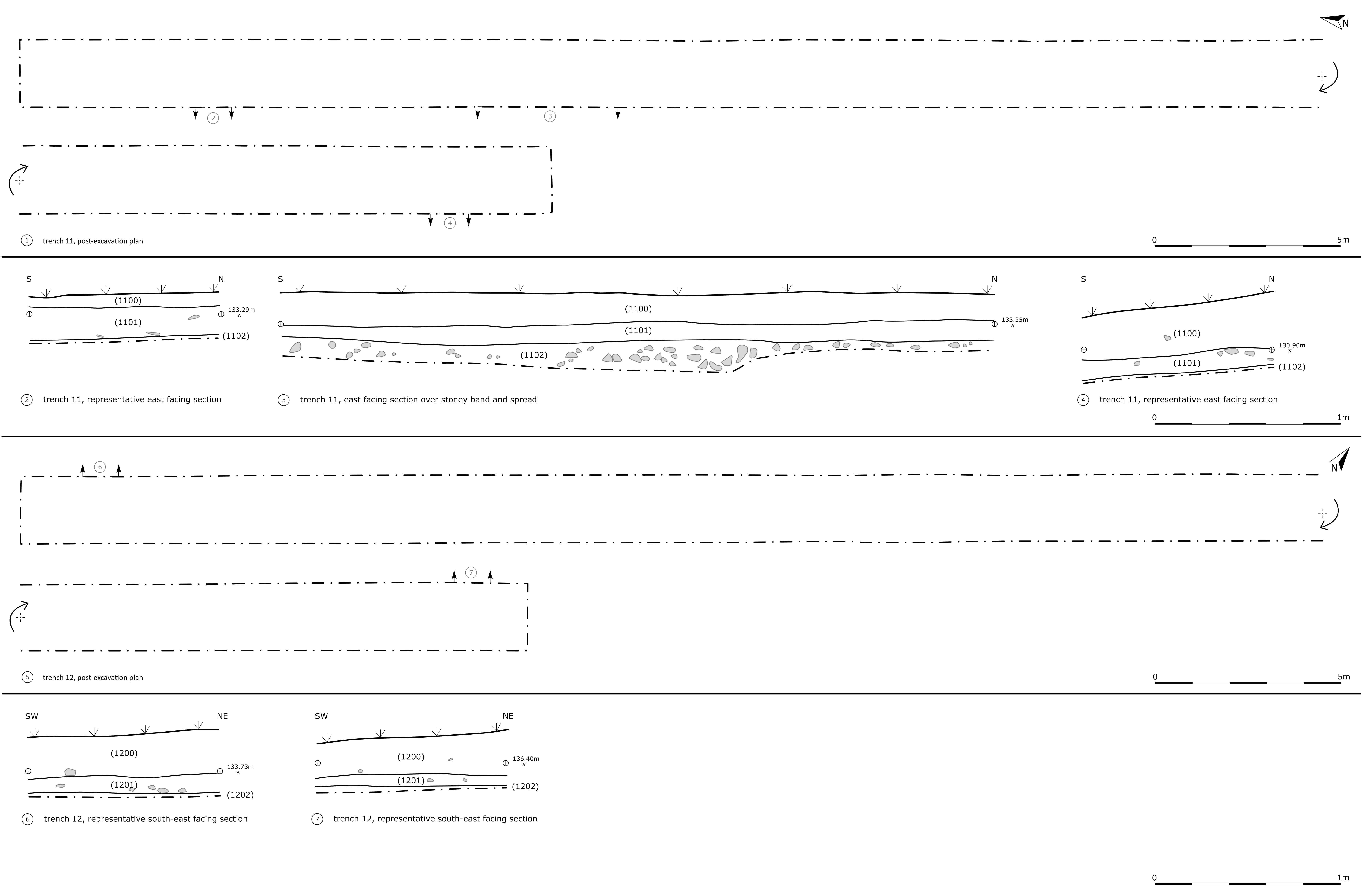
| An illustrated copy of the plans and the sections. | |||
|---|---|---|---|
| Filename | HRR20_plans_and_sections_004.jpg (346 kB) |
JPG |
Info
Download |

|
|||
| An illustrated copy of the plans and the sections. | |||
|---|---|---|---|
| Filename | HRR20_plans_and_sections_005.jpg (311 kB) |
JPG |
Info
Download |

|
|||
| An illustrated copy of the plans and the sections. | |||
|---|---|---|---|
| Filename | HRR20_plans_and_sections_006.jpg (354 kB) |
JPG |
Info
Download |

|
|||
| An illustrated copy of the plans and the sections. | |||
|---|---|---|---|
| Filename | HRR20_plans_and_sections_007.jpg (286 kB) |
JPG |
Info
Download |

|
|||
| An illustrated copy of the plans and the sections. | |||
|---|---|---|---|
| Filename | HRR20_plans_and_sections_008.jpg (314 kB) |
JPG |
Info
Download |

|
|||
| An illustrated copy of the plans and the sections. | |||
|---|---|---|---|
| Filename | HRR20_plans_and_sections_009.jpg (363 kB) |
JPG |
Info
Download |

|
|||
| An illustrated copy of the plans and the sections. | |||
|---|---|---|---|
| Filename | HRR20_plans_and_sections_010.jpg (514 kB) |
JPG |
Info
Download |

|
|||
| An illustrated copy of the plans and the sections. | |||
|---|---|---|---|
| Filename | HRR20_plans_and_sections_011.jpg (367 kB) |
JPG |
Info
Download |


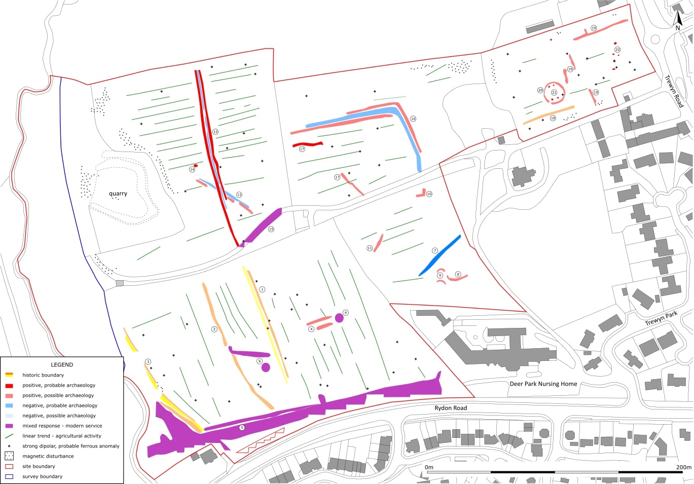
|
|||
| An interpretation of the gradiometer survey data. | |||
|---|---|---|---|
| Filename | HRR20_interpretation_001.jpg (210 kB) |
JPG |
Info
Download |
 as a PNG image")
|
|||
| Land between Rydon Road and Trewyn Road, Holsworthy, Torridge, Devon: Greyscale Shade Plot (Minimal Processing) | |||
|---|---|---|---|
| Filename | HRR20_GS_MP_001.png (370 kB) |
PNG |
Info
Download |
| Description | A greyscale shade plot (Minimal Processing) from the geophysical survey that was carried out by South West Archaeology Ltd. (SWARCH) on land between Rydon Road and Trewyn Road, Holsworthy, Torridge, Devon. | ||
 as a PNG image")
|
|||
| Land between Rydon Road and Trewyn Road, Holsworthy, Torridge, Devon: Red-Green-Blue Shade Plot (Band Weight Equalised) | |||
|---|---|---|---|
| Filename | HRR20_RGB2_BWE_001.png (1 MB) |
PNG |
Info
Download |
| Description | A red-green-blue shade plot (Band Weight Equalised) from the geophysical survey that was carried out by South West Archaeology Ltd. (SWARCH) on land between Rydon Road and Trewyn Road, Holsworthy, Torridge, Devon. | ||
 as a PNG image")
|
|||
| Land between Rydon Road and Trewyn Road, Holsworthy, Torridge, Devon: Red-Grey-Blue Shade Plot (Band Weight Equalised) | |||
|---|---|---|---|
| Filename | HRR20_RGB1_BWE_001.png (1 MB) |
PNG |
Info
Download |
| Description | A red-grey-blue shade plot (Band Weight Equalised) from the geophysical survey that was carried out by South West Archaeology Ltd. (SWARCH) on land between Rydon Road and Trewyn Road, Holsworthy, Torridge, Devon. | ||
 as a PNG image")
|
|||
| Land between Rydon Road and Trewyn Road, Holsworthy, Torridge, Devon: Terrain Shade Plot (Minimal Processing) | |||
|---|---|---|---|
| Filename | HRR20_TERRAIN_MP_001.png (1 MB) |
PNG |
Info
Download |
| Description | A terrain shade plot (Minimal Processing) from the geophysical survey that was carried out by South West Archaeology Ltd. (SWARCH) on land between Rydon Road and Trewyn Road, Holsworthy, Torridge, Devon. | ||
| Land between Rydon Road and Trewyn Road, Holsworthy, Torridge, Devon: Site Records | |||
|---|---|---|---|
| Filename | HRR20_site_records_001.pdf (19 MB) |
|
Info
Download |
| Description | A collection of site records from the archaeological evaluation that was carried out by South West Archaeology Ltd. (SWARCH) on land between Rydon Road and Trewyn Road, Holsworthy, Torridge, Devon. | ||