One of the many requirements for the new OASIS system was the ability to link together individual projects that belong to the same scheme of works or research project. This could be defined as:
- fieldwork that followed on from a previous event e.g. an excavation after an evaluation
- fieldwork that was split into phases or field seasons
- multiple piences of fieldwork on the same infrastructure project such as a road scheme or pipeline
However, the definition of a project is always tricky! OASIS itself sets no definitions on what a ‘project’ is, as this can vary between users and between countries and local authorities. Although often synonymous with as single event such as a watching brief or building survey, in OASIS a project can comprise multiple event types and locales (sites) if this helps the user. A good rule of thumb is to treat a single OASIS project as the best way to wrap up the information contained in the final report or, if in Scotland, a submission to DES.
However, if you are creating multiple records and want to link them together then the place to do this is on the Additional info page
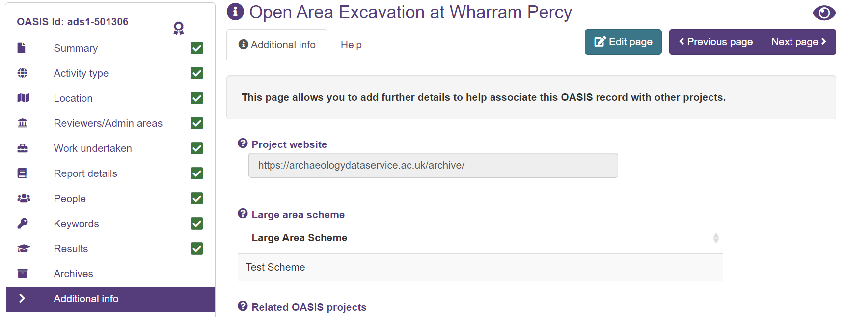
When you go to this page you’ll see two options.
The first is the Large Area Scheme field. This should be used to group together projects from large-scale infrastructure or research projects. When you activate the drop-down you’ll see a list of schemes that all users have entered. For example High Speed 2. Adding a scheme links your record to this scheme, which means:
- it does not give other users who are part of that scheme access to your record
- it does allow national users such as HE and HES, who want to analyse and understand OASIS metadata, to be able to query and identify diverse records belonging to the same scheme.
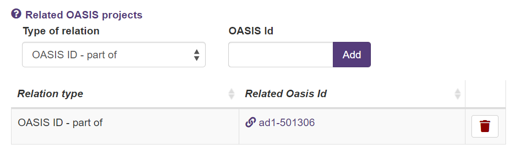
The second option is the Related OASIS projects field. Here you can choose from:
- Is part of: where a project feeds into the results or rationale for having been done. For example where an excavation has followed an evaluation.
- Related: where there is no administrative link, but you feel that flagging the relation will help people understand your work in a larger context. For example an evaluation in an adjacent field to an excavation that you did several years ago.
Users should enter the full OASIS ID (see example below). Once entered the form verifies this is a valid OASIS ID, and if true stores it as a hyperlink.
As with the Large Area Scheme function, linking a record does not give you additional access. For example, if you know “Unit X” did the evaluation and you know the OASIS ID you can put it in, but it doesn’t give you (“Unit Y”) access to this record. What it does do is allow HERS and national authorities who do have access to all records to see and follow the links. It’s hopefully just a simple way to signpost between projects, and icrease the re-use potential of OASIS metadata.