Disseminating laser scan data
Free data viewers for point cloud datasets
Point cloud data sets, particularly those produced by large terrestrial surveys, can be very large often containing millions of points. Point clouds are a unique data type that are not yet widely supported in typical 3D modeling or CAD packages. Instead, software packages used to edit and process point cloud datasets typically make free data viewers available that are used for viewing and manipulating point clouds. These packages vary widely in the types of point cloud data sets that are supported, many packages only support proprietary formats, and the advanced functionality beyond basic point cloud viewing and manipulation. Below is a list of common free point cloud viewers followed by a quick comparison chart. For complete software specifications, please visit the appropriate website.
Polyworks IMView
IMView is the free viewer provided by Polyworks and is optimized for viewing projects generated from the IMInspect module available in the commercial version of the Polyworks software. Users can export and distribute IMInspect projects which can include point cloud, mesh, or CAD datasets which can then be viewed in IMView. In IMView, users can calculate basic measurements including distance, radii, angles, and cross-sections and can also generate inspection reports in PDF, Word, Excel or HTML formats. IMView also imports standalone mesh files including OBJ, WRL, PLY and others however all measurement functionality is removed and the software only acts as a free viewer with basic 3D viewing capabilities.
Rapidform Explorer
Rapidform Explorer is a free data viewer that supports 3D viewing and measurement capabilities for numerous point cloud, mesh, and CAD formats. In addition to basic 3D viewing and measurements, Explorer also offers area and volume calculations for mesh and CAD models. Rapidform Explorer offers support for a wide variety of formats including standard formats such as ASCII, OBJ, and DXF and numerous scanner proprietary formats. It also offers standard reporting options as well as the ability to publish 3D scan models embedded in HTML pages.
Geomagic Review
Geomagic Review offers the ability for users to view inspection results created by Geomagic Qualify. Users can measure distances, annotate, create reports, and modify data sets. Geomagic Qualify only opens Geomagic WRP files.
Cyclone TruView and Cyclone Viewer
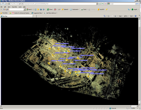
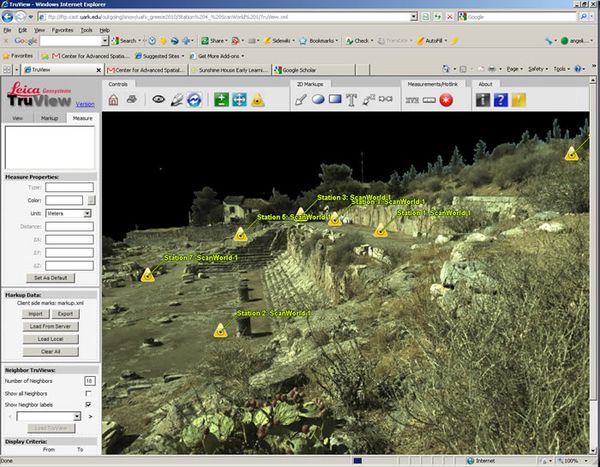
Leica Cyclone offers two free point cloud viewing options. TruView is a web-based point cloud viewer that allows users to view and measure point cloud datasets online. The user is typically provided with a “site map” that has hyperlinks to individual scan locations. Once a location is clicked on, the user jumps to that location where they can rotate, zoom, measure features, and annotate within the view. The view is constrained to the perspective of the scanner and is not considered to be full 3D viewing where the dataset can be observed from multiple directions. In addition, the user can “jump” between scanner locations that overlap within a viewing area. TruView offers a simplified means for viewing point cloud datasets that requires no previous 3D experience. To view a truview file, the end user must download the Internet Explorer TruView plugin from the Leica website. A truview file is created simply by publishing one’s project from Leica Cyclone using Cyclone Publisher.


Cyclone Viewer is the unlicensed data viewer for Cyclone. It simply allows the user to view and manipulate point cloud datasets that have been imported and saved in the proprietary Cyclone IMP format. Cyclone Viewer Pro with measurement capabilities is available for additional cost from Leica.
Pointools Viewer
Pointools Viewer is the unlicensed version of Pointools Viewer Pro. Pointools can import standard data formats for point clouds, meshes, and CAD files including ASCII, 3DS, OBJ, DXF, and DWG. It provides basic distance measuring tools for all data types.
Meshlab
Meshlab is an open source software for processing and editing point cloud and mesh datasets. Some functions in Meshlab include mesh creation, editing, cleaning, healing, inspection, and more. Meshlab can import numerous point cloud and mesh data formats and works well as a data viewer. Basic distance measurement tools are also available.
Basic Viewer comparison
| Free Viewer | ASCII Data Import | Supported Formats | Advanced Measurement Capabilities |
|---|---|---|---|
| Polyworks IMView | No | PWZIP, Numerous mesh formats | Yes (only on PWZIP) |
| Rapidform Explorer | Yes | Numerous point cloud (some scanner proprietary formats), mesh, and CAD formats | Yes |
| Geomagic Review | No | WRP | Yes |
| Cyclone TruView (Web-based) | No | HTML file | Yes – distance only |
| Cyclone Viewer | No | IMP | No |
| Pointools Viewer | Yes | Numerous point cloud, mesh, and CAD formats | Yes – distance only |
| MeshLab | Yes | Numerous mesh formats, some scanner proprietary formats | Yes – distance only |
The list of free point cloud viewers reviewed here are some of the most common ones used by industry professionals. Most of the viewers listed above are optimized to work with data types generated by their commercial counterparts. However, Rapidform Explorer offers the same functionality for all data formats and can import variety of file types. Rapidform, Pointools, and Meshlab are probably the more robust of the free viewers given their ability to import numerous data types and perform basic measurements. These three viewers can also directly import ASCII data which is important for viewing point cloud datasets that have been archived in the ASCII format.
Free data viewers for polygonal mesh datasets
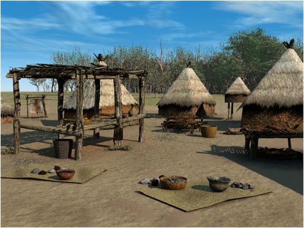
As noted above in the point cloud section, Rapidform Explorer, Pointools, and Meshlab are all free data viewers that can all import most common mesh formats including OBJ, WRL (VRML), and 3DS. These software also provide basic measurement capabilities on objects. Polygonal meshes can be imported into most 3D modeling software including 3DStudio Max, SoftImage, Cinema 4D, Maya, and others. See the image below that has a scanned pottery vessel from the Hampson collection inserted into a 3D scene.

These packages however are typically not meant to view mesh models that have been converted from point clouds that may have high triangle counts. Typically a mesh model will need to be decimated to easily be viewable in a commercial modeling software.
One of the most common free 3D modeling packages available is Blender. Blender is an open source software that was released to the public in 2002. Common tasks included in Blender include 3D modeling, animation, texturing, character rigging, smoke/water simulations, rendering, and compositing. Blender can import OBJ, WRL, 3DS, files and more.


